
Glasgow, Montana | |
|---|---|
 Downtown Glasgow | |
 Location of Glasgow, Montana | |
| Coordinates: 48°11′57″N 106°37′55″W / 48.19917°N 106.63194°W | |
| Country | United States |
| State | Montana |
| County | Valley |
| Founded | 1887 |
| Area | |
| • Total | 1.40 sq mi (3.63 km2) |
| • Land | 1.40 sq mi (3.63 km2) |
| • Water | 0.00 sq mi (0.00 km2) |
| Elevation | 2,113 ft (644 m) |
| Population (2020) | |
| • Total | 3,202 |
| • Density | 2,282.25/sq mi (880.89/km2) |
| Time zone | UTC−7 (Mountain) |
| • Summer (DST) | UTC−6 (Mountain) |
| ZIP codes | 59230–59231[3] |
| Area code | 406 |
| FIPS code | 30-31075 |
| GNIS feature ID | 2410594[2] |
| Website | cityofglasgowmt.com |
Glasgow is a city in and the county seat of Valley County, Montana, United States. The population was 3,202 at the 2020 census.[4]
Despite being just the 23rd most populous city in Montana, Glasgow is the most populous city for over 110 mi (177 km), thus making it an important economic hub for a large region in Eastern Montana.[5] Both Amtrak and the National Weather Service operate facilities in Glasgow that link the city to the surrounding region.[6][7]
YouTube Encyclopedic
-
1/3Views:1 7341 337 299180 407
-
Frances Mahon Deaconess Hospital | Glasgow, MT
-
Why Nobody Lives in Montana.
-
Worst Rural Towns in Montana. (Bad but Cheap)
Transcription
History

Native Americans inhabited the region for centuries, and extensive buffalo and pronghorn antelope herds provided ample food for the nomadic tribes. The Nakoda, Lakota, and Dakota peoples alternately inhabited and claimed the region from the 16th to the late 19th centuries. In 1804 the Lewis and Clark Expedition came within 15 miles (24 km) of the future site of Glasgow and noted the extensive herds of buffalo and various game. In 1851, the US government formed the first treaty with the Native American tribes, in 1885 the tribes engaged in the last known buffalo hunt in the region.
From 1885 to Montana Statehood in 1889, the tribes participated in agreements with the US government to re-drawing the Fort Peck reservation boundaries in exchange for federal subsidies.[8] As more and more homesteaders moved into the surrounding areas, pressure was placed on Congress to open up the Fort Peck Reservation to homesteading, resulting in tribes leaving the Glasgow area.
Glasgow was founded in 1887 as a railroad town by James Hill, who was responsible for creating many communities along the Hi-Line. He and a local railroader named the town when they spun a globe with a finger landing on Glasgow, Scotland.[9] Glasgow grew during the 1930s when President Franklin D. Roosevelt authorized the construction of the Fort Peck Dam, which became a major source of employment for the Glasgow area.[10]
During World War II, the Glasgow Army Airfield housed the 96th Bombardment Squadron and 614th Bombardment Squadron, flying B-17 Flying Fortresses, at different times during the war. Starting in December 1944, a German POW camp was established at the facility, lasting until the end of the war. After the war ended the base was closed, and part of the facility eventually became the present day Glasgow Valley County Airport. Glasgow was the death place of Lieutenant Colonel Ronald Speirs, famed member of Easy Company, 101st Airborne.[11]
In the 1960s, the population rose to about 6,400 due to the nearby presence of the Glasgow Air Force Base, (SAC air command and housing B-52 bombers) used during the Vietnam War and the earlier part of the Cold War. A significant amount of mid-century modern and Googie-style architecture was built then. After the de-activation and closure of the base in 1969, Glasgow's population declined to about half its one-time size by 1990, when the loss rate stabilized.[12][13] Glasgow still functions as the major regional administrative, shopping and services hub for Valley County and some of the areas beyond.
Geography
According to the United States Census Bureau, the city has a total area of 1.43 square miles (3.7 km2), all land.[14] The town has an elevation of 2,093 feet (638 m).[15] It is nestled in the Milk River Valley with the river itself meandering along to south.
Glasgow is 18 miles (29 km) west of Fort Peck Lake, the fifth largest artificial lake in the United States. The lake is popular for fishing and for recreation. The Charles M. Russell National Wildlife Refuge surrounds the lake providing an opportunity to experience nearly the same surroundings as encountered by the Lewis and Clark Expedition in 1805.[16]
Using data from Oxford University's Big Data Institute, The Washington Post, in 2018, identified Glasgow as "the middle of nowhere" for the contiguous United States. The article stated "Of all towns with more than 1,000 residents, Glasgow ... is farthest – about 4.5 hours in any direction – from any metropolitan area of more than 75,000 people".[17]
Climate
Glasgow experiences a continental semi-arid climate (Köppen climate classification BSk) with long, dry winters with typically freezing but exceedingly variable temperatures and hot, dry summers. The extreme variability of winter temperatures is due to the large warming produced by chinook winds as air descending from the Rockies is warmed, contrasting with very cold continental air masses typical of inland locations at this latitude. As an illustration, the record cold month of February 1936 averaged −15.8 °F (−26.6 °C), but the two warmest Februaries of 1931 and 1984 averaged above 32 °F or 0 °C and had mean maxima above 43.5 °F or 6.4 °C. Snowfall averages 34.8 inches or 0.88 metres per year.[18] Tornadoes are a rare occurrence. Two F2 tornadoes did, however, hit the Glasgow area on June 25, 1975.[19]
| Climate data for Glasgow Valley County Airport, Montana, 1991–2020 normals, extremes 1893–present | |||||||||||||
|---|---|---|---|---|---|---|---|---|---|---|---|---|---|
| Month | Jan | Feb | Mar | Apr | May | Jun | Jul | Aug | Sep | Oct | Nov | Dec | Year |
| Record high °F (°C) | 62 (17) |
74 (23) |
81 (27) |
93 (34) |
102 (39) |
110 (43) |
113 (45) |
108 (42) |
103 (39) |
96 (36) |
79 (26) |
69 (21) |
113 (45) |
| Mean maximum °F (°C) | 46.7 (8.2) |
49.1 (9.5) |
65.7 (18.7) |
78.9 (26.1) |
86.5 (30.3) |
93.8 (34.3) |
98.8 (37.1) |
99.3 (37.4) |
92.7 (33.7) |
80.7 (27.1) |
64.3 (17.9) |
48.3 (9.1) |
101.4 (38.6) |
| Mean daily maximum °F (°C) | 23.5 (−4.7) |
28.0 (−2.2) |
41.8 (5.4) |
56.8 (13.8) |
67.7 (19.8) |
76.3 (24.6) |
85.5 (29.7) |
84.8 (29.3) |
72.9 (22.7) |
56.5 (13.6) |
40.0 (4.4) |
27.2 (−2.7) |
55.1 (12.8) |
| Daily mean °F (°C) | 14.6 (−9.7) |
18.7 (−7.4) |
31.6 (−0.2) |
44.8 (7.1) |
55.5 (13.1) |
64.5 (18.1) |
72.0 (22.2) |
71.0 (21.7) |
59.9 (15.5) |
45.2 (7.3) |
30.2 (−1.0) |
18.5 (−7.5) |
43.9 (6.6) |
| Mean daily minimum °F (°C) | 5.8 (−14.6) |
9.4 (−12.6) |
21.4 (−5.9) |
32.8 (0.4) |
43.3 (6.3) |
52.7 (11.5) |
58.5 (14.7) |
57.2 (14.0) |
46.9 (8.3) |
33.8 (1.0) |
20.5 (−6.4) |
9.7 (−12.4) |
32.7 (0.4) |
| Mean minimum °F (°C) | −22.9 (−30.5) |
−14.5 (−25.8) |
−4.0 (−20.0) |
16.4 (−8.7) |
28.3 (−2.1) |
41.4 (5.2) |
48.1 (8.9) |
43.6 (6.4) |
30.4 (−0.9) |
15.1 (−9.4) |
−2.8 (−19.3) |
−16.5 (−26.9) |
−27.8 (−33.2) |
| Record low °F (°C) | −56 (−49) |
−59 (−51) |
−45 (−43) |
−19 (−28) |
15 (−9) |
24 (−4) |
34 (1) |
28 (−2) |
14 (−10) |
−8 (−22) |
−41 (−41) |
−47 (−44) |
−59 (−51) |
| Average precipitation inches (mm) | 0.44 (11) |
0.35 (8.9) |
0.47 (12) |
1.01 (26) |
2.22 (56) |
2.83 (72) |
1.95 (50) |
1.27 (32) |
1.06 (27) |
0.92 (23) |
0.49 (12) |
0.43 (11) |
13.44 (340.9) |
| Average snowfall inches (cm) | 9.8 (25) |
6.2 (16) |
5.6 (14) |
2.5 (6.4) |
0.9 (2.3) |
0.0 (0.0) |
0.0 (0.0) |
0.0 (0.0) |
0.0 (0.0) |
1.5 (3.8) |
5.9 (15) |
8.3 (21) |
40.7 (103.5) |
| Average extreme snow depth inches (cm) | 7 (18) |
5 (13) |
5 (13) |
2 (5.1) |
0 (0) |
0 (0) |
0 (0) |
0 (0) |
0 (0) |
1 (2.5) |
3 (7.6) |
5 (13) |
7 (18) |
| Average precipitation days (≥ 0.01 in) | 7.8 | 6.4 | 6.8 | 7.8 | 10.6 | 12.7 | 9.2 | 7.6 | 6.7 | 6.7 | 6.2 | 6.6 | 95.1 |
| Average snowy days (≥ 0.1 in) | 8.5 | 6.7 | 5.1 | 2.2 | 0.6 | 0.0 | 0.0 | 0.0 | 0.0 | 1.5 | 4.6 | 7.1 | 36.3 |
| Source 1: NOAA[20] | |||||||||||||
| Source 2: National Weather Service(Snow depth 1991-2023)[21] | |||||||||||||
Demographics
| Census | Pop. | Note | %± |
|---|---|---|---|
| 1910 | 1,158 | — | |
| 1920 | 2,059 | 77.8% | |
| 1930 | 2,216 | 7.6% | |
| 1940 | 3,799 | 71.4% | |
| 1950 | 3,821 | 0.6% | |
| 1960 | 6,398 | 67.4% | |
| 1970 | 4,700 | −26.5% | |
| 1980 | 4,455 | −5.2% | |
| 1990 | 3,572 | −19.8% | |
| 2000 | 3,253 | −8.9% | |
| 2010 | 3,250 | −0.1% | |
| 2020 | 3,202 | −1.5% | |
| U.S. Decennial Census[12][4] | |||
As of the 2010 census,[22] there were 3,250 people, 1,479 households, and 834 families residing in the city. The population density was 2,272.7 inhabitants per square mile (877.5/km2). There were 1,653 housing units at an average density of 1,155.9 per square mile (446.3/km2). The racial makeup of the city was 91.8% white, .2% African American, 4.5% Native American, .3% Asian, .4% from other races, and 2.7% from two or more races. Hispanic or Latino of any race were 1.8% of the population.
There were 1,479 households, of which 26.6% had children under the age of 18 living with them, 43.5% were married couples living together, 9.1% had a female householder with no husband present, 3.8% had a male householder with no wife present, and 43.6% were non-families. 39.7% of all households were made up of individuals, and 19.6% had someone living alone who was 65 years of age or older. The average household size was 2.13 and the average family size was 2.85.
The median age in the city was 45.6 years. 22.7% of residents were under the age of 18; 5.2% were between the ages of 18 and 24; 21.3% were from 25 to 44; 28% were from 45 to 64; and 22.7% were 65 years of age or older. The gender makeup of the city was 47.8% male and 52.2% female.
The median income for a household in the city was $35,504. 14.5% of the population were below the federal poverty line, compared to 15.1% for the USA as a whole.
Economy
In May 2012, the major industries present in Glasgow were retail (23% of employment), public administration (16%), construction (14%), and health care and social assistance (7%). Farmers and farm services comprised 4% of employment. As of June 2014[update], the unemployment rate was 3.2%.[23]
For Valley County, the median value of owner-occupied housing units was $160,800 from 2017 to 2021.[24]
Education
Glasgow is served by the Glasgow School District[25] with three public schools. For the 2021-2022 school year, 379 students were enrolled in kindergarten through 5th grade at Irle Elementary School.[26] At Glasgow Middle School, for 6th-8th grade, 167 students were enrolled.[27] Glasgow High School had 245 students enrolled.[28] The team name for the school is the Scotties.[29]
From 2017-2022 census data on those 25 years and older in Valley County, 93% had attained high school graduation or higher, 19.1% had a Bachelor's degree or higher.[24]
Glasgow City-County Library serves the area.[30]
Sports
As of 2023, the Scotties of Glasgow High School have won 48 Montana state championships.[31] Glasgow High School offered 13 sports in 2023.[31] Since the 1992–93 school year, they have competed as a Class B school, a designation used by the Montana High School Association based on population.
They have won 14 state championships and 33 state trophies in boys wrestling.[32] The Girls Cross Country team has won the state championship 16 times.[33]
The Glasgow Reds baseball team competes in the American Legion Baseball league, played by 13-to-19-year-olds. They finished second at the state championships in 2000 and 2012 and third in 1999, 2013, and 2015.
Infrastructure
Crime
There were no reports of rape or murder occurring in Glasgow in 2010, compared with one murder the previous year, and 16 incidents of rape from 2003 to 2008. Overall, the crime rate to 2010 appears to be in a general downward trend, and is well below the national average.[23]
A sheriff's detention facility was completed in April 2011 at a cost of $3.16 million. The facility, located downtown, is 10,000 square feet (930 m2) and has 26 beds, replacing the 16 beds of the previous jail. The detention center houses inmates from local police and sheriff, as well as regional inmates for agencies such as the FBI, U.S. Marshals Service and Montana Highway Patrol and has an average of 16 inmates on any given day.[citation needed]
Transportation
Rail
Glasgow is on the Hi-Line of the BNSF Railway and is served daily westbound and eastbound by Amtrak's Empire Builder route.[34]
Air
Glasgow is served by Glasgow Valley County Airport and has daily commercial service to Billings. Since 2013, the commercial air service provider is Cape Air.
Bus
Glasgow and the greater Valley County region are served by a non-profit taxi/bus service called Valley Country Transit.[35] Bus and/or Van rides are available daily for in-county travel purposes. Riders are charged on a per trip basis and must call in a ride. As of 2022, the transportation service, Uber is also now in operation within city limits.
Roads
Glasgow is located on U.S. Highway 2, which is a major east-west traffic corridor of the northern Great Plains region. Montana Highway 24 passes nearby the city, a major north-south route connecting southern Montana to Canada. No Interstates run near the region.
Media
Glasgow is part of the Glendive Media Market, as of 2021, the smallest tracked by Neilson serving an estimated 3,900 homes.[36]
Newspaper
- The Glasgow Courier, established in 1913 and published every Wednesday, is the newspaper of record for Valley County,[37]
- The BS Buzz, is a daily newspaper for Glasgow. The Buzz is published Monday thru Friday.[citation needed]
Local radio stations
Local television stations
Notable people
- Stacy Edwards, actress
- Julie Golob, professional sharpshooter and competition shooter
- Ann Hould-Ward, Tony-winning costume designer
- Michael McFaul, former United States Ambassador to Russia
- Donald Grant Nutter, 15th governor of Montana
- Tony Raines, NASCAR driver
- Uan Rasey, trumpeter who played on several motion picture soundtracks in the 1950s and 1960s
- Steve Reeves, bodybuilder and actor
- Jerry Rosholt, journalist and author
- Brian Salonen, NFL player
- Anthony Washington, three-time Olympic discus thrower
References
- ^ "ArcGIS REST Services Directory". United States Census Bureau. Retrieved September 5, 2022.
- ^ a b U.S. Geological Survey Geographic Names Information System: Glasgow, Montana
- ^ "Look Up a ZIP Code". USPS. Archived from the original on July 5, 2015.
- ^ a b "U.S. Census website". United States Census Bureau. Retrieved November 2, 2021.
- ^ Bureau, U.S. Census. "U.S. Census website". United States Census Bureau. Retrieved July 31, 2019.
- ^ "Glasgow Amtrak Station". Montana. Retrieved July 31, 2019.
- ^ US Department of Commerce, NOAA. "Glasgow, MT". www.weather.gov. Retrieved July 31, 2019.
- ^ Shanley, James; Smith, Dennis; McGeshick, Joseph R.; Miller, David Reed (2008). The History of the Assiniboine and Sioux Tribes of the Fort Peck Indian Reservation, Montana, 1800–2000. Poplar, MT: Fort Peck Community College. p. 497. ISBN 978-0-9759196-5-1. Retrieved February 21, 2017.
- ^ Helland, Joan; Helland, Mary; Maxness, Marilyn; Rea, James; Rusher, Kitty Lou (2010). Glasgow and Valley County. Images of America. Valley County Historical Society. Arcadia Publishing. pp. 7–8. ISBN 978-0-7385-8063-0. LCCN 2009943666. OCLC 535495456. OL 24383083M.
James Hill, president of the St. Paul, Minneapolis and Manitoba Railroad, soon to be the Great Northern, could not wait to share what he had seen with the rest of the world. They spun a globe, a railroad worker's finger landed on Glasgow, Scotland, and the siding was named Glasgow, Montana Territory.
- ^ "Glasgow". Montana Place Names Companion. Montana Historical Society. Retrieved April 3, 2021.
- ^ "Glasgow, Montana". Big Sky Fishing.Com. Retrieved April 25, 2012.
- ^ a b "U.S. Decennial Census". Census.gov. April 20, 2012. Retrieved April 25, 2012.
- ^ "Population Estimates". United States Census Bureau. Archived from the original on October 19, 2016. Retrieved July 16, 2016.
- ^ "US Gazetteer files 2010". United States Census Bureau. Archived from the original on January 12, 2012. Retrieved December 18, 2012.
- ^ "Profile for Glasgow, Montana, MT". ePodunk. Retrieved April 25, 2012.
- ^ "Charles M. Russell National Wildlife Refuge". US Fish and Wildlife Service. Retrieved October 4, 2023.
- ^ Van Dam, Andrew; Karklis, Laris (February 20, 2018). "Using the best data possible, we set out to find the middle of nowhere". The Washington Post. Archived from the original on June 13, 2018.
- ^ "Weather Forecast Office Glasgow: About Us". NOAA National Weather Service. June 25, 2018. Archived from the original on October 7, 2018.
Normal snowfall is 34.8 inches [34 inches or 0.86 metres], but the record was 108.6″ [108.6 inches or 2.76 metres] in 2010–2011.
- ^ "Tornado History Project: Maps and Statistics". www.tornadohistoryproject.com.
- ^ "U.S. Climate Normals Quick Access". National Oceanic and Atmospheric Administration. Retrieved September 7, 2022.
- ^ "NOAA Online Weather Data". National Weather Service. Retrieved September 7, 2022.
- ^ "U.S. Census website". United States Census Bureau. Retrieved December 18, 2012.
- ^ a b "Glasgow, Montana". City-Data.com. Archived from the original on June 23, 2015.
- ^ a b "QuickFacts Valley County, Montana". United States Census Bureau. Retrieved October 4, 2023.
- ^ "Glasgow Public Schools web page". Glasgow.k12.mt.us. April 11, 2012. Retrieved April 25, 2012.
- ^ "Irle Elementary School". National Center for Education Statistics. Retrieved October 4, 2023.
- ^ "Glasgow Middle School". National Center for Education Statistics. Retrieved October 4, 2023.
- ^ "Glasgow High School". National Center for Education Statistics. Retrieved October 4, 2023.
- ^ "Member Schools". Montana High School Association. Retrieved April 19, 2021.
- ^ "Glasgow City-County Library". Retrieved April 13, 2021.
- ^ a b "Glasgow Scottie Athletics". Glasgow High School. Retrieved October 4, 2023.
- ^ "Wrestling". Glasgow High School. Retrieved October 4, 2023.
- ^ "Girls Cross Country". Glasgow High School. Retrieved October 4, 2023.
- ^ "Glasgow Train Station". Glasgow, Montana: Amtrak. Retrieved June 20, 2023.
- ^ "Valley County Transit". Glasgow, Montana: Valley County Transit. Retrieved March 4, 2023.
- ^ AdeptPlus. "Nielsen DMA 2021 Rankings". MediaTracks Communications. Retrieved February 8, 2021.
- ^ "About The Glasgow Courier". The Glasgow Courier. 2016. ISSN 2378-8305. LCCN sn85042379. OCLC 12317058. Archived from the original on September 5, 2015.
- ^ "KLTZ". FCC. Retrieved October 4, 2023.
- ^ "KLAN". FCC. Retrieved October 4, 2023.
External links
Municipalities and communities of Valley County, Montana, United States | ||
|---|---|---|
| City | 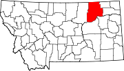 | |
| Towns | ||
| CDPs | ||
| Other communities | ||
| Indian reservations | ||
| Ghost towns | ||
| Footnotes | ‡This populated place also has portions in an adjacent county or counties | |
| International | |
|---|---|
| National | |
| Geographic | |
| Other | |