
Girei | |
|---|---|
LGA and town | |
 Map of Adamawa State highlighting Girei | |
| Nickname: man geda bata bacci ko anyi ruwan sama | |
 Girei | |
| Coordinates: 9°22′N 12°33′E / 9.367°N 12.550°E | |
| Country | |
| State | Adamawa State |
| Area | |
| • Total | 400 sq mi (1,040 km2) |
| Population (2022)[1] | |
| • Total | 200,200 |
| • Density | 500/sq mi (190/km2) |
| Time zone | UTC+1 (WAT) |
 | |
Girei is a town and local government area of Adamawa State, Nigeria. It lies on the Benue River.[2] The dominant tribe in the area are the Fulɓe or Fulani; however, a substantial number of Bwatiye also dwell in villages such as Greng, Notable, and Labondo within the Girei local government area.[3][4] The primary occupation of the people in the area is farming and cattle rearing.[5] Girei is also a home to Radio Gotel.[4]
Climate
In Girei, the dry season is oppressively hot and partially cloudy, and the wet season is oppressively hot and humid. The average annual temperature ranges from 62 to 102 degrees Fahrenheit, rarely falling below 56 or rising over 108.[6][7][8]
Girei's typical hot temperature
From February 26 to April 26 is the hot season, which has an average daily high temperature of over 99 °F. With an average high of 100 °F and low of 80 °F, April is the hottest month of the year in Girei.[7][6]
Girei's typical cool temperature
The 3.3-month cool season, which runs from June 23 to October 1, has an average daily maximum temperature of less than 90 °F. Girei experiences its coldest month of the year in January, with an average high of 91 °F and low of 63 °F.[6][7][8]
Girei's Cloud
Agaie's annual average for the proportion of the sky that is covered in clouds varies significantly by season.[6][7][8]
Around November 6 marks the start of Agaie's clearer season, which lasts for 3.5 months and ends around February 21.[6][7]
In Agaie, December is the clearest month of the year, with the sky remaining clear, mostly clear, or partly overcast 55% of the time.[6][7]
Beginning at February 21 and lasting for 8.5 months, the cloudier period of the year ends around November 6.[7][6]
May is the cloudiest month of the year in Agaie, with the sky being overcast or mostly cloudy 82% of the time on average during this month.[7][6]
Pollution
In excess of 3,000 individuals have been uprooted across Jabilamba people group and environs in Girei LGA, following extreme blaze flooding from weighty storms somewhere in the range of 18 and 19 August. As per SEMA, something like 10 occupants were killed and three others injured in the blaze flooding that additionally harmed or annihilated many homes, basic offices and vocations across the impacted regions.
Sources have announced the appearance of a portion of the uprooted families in adjoining Tune and Yola LGAs starting around 22 August, while many homes stay lowered across the impacted regions and most occupants unfit to get back to rescue property and resources.
Girei LGA is one of the significant cholera areas of interest in Adamawa State and the defilement of water sources by the floodwater has uplifted the dangers of waterborne sicknesses across the impacted regions.
Notwithstanding, unverified reports from Girei showed that the town is totally abandoned after the flooding, decimation of vocations and progressing food deficiencies because of the lean season.[9]
History
In 1853, Lamido Muhammad Lawal led a decisive expedition against the formidable Bata of Bagale, a group that had staunchly resisted previous Fulbe attacks during Modibbo Adama's rule. The Bata were known for raiding traders along a critical trade route passing through their region, disrupting the flow of essential caravans that required military escorts. The Fulbe also critically needed farmlands and grazing areas at the time which made the Bagale area highly important to Lamido Lawal due to its fertile land which was suitable for both farming and grazing.[10]
According to German explorer Heinrich Barth the Bata of Bagale "protected by the inaccessible character of their strongholds, and their formidable double spears, have not only been able hitherto to repulse all attacks' which the Fulbe had been making against them, but descending from their haunts, commit almost daily depredations upon the cattle of their enemies."[10]
Previous attempts to conquer Bagale through two expeditions had failed, as Yola's forces heavily relied on cavalry tactics that proved ineffective in the region's mountainous terrain. However, Lamido Lawal was determined to achieve success and prepared for a prolonged siege, founding Girei as a base for the long siege. After an intense two-month-long siege, Bagale was finally overcome. Oral tradition highlights the role of a Bagale woman seeking vengeance against Geloye, the chief of Bagale, who had abducted her daughter. This woman guided the Yola forces under the cover of darkness to Geloye's location. During this covert operation, Geloye was killed, and the stronghold was razed to the ground.[10][11]
With the Bata's influence subdued, the region saw an increase in grazing activity by Fulbe nomads and the establishment of Fulbe settlements. Lamido Lawal appointed Lawan Dan Goba to oversee the inhabitants of the plains north of the Benue River, giving him significant authority. During the latter part of Lamido Lawal's reign, Girei gained prominence as a hub for scholars who had migrated to Fombina from various parts of the Sokoto Caliphate. This gathering of scholars contributed to the intellectual and cultural growth of the area.[10]
Local Government Area
State capital: Yola | ||
| Local Government Areas | 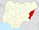 | |
References
- ^ "Girei (Local Government Area, Nigeria) - Population Statistics, Charts, Map and Location". www.citypopulation.de. Retrieved 2024-02-05.
- ^ "Rapid Overview of Areas of Return (ROAR): Girei LGA, Adamawa State, Nigeria, June 2022 - Nigeria | ReliefWeb". reliefweb.int. 2022-06-07. Retrieved 2023-07-12.
- ^ "Adamawa | Fulfulde, Ganye, Yola | Britannica". www.britannica.com. Retrieved 2023-07-12.
- ^ a b places (1970-01-01). "Towns & Villages in Gerei « Adamawa State « Nigeria". Towns & Villages. Retrieved 2023-07-12.
- ^ "Girei Local Government Area". www.finelib.com. Retrieved 2023-07-12.
- ^ a b c d e f g h "Simulated historical climate & weather data for Girei". meteoblue. Retrieved 2023-07-12.
- ^ a b c d e f g h "Girei Climate, Weather By Month, Average Temperature (Nigeria) - Weather Spark". weatherspark.com. Retrieved 2023-07-12.
- ^ a b c Vizzuality. "Agaie, Niger, Nigeria Deforestation Rates & Statistics | GFW". www.globalforestwatch.org. Retrieved 2023-07-12.
- ^ "Nigeria: Jabilamba Community, Girei LGA, Adamawa State - Flash Floods Update, August 2022 - Nigeria | ReliefWeb". reliefweb.int. 2022-08-25. Retrieved 2023-10-20.
- ^ a b c d Abubakar, Saʹad (1977). The lāmīb̳e of Fombina : a political history of Adamawa, 1809-1901. Internet Archive. Zaria, [Nigeria] : Ahmadu Bello University Press. p. 87. ISBN 978-978-125-011-8.
- ^ Njeuma, Martin (1969). THE RISE AND FALL OF FULANI RULE IN ADAMAWA 1809 - 1901 (PDF). University of London. p. 140.