Gilles Street | |
|---|---|
 | |
| Gilles Street in 2010 | |
 | |
| Coordinates | |
| General information | |
| Type | Street |
| Location | Adelaide city centre |
| Length | 1.6 km (1.0 mi)[1] |
| Opened | 1837 |
| Major junctions | |
| West end | King William Street Adelaide |
| East end | East Terrace Adelaide |
| Location(s) | |
| LGA(s) | City of Adelaide |
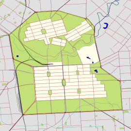
Gilles Street is a thoroughfare in the south-eastern sector of the centre of Adelaide, South Australia.[2][3] It runs east–west between East Terrace and King William Street, crossing Hutt Street and Pulteney Street. It was named after Osmond Gilles, an early treasurer of the colony of South Australia on 23 May 1837.[4][5]

Gilles Street is one of the narrower streets of the Adelaide grid, at 1 chain (66 ft; 20 m) wide. Two school properties adjoin near the western end: Gilles Street Primary School and Pulteney Grammar School.
Junction list
| Location | km[1] | mi | Destinations | Notes | |
|---|---|---|---|---|---|
| Adelaide city centre | 0 | 0.0 | King William Street | Continues as Gilbert Street | |
| 0.55 | 0.34 | Pulteney Street | |||
| 1.1 | 0.68 | Hutt Street | |||
| 1.6 | 0.99 | East Terrace | |||
| 1.000 mi = 1.609 km; 1.000 km = 0.621 mi | |||||
See also
- Gilles Street Primary School
References
- ^ a b Google (1 June 2022). "Gilles Street" (Map). Google Maps. Google. Retrieved 1 June 2022.
- ^ 2003 Adelaide Street Directory, 41st Edition. UBD (A Division of Universal Press Pty Ltd). 2003. ISBN 0-7319-1441-4.
- ^ Map Archived 25 March 2017 at the Wayback Machine of the Adelaide CBD, North Adelaide and the Adelaide Parklands.
- ^ "Gilles Street Primary School - History". 25 February 2008. Retrieved 24 April 2009.
- ^ "History of Adelaide Through Street Names - Streets Named on the 23rd May, 1837". 4 March 2005. Archived from the original on 19 February 2009. Retrieved 24 April 2009.
- ^ Department of Sustainability, Environment, Water, Population and Communities: Australian Heritage Database

