
Gibson Township, Cameron County, Pennsylvania | |
|---|---|
 An old road in the Quehanna Wild Area | |
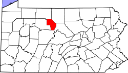
 Map of Cameron County, Pennsylvania highlighting Gibson Township | |
 Map of Cameron County, Pennsylvania | |
| Country | United States |
| State | Pennsylvania |
| County | Cameron |
| Settled | 1804 |
| Area | |
| • Total | 94.57 sq mi (244.93 km2) |
| • Land | 93.93 sq mi (243.29 km2) |
| • Water | 0.63 sq mi (1.64 km2) |
| Population (2020) | |
| • Total | 178 |
| • Estimate (2021)[2] | 174 |
| • Density | 1.60/sq mi (0.62/km2) |
| Time zone | UTC-5 (Eastern (EST)) |
| • Summer (DST) | UTC-4 (EDT) |
| Area code | 814 |
| FIPS code | 42-023-29008 |
Gibson Township is a township in Cameron County, Pennsylvania, United States. The population was 178 at the 2020 census,[2] up from 164 in 2010,[3] which in turn was a decline from the figure of 222 in 2000.
YouTube Encyclopedic
-
1/1Views:1 402
-
Frack Site Near Homes and Road - New Milford, Pa.
Transcription
Geography
Gibson Township is in southern Cameron County and is bordered by Lumber Township to the north, Grove Township to the east, Clearfield County to the south and Elk County to the west. The township surrounds the borough of Driftwood but is separate from it.
According to the United States Census Bureau, the township has a total area of 94.6 square miles (244.9 km2), of which 93.9 square miles (243.3 km2) is land and 0.62 square miles (1.6 km2), or 0.67%, is water.[3] The Driftwood Branch and Bennett Branch of Sinnemahoning Creek flow through the township, joining at Driftwood to form Sinnemahoning Creek, which continues east across the township on its way towards the West Branch Susquehanna River.
Demographics
| Census | Pop. | Note | %± |
|---|---|---|---|
| 2000 | 222 | — | |
| 2010 | 164 | −26.1% | |
| 2020 | 178 | 8.5% | |
| 2021 (est.) | 174 | [2] | −2.2% |
| U.S. Decennial Census[4] | |||
As of the census[5] of 2000, there were 222 people, 89 households, and 60 families residing in the township. The population density was 2.3 people per square mile (0.9/km2). There were 578 housing units at an average density of 6.1/sq mi (2.4/km2). The racial makeup of the township was 96.40% White, 1.35% Native American, 0.45% Asian, and 1.80% from two or more races. Hispanic or Latino of any race were 1.80% of the population.
There were 89 households, out of which 25.8% had children under the age of 18 living with them, 65.2% were married couples living together, 2.2% had a female householder with no husband present, and 31.5% were non-families. 29.2% of all households were made up of individuals, and 14.6% had someone living alone who was 65 years of age or older. The average household size was 2.49 and the average family size was 3.10.
In the township the population was spread out, with 25.7% under the age of 18, 4.5% from 18 to 24, 24.3% from 25 to 44, 25.2% from 45 to 64, and 20.3% who were 65 years of age or older. The median age was 43 years. For every 100 females, there were 107.5 males. For every 100 females age 18 and over, there were 108.9 males.
The median income for a household in the township was $27,917, and the median income for a family was $36,667. Males had a median income of $31,250 versus $14,167 for females. The per capita income for the township was $11,888. About 5.0% of families and 4.2% of the population were below the poverty line, including none of those under the age of eighteen or sixty five or over.
Notable person
References
- ^ "2016 U.S. Gazetteer Files". United States Census Bureau. Retrieved August 13, 2017.
- ^ a b c Bureau, US Census. "City and Town Population Totals: 2020-2021". Census.gov. US Census Bureau. Retrieved June 25, 2022.
- ^ a b "Geographic Identifiers: 2010 Demographic Profile Data (G001): Gibson township, Cameron County, Pennsylvania". U.S. Census Bureau, American Factfinder. Archived from the original on February 13, 2020. Retrieved April 1, 2015.
- ^ "Census of Population and Housing". Census.gov. Retrieved June 4, 2016.
- ^ "U.S. Census website". United States Census Bureau. Retrieved January 31, 2008.
Municipalities and communities of Cameron County, Pennsylvania, United States | ||
|---|---|---|
| Boroughs |  | |
| Townships | ||
| CDP | ||
| Unincorporated communities | ||
41°22′00″N 78°06′59″W / 41.36667°N 78.11639°W