General Enrique Martínez
La Charqueada | |
|---|---|
Village | |
 Pontoon ferry over Cebollatí River at La Charqueada | |
| Coordinates: 33°12′24″S 53°48′19″W / 33.20667°S 53.80528°W | |
| Country | |
| Department | Treinta y Tres Department |
| Founded | 1914 |
| Population (2011) | |
| • Total | 1,430 |
| Time zone | UTC -3 |
| Postal code | 33002 |
| Dial plan | +598 4458 (+4 digits) |
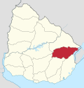
General Enrique Martínez, also known as La Charqueada, is a village in the Treinta y Tres Department of eastern Uruguay.
YouTube Encyclopedic
-
1/3Views:8718 9241 024
-
PUEBLO GRAL ENRIQUE MARTÍNEZ - PUERTO DE "LA CHARQUEADA"
-
On Being: Krista Tippett and Enrique Martínez Celaya
-
Enrique Martínez Celaya in conversation with Sir Charles Saumarez Smith and Catherine Goodman
Transcription
Geography
The village is located at the east end of Route 17, and the south end of Route 91, situated on the north bank of Cebollatí River and west of the mouth of the stream Arroyo del Parao. A small pontoon ferry connects across the Cebollatí River with a secondary street of 7.5 kilometres (4.7 mi), which joins it with Cebollatí of Rocha Department.
History
It was founded in April 1914 and was the head of the judicial section "Ceibos".[1] Its status was elevated to "Pueblo" (village) on 15 October 1963 by the Act of Ley Nº 13.167.[2]
Population
In 2011 it had a population of 1,430.[3]
| Year | Population |
|---|---|
| 1908 | 4,374 |
| 1963 | 931 |
| 1975 | 956 |
| 1985 | 979 |
| 1996 | 1,342 |
| 2004 | 1,513 |
| 2011 | 1,430 |
Source: Instituto Nacional de Estadística de Uruguay[1]
Economy
The economy based on agriculture, with extensive rice fields that make up part of the landscape, livestock and fish. Tourism is also important. It has a port that served to start trade with Brazil, exporting jerky products,[citation needed] which prompted the town to recently be renamed (La Charqueada).
Places of worship
- Mary Help of Christians Parish Church (Roman Catholic)
References
- ^ a b "Statistics of urban localities (1908–2004)" (PDF). INE. 2012. Archived from the original (PDF) on 13 November 2009.
- ^ "Ley Nº 13.167". República Oriental del Uruguay, Poder Legislativo. 1963. Archived from the original on 16 February 2015.
- ^ "Censos 2011 Cuadros Trenta y Tres". INE. 2012. Archived from the original on 10 October 2012. Retrieved 25 August 2012.
External links


