
Gaston, North Carolina | |
|---|---|
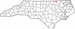 Location of Gaston, North Carolina | |
| Coordinates: 36°29′47″N 77°38′41″W / 36.49639°N 77.64472°W | |
| Country | United States |
| State | North Carolina |
| County | Northampton |
| Area | |
| • Total | 1.83 sq mi (4.74 km2) |
| • Land | 1.69 sq mi (4.38 km2) |
| • Water | 0.14 sq mi (0.36 km2) |
| Elevation | 131 ft (40 m) |
| Population (2020) | |
| • Total | 1,008 |
| • Density | 596.10/sq mi (230.20/km2) |
| Time zone | UTC-5 (Eastern (EST)) |
| • Summer (DST) | UTC-4 (EDT) |
| ZIP code | 27832 |
| Area code | 252 |
| FIPS code | 37-25560[3] |
| GNIS feature ID | 2406550[2] |
Gaston is a town in Northampton County, North Carolina, United States. The population was 1,152 at the 2010 census. It is part of the Roanoke Rapids, North Carolina Micropolitan Statistical Area.
YouTube Encyclopedic
-
1/5Views:61213 3105174 529808
-
Lake Gaston North Carolina
-
Gastonia - North Carolina - Downtown Drive
-
Lake Gaston, North Carolina - A Cinematic Travel Film
-
Things to do around Lake Gaston - Lake life is awesome!
-
Gaston County Blueways: A Family Adventure with Deborah Holt Noel
Transcription
History
The Gaston School was listed on the National Register of Historic Places in 2012.[4]
Geography
According to the United States Census Bureau, the town has a total area of 1.8 square miles (4.7 km2), of which 1.7 square miles (4.4 km2) is land and 0.1 square miles (0.26 km2) (7.65%) is water.
Demographics
| Census | Pop. | Note | %± |
|---|---|---|---|
| 1850 | 274 | — | |
| 1870 | 11 | — | |
| 1950 | 1,218 | — | |
| 1960 | 1,214 | −0.3% | |
| 1970 | 1,105 | −9.0% | |
| 1980 | 883 | −20.1% | |
| 1990 | 1,003 | 13.6% | |
| 2000 | 973 | −3.0% | |
| 2010 | 1,152 | 18.4% | |
| 2020 | 1,008 | −12.5% | |
| U.S. Decennial Census[5] | |||
2020 census
| Race | Number | Percentage |
|---|---|---|
| White (non-Hispanic) | 502 | 49.8% |
| Black or African American (non-Hispanic) | 447 | 44.35% |
| Native American | 10 | 0.99% |
| Other/Mixed | 34 | 3.37% |
| Hispanic or Latino | 15 | 1.49% |
As of the 2020 United States census, there were 1,008 people, 567 households, and 341 families residing in the town.
2000 census
As of the census[3] of 2000, there were 973 people, 429 households, and 296 families residing in the town. The population density was 575.5 inhabitants per square mile (222.2/km2). There were 479 housing units at an average density of 283.3 per square mile (109.4/km2). The racial makeup of the town was 66.39% White, 31.76% African American, 0.31% Native American, 0.31% from other races, and 1.23% from two or more races. Hispanic or Latino of any race were 1.03% of the population.
There were 429 households, out of which 27.7% had children under the age of 18 living with them, 43.6% were married couples living together, 22.6% had a female householder with no husband present, and 30.8% were non-families. 27.7% of all households were made up of individuals, and 11.9% had someone living alone who was 65 years of age or older. The average household size was 2.27 and the average family size was 2.73.
In the town, the population was spread out, with 24.7% under the age of 18, 8.8% from 18 to 24, 28.8% from 25 to 44, 23.1% from 45 to 64, and 14.6% who were 65 years of age or older. The median age was 37 years. For every 100 females, there were 82.2 males. For every 100 females age 18 and over, there were 80.5 males.
The median income for a household in the town was $23,824, and the median income for a family was $29,375. Males had a median income of $27,500 versus $18,819 for females. The per capita income for the town was $14,247. About 18.2% of families and 21.1% of the population were below the poverty line, including 35.5% of those under age 18 and 18.4% of those age 65 or over.
Education
The elementary and middle schools serving Gaston are Gaston Elementary and Gaston Middle. The high school serving Gaston is Northampton County High School.[7] Also located in Gaston is KIPP Pride High School, a charter school part of the Knowledge is Power Program commonly known as KIPP.[8]
References
- ^ "ArcGIS REST Services Directory". United States Census Bureau. Retrieved September 20, 2022.
- ^ a b U.S. Geological Survey Geographic Names Information System: Gaston, North Carolina
- ^ a b "U.S. Census website". United States Census Bureau. Archived from the original on December 27, 1996. Retrieved January 31, 2008.
- ^ "National Register of Historic Places Listings". Weekly List of Actions Taken on Properties: 4/09/12 through 4/13/12. National Park Service. April 20, 2012. Archived from the original on April 3, 2015. Retrieved March 4, 2015.
- ^ "Census of Population and Housing". Census.gov. Archived from the original on April 26, 2015. Retrieved June 4, 2015.
- ^ "Explore Census Data". data.census.gov. Archived from the original on December 24, 2021. Retrieved December 24, 2021.
- ^ Northampton County Schools Archived 2022-04-30 at the Wayback Machine. Retrieved June 21, 2020.
- ^ KIPP Pride High School Archived 2021-05-08 at the Wayback Machine. Retrieved June 21, 2020.
External links
Municipalities and communities of Northampton County, North Carolina, United States | ||
|---|---|---|
| Towns |  | |
| CDP | ||
| Other communities | ||
| International | |
|---|---|
| National | |