
Gantts Quarry, Alabama | |
|---|---|
 Abandoned houses in Gantts Quarry | |
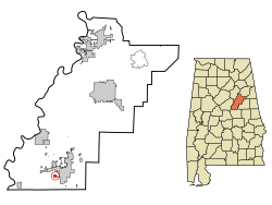 Location in Talladega County and the state of Alabama | |
| Coordinates: 33°08′54″N 86°17′22″W / 33.14833°N 86.28944°W | |
| Country | United States |
| State | Alabama |
| County | Talladega |
| Area | |
| • Total | 0.3 sq mi (0.9 km2) |
| • Land | 0.3 sq mi (0.9 km2) |
| • Water | 0 sq mi (0 km2) |
| Elevation | 633 ft (193 m) |
| Population (2000) | |
| • Total | 0 |
| • Density | 0.0/sq mi (0.0/km2) |
| Time zone | UTC-6 (Central (CST)) |
| • Summer (DST) | UTC-5 (CDT) |
| FIPS code | 01-28984 |
| GNIS feature ID | 0118815 |
Gantts Quarry is a quarry and ghost town in Talladega County, Alabama, United States. The population was 0 at the 2000 census,[1] although it had seven residents as late as the 1998 population estimate.[2] Incorporated in 1910 to keep neighboring Sylacauga from annexing it,[3] it was officially disincorporated after its population dwindled to zero effective December 31, 2001.[4]
YouTube Encyclopedic
-
1/3Views:2 939615592
-
Discover Alabama's Beautiful Hidden Quarry
-
Imerys-Gantt‘s Quarry Observation Site
-
"What Lies Beneath: Sylacauga's Abundant Marble Resource and...Artistic Applications" by Ruth Cook
Transcription
History
The history of the town goes back to 1830 when Dr. Edward Gantt discovered white marble and was one of the first towns in the county. A block of marble from the area is in the Washington Monument.[5] The 1930 census showed a population of 542 but the Great Depression and dwindling demand for marble used in building construction began the towns decline. In 1940 the population was 456 and by 1973 it was down to 63 residents. According to the 1990 U.S. Census, the incorporated town of Gantt's Quarry had a population of seven.[5]
When the town was first established, the town was governed by a mayor, a five-member city council, and the odd citizen out served as the town clerk. Company housing was set up for the employees. By the late 1960s, the company that owned the Quarry decided to demolish the company owned houses and this forced the residents to move to other towns and communities.
The town had its own post office, which also served as a library. The post office is pictured below. It was moved from the Quarry to its new location behind the B.B. Comer Museum in Sylacauga.
By the time of the 2000 Census, the town shows a population of zero,[6] and much of it appears to have been annexed into the city of Sylacauga. Preventing such an annexation was most likely the reason the town incorporated in the first place.
Demographics
| Census | Pop. | Note | %± |
|---|---|---|---|
| 1920 | 413 | — | |
| 1930 | 542 | 31.2% | |
| 1940 | 456 | −15.9% | |
| 1950 | 426 | −6.6% | |
| 1960 | 238 | −44.1% | |
| 1970 | 63 | −73.5% | |
| 1980 | 71 | 12.7% | |
| 1990 | 7 | −90.1% | |
| 2000 | 0 | −100.0% | |
| U.S. Decennial Census[7] | |||
Geography
Gantts Quarry is located at 33°08'54" North, 86°17'22" West (33.152570, -86.28942).[8]
According to the United States Census Bureau, the location has a total area of 0.9 km2 (0.3 mi²), all land.
Gallery
-
 The old marble quarry from which the town derived its name.
 -
 The old Gantts Quarry Post Office was moved to its current location at the corner of N. Norton Ave and W. 8th St. in Sylacauga, Alabama.
References
- ^ "U.S. Census website". United States Census Bureau. Retrieved January 31, 2008.
- ^ Bogie, Donald. 5,500 Year Old Concept Still Emerging in the Montgomery Area Archived September 1, 2006, at the Wayback Machine, Montgomery Advertiser, reprinted by Auburn University Montgomery. Printed January 1998; accessed December 13, 2007.
- ^ "Archived copy". news.google.com. Archived from the original on March 12, 2016. Retrieved January 13, 2022.
{{cite web}}: CS1 maint: archived copy as title (link) - ^ "Archived copy". Archived from the original on March 11, 2016. Retrieved March 10, 2016.
{{cite web}}: CS1 maint: archived copy as title (link) - ^ a b [1][dead link]
- ^ "Alabama Census 2000". Al.com. Archived from the original on March 4, 2016. Retrieved October 29, 2016.
- ^ "U.S. Decennial Census". Census.gov. Retrieved June 6, 2013.
- ^ "US Gazetteer files: 2010, 2000, and 1990". United States Census Bureau. February 12, 2011. Retrieved April 23, 2011.
External links
- Historic American Engineering Record (HAER) No. AL-6, "Gannts' Quarry, Quarry Road, Sylacauga, Talladega County, AL", 9 photos, 1 data page, 1 photo caption page
33°08′54″N 86°17′22″W / 33.14833°N 86.28944°W
Municipalities and communities of Talladega County, Alabama, United States | ||
|---|---|---|
| Cities | 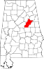 | |
| Towns | ||
| CDPs | ||
| Unincorporated communities | ||
| Ghost town | ||
| Footnotes | ‡This populated place also has portions in an adjacent county or counties | |