
Gaju | |
|---|---|
Populated place | |
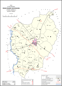 Map showing Gaju (#864) in Kachhauna CD block | |
 Gaju Location in Uttar Pradesh, India  Gaju Gaju (India) | |
| Coordinates: 27°12′N 80°23′E / 27.200°N 80.383°E[1] | |
| Country | |
| State | Uttar Pradesh |
| District | Hardoi |
| Area | |
| • Total | 12.994 km2 (5.017 sq mi) |
| Population (2011)[2] | |
| • Total | 8,912 |
| • Density | 690/km2 (1,800/sq mi) |
| Languages | |
| • Official | Hindi |
| Time zone | UTC+5:30 (IST) |
Gaju is a village in Kachhauna block of Hardoi district, Uttar Pradesh, India.[2] Located on the road from Balamau station to Beniganj and Sitapur,[1] Gaju has a railway station (Gaju Halt) on the Sitapur-Balamau branch line and hosts a market on Mondays and Thursdays.[3] As of 2011, its population is 8,912, in 1,592 households.[2]
History
At the turn of the 20th century, Gaju was described as a mostly unremarkable agricultural village, with good soil and a small village school.[1] It lay in the pargana of Sandila and was held in taluqdari tenure by Maharaj Singh of Atwa Nasirpur, who resided in the neighbouring village of Hathaura.[1] British authors at the time considered it only noteworthy for its large size: the 1901 census recorded its population as being 2,510 people.[1]
The 1961 census recorded Gaju as comprising 10 hamlets, with a total population of 3,846 (2,050 male and 1,796 female), in 768 households and 592 physical houses.[3] The area of the village was given as 3,347 acres.[3] Average attendance of the biweekly market was about 100.[3]
References
- ^ a b c d e Nevill, H.R. (1904). Hardoi - A Gazetteer. Allahabad: Government Press. p. 24. Retrieved 15 June 2021.
- ^ a b c d "Census of India 2011: Uttar Pradesh District Census Handbook - Hardoi, Part A (Village and Town Directory)" (PDF). Census 2011 India. pp. 407–16. Retrieved 15 June 2021.
- ^ a b c d Census 1961: District Census Handbook, Uttar Pradesh (36 - Hardoi District) (PDF). Lucknow. 1965. pp. 144, 160–1, 168, cxxxvi-cxxxvii of section "Sandila Tehsil". Retrieved 15 June 2021.
{{cite book}}: CS1 maint: location missing publisher (link)