
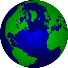
GSHHG (Global Self-consistent, Hierarchical, High-resolution Geography Database; formerly Global Self-consistent, Hierarchical, High-resolution Shoreline Database (GSHHS)) is a high-resolution shoreline data set amalgamated from two data bases (the CIA world database WDBII, and the World Vector Shoreline database) in the public domain. The data have undergone extensive processing and are free of internal inconsistencies such as erratic points and crossing segments. The shorelines are constructed entirely from hierarchically arranged closed polygons. The four-level hierarchy is as follows: seashore, lakes, islands within lakes, ponds within islands within lakes.
The data can be used to simplify data searches and data selections, or to study the statistical characteristics of shorelines and land-masses. It comes with access software and routines to facilitate decimation based on a standard line-reduction algorithm.
GSHHS is developed and maintained by Dr. Paul Wessel at the University of Hawaiʻi, and Dr. Walter H. F. Smith at the NOAA Laboratory for Satellite Altimetry.
YouTube Encyclopedic
-
1/1Views:804
-
OpenCPN: Pilot Charts, Polar, Climatology, GSHHG. #13
Transcription
See also
- Vector Map, a vector based collection of GIS data covering the earth
References
- Wessel, Pål; Smith, Walter H. F. (1996). "A global, self-consistent, hierarchical, high-resolution shoreline database". Journal of Geophysical Research: Solid Earth. 101 (B4): 8741–8743. Bibcode:1996JGR...101.8741W. doi:10.1029/96JB00104. ISSN 0148-0227.
External links
- GSHHG - A Global Self-consistent, Hierarchical, High-resolution Geography Database (Version 2.3.7 as of June 15, 2017)
- Shoreline/Coastline Databases | NCEI
This article contains public domain text created by the U.S. Federal government, taken from the NOAA website at [1]
This cartography or mapping term article is a stub. You can help Wikipedia by expanding it. |
This database-related article is a stub. You can help Wikipedia by expanding it. |
This oceanography article is a stub. You can help Wikipedia by expanding it. |