
Fukagawa
深川市 | |
|---|---|
 Flag  Emblem | |
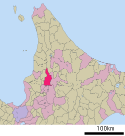 Location of Fukagawa in Hokkaido (Sorachi Subprefecture) | |
 Fukagawa Location in Japan | |
| Coordinates: 43°43′4″N 142°2′25″E / 43.71778°N 142.04028°E | |
| Country | Japan |
| Region | Hokkaido |
| Prefecture | Hokkaido (Sorachi Subprefecture) |
| Government | |
| • Mayor | Takefumi Yamashita |
| Area | |
| • Total | 529.12 km2 (204.29 sq mi) |
| Population (October 1 2020) | |
| • Total | 20,039 |
| • Density | 38/km2 (98/sq mi) |
| Time zone | UTC+09:00 (JST) |
| City hall address | 17-17 Ni-jō, Fukagawa-shi, Hokkaidō 074-8650 |
| Climate | Dfb |
| Website | www |
| Symbols | |
| Bird | Common cuckoo |
| Flower | Chrysanthemum |
| Tree | Japanese White Birch |
Fukagawa (深川市, Fukagawa-shi) is a city located in Sorachi Subprefecture, Hokkaido, Japan.
As of 1 October 2020, the city has an estimated population of 20,039, and the density of 38 persons per km2. The total area is 529.12 km2.
Fukagawa is a small but vibrant city most known for its plentiful rice fields and apple and cherry orchards in Otoe, a township to the south of the downtown area. Fukagawa is growing largely in Otoe, anchored by its Roadside Station, which is the third-busiest in Hokkaido, according to an article in the Hokkaido Shimbun.
YouTube Encyclopedic
-
1/5Views:6491 9032 1881 473479
-
Hokkaido Fukagawa City【English】Long Ver.
-
4K Walk Japan 深川市の本町通り商店街を散歩 2021年7月
-
ウロコダンゴを食べてみた @北海道深川市 UrokoDango in Fukagawa Hokkaido
-
戸外炉峠(ととろとうげ)のネコバス。深川市を一望できる展望台 【Fukagawa Hokkaido】
-
Sapporo station to Fukagawa station in Hokkaido by train
Transcription
Geography
Fukagawa is located on the Ishikari Plain, and is roughly an equal distance in between Asahikawa to the northeast, and Takikawa to the southwest.[1][2]
Neighboring municipalities
Fukagawa borders on nine municipalities in Hokkaido Prefecture, spanning Sorachi, Kamikawa, and Rumoi subprefectures:
- Sorachi Subprefecture
- Kamikawa Subprefecture
- Rumoi Subprefecture
Climate
| Climate data for Fukagawa (1991−2020 normals, extremes 1977−present) | |||||||||||||
|---|---|---|---|---|---|---|---|---|---|---|---|---|---|
| Month | Jan | Feb | Mar | Apr | May | Jun | Jul | Aug | Sep | Oct | Nov | Dec | Year |
| Record high °C (°F) | 6.1 (43.0) |
7.7 (45.9) |
13.5 (56.3) |
25.7 (78.3) |
31.9 (89.4) |
33.6 (92.5) |
35.8 (96.4) |
36.1 (97.0) |
33.1 (91.6) |
24.9 (76.8) |
20.9 (69.6) |
13.2 (55.8) |
36.1 (97.0) |
| Mean daily maximum °C (°F) | −3.2 (26.2) |
−2.0 (28.4) |
2.3 (36.1) |
10.1 (50.2) |
17.6 (63.7) |
21.8 (71.2) |
25.2 (77.4) |
25.8 (78.4) |
21.8 (71.2) |
15.0 (59.0) |
6.5 (43.7) |
−0.9 (30.4) |
11.7 (53.0) |
| Daily mean °C (°F) | −7.3 (18.9) |
−6.6 (20.1) |
−2.0 (28.4) |
4.8 (40.6) |
11.7 (53.1) |
16.4 (61.5) |
20.1 (68.2) |
20.6 (69.1) |
16.1 (61.0) |
9.5 (49.1) |
2.5 (36.5) |
−4.3 (24.3) |
6.8 (44.2) |
| Mean daily minimum °C (°F) | −13.0 (8.6) |
−13.0 (8.6) |
−7.5 (18.5) |
−0.5 (31.1) |
6.3 (43.3) |
11.9 (53.4) |
16.2 (61.2) |
16.4 (61.5) |
10.9 (51.6) |
4.3 (39.7) |
−1.5 (29.3) |
−9.0 (15.8) |
1.8 (35.2) |
| Record low °C (°F) | −28.9 (−20.0) |
−29.7 (−21.5) |
−26.7 (−16.1) |
−14.8 (5.4) |
−3.2 (26.2) |
2.6 (36.7) |
6.8 (44.2) |
7.5 (45.5) |
0.7 (33.3) |
−6.0 (21.2) |
−18.9 (−2.0) |
−28.7 (−19.7) |
−29.7 (−21.5) |
| Average precipitation mm (inches) | 50.0 (1.97) |
39.9 (1.57) |
42.7 (1.68) |
47.9 (1.89) |
67.9 (2.67) |
62.1 (2.44) |
130.1 (5.12) |
147.3 (5.80) |
147.0 (5.79) |
122.6 (4.83) |
111.1 (4.37) |
74.4 (2.93) |
1,044.2 (41.11) |
| Average snowfall cm (inches) | 243 (96) |
188 (74) |
146 (57) |
23 (9.1) |
0 (0) |
0 (0) |
0 (0) |
0 (0) |
0 (0) |
1 (0.4) |
83 (33) |
242 (95) |
929 (366) |
| Average precipitation days (≥ 1.0 mm) | 16.3 | 13.6 | 11.9 | 11.1 | 10.7 | 8.7 | 10.2 | 11.1 | 13.4 | 15.4 | 19.2 | 19.1 | 160.7 |
| Average snowy days (≥ 3 cm) | 23.2 | 19.4 | 16.1 | 3.0 | 0 | 0 | 0 | 0 | 0 | 0.2 | 7.3 | 22.0 | 91.2 |
| Mean monthly sunshine hours | 73.9 | 91.1 | 133.1 | 162.1 | 195.7 | 171.6 | 166.9 | 163.3 | 153.4 | 127.4 | 65.3 | 54.2 | 1,560 |
| Source: Japan Meteorological Agency[3][4] | |||||||||||||
History
Fukagawa was settled by the tondenhei, or the colonist militia, between 1895 and 1896.[1][5]
- 1892 Fukagawa village was founded.
- 1915 Tadoshi village split off from Ichiyan village.
- 1918 Fukagawa village became Fukagawa town.
- 1962 Tadoshi village became Tadoshi town.
- 1963 Fukagawa town, Ichiyan village, Osamunai village, and Otoe village were merged to form Fukagawa city.
- 1970 Tadoshi town was merged into Fukagawa city.
Economy
The main economic activity of Fukugawa is rice production. Rice paddies in the city are irrigated by the Taishō Canal, which is channeled off the Ishikari River. Potatoes and apples are also agricultural products of the city.[1]
Education
Junior college
High schools
Public
- Hokkaido Fukagawa Nishi High School
- Hokkaido Fukagawa Higashi High School
Private
- Clark Memorial International High School
Transportation
Both trains and buses provide a direct link to the prefectural capital, Sapporo.
Rail
- JR Hokkaido Hakodate Main Line : Fukagawa - Osamunai
- JR Hokkaido Rumoi Main Line : Fukagawa - Kita-Ichiyan
Road
- Hokkaido Expressway : Fukagawa IC
- Fukagaw-Rumoi Expressway : Fukagawa-Nishi IC
- Route 12
Sister city
 Abbotsford, British Columbia, Canada[6]
Tourism
One of the main tourist attractions is Mount Kamui, a popular ski resort technically in Asahikawa, but only minutes away from Fukagawa by car or bus.[7]
References
- ^ a b c "Fukagawa". Encyclopedia of Japan. Tokyo: Shogakukan. 2013. OCLC 56431036. Archived from the original on 2007-08-25. Retrieved 2013-09-20.
- ^ "深川(市)" [Fukagawa]. Nihon Daihyakka Zensho (Nipponika) (in Japanese). Tokyo: Shogakukan. 2013. OCLC 153301537. Archived from the original on 2007-08-25. Retrieved 2013-09-20.
- ^ 観測史上1~10位の値(年間を通じての値). JMA. Retrieved March 3, 2022.
- ^ 気象庁 / 平年値(年・月ごとの値). JMA. Retrieved March 3, 2022.
- ^ History of Fukagawa
- ^ Sister city of Fukagawa
- ^ Kamui Ski Links
External links
- Official Website (in Japanese)
| ||||||||||||
| ||||||||||||
| ||||||||||||
| ||||||||||||
| ||||||||||||
| ||||||||||||
| ||||||||||||
| ||||||||||||
| ||||||||||||
| ||||||||||||
| ||||||||||||
| ||||||||||||
| ||||||||||||
| ||||||||||||
| International | |
|---|---|
| National | |
| Geographic | |
This Hokkaidō location article is a stub. You can help Wikipedia by expanding it. |