
Friendship Heights | |
|---|---|
 Facing north on Wisconsin Avenue in Friendship Heights | |
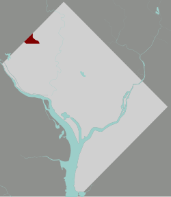 Map of Washington, D.C., with Friendship Heights highlighted in red | |
| Coordinates: 38°57′25″N 77°05′02″W / 38.957°N 77.083778°W | |
| Country | United States |
| District | Washington, D.C. |
| Ward | Ward 3 |
| Government | |
| • Councilmember | Matthew Frumin |
Friendship Heights is an urban commercial and residential neighborhood in northwest Washington, D.C., and southern Montgomery County, Maryland. Though its borders are not clearly defined, Friendship Heights consists roughly of the neighborhoods and commercial areas around Wisconsin Avenue north of Fessenden Street NW and Tenleytown to Somerset Terrace and Willard Avenue in Maryland, and from River Road in the west to Reno Road and 41st Street in the east. Within Maryland west of Wisconsin Avenue is the Village of Friendship Heights, technically a special taxation district.
The portion in the District of Columbia lies in Ward 3, represented by ANCs 3E03 and 3E04. It is often considered to be part of Chevy Chase, D.C.; The most substantial commercial aspects are the shopping plazas near the intersection of Wisconsin and Western Avenues. Found here are many department stores, as well as numerous boutiques, day spas, a multiplex cinema and other services which cater to the residents as well as visitors to the area. The area also features a variety of moderate and discount chains.
The neighborhood also supports a number of offices, including the corporate headquarters of insurance giant GEICO (originally Government Employees Insurance Company) and the Ritz-Carlton hotel chain, and a concentration of broadcast media including the studios of WMAL-FM and WTOP-FM. As a result, heavy traffic is not uncommon.
The Friendship Heights Station on the Red Line of the Washington Metro system serves the area, and the station is also a major connecting depot for area bus services. Streetcar service, which once connected the neighborhood to Georgetown, was abandoned in 1960.
Since the late 1990s, development has accelerated in the neighborhood, notably the construction of Chase Tower on Willard Avenue, a new Chevy Chase Center replacing the older 1980s-era complex of the same name, and new condominiums on the site of the former Washington Women's Clinic.
Retail
For decades, a six-block stretch of Wisconsin Avenue in Friendship Heights and Chevy Chase contained the only concentration of traditional department stores at least partially in Washington, D.C. Two of these closed in 2020: the Lord & Taylor and Neiman Marcus stores, both of which were in D.C.[1] As of 2022, two department stores remain, both on the Maryland side: a freestanding Saks Fifth Avenue and a Bloomingdale's in Wisconsin Place, which also includes a Whole Foods Market, boutiques, and residential and office space.
The D.C. portion of the stretch includes these shopping centers:
- Friendship Center, with big-box discount retailers Marshalls and DSW
- Chevy Chase Metro Center, with big-box craft retailer Michaels
- Chevy Chase Pavilion, whose Cost Plus World Market and Old Navy closed in 2020.[2]
On the Maryland side is The Collection at Chevy Chase, an upscale center that includes a Tiffany & Co. location.
Education
District of Columbia Public Schools operates public schools. Friendship Heights is served by Janney Elementary School, Alice Deal Middle School, and Jackson-Reed High School.[3]
The Maryland side of Friendship Heights is served by Somerset Elementary School, Westland Middle School, and Bethesda Chevy Chase High School.
District of Columbia Public Library operates the Tenley-Friendship Library.[4] After seven years in an interim location, the library reopened in 2011 at the corner of Wisconsin Avenue and Albemarle Streets.[5]
See also
External links
References
- ^ https://planning.dc.gov/sites/default/files/dc/sites/op/publication/attachments/Friendship%2520Heights.draft%2520final.pdf
- ^ https://www.popville.com/2020/12/friendship-heights-is-looking-more-and-more-bare/
- ^ "D.C.'s new school boundaries for 2015 - Washington Post".
- ^ "Hours & Locations." District of Columbia Public Library. Retrieved on October 21, 2009.
- ^ "Hours & Locations." District of Columbia Public Library. Retrieved on October 21, 2009.
Places adjacent to Friendship Heights | ||||||||||||||||
|---|---|---|---|---|---|---|---|---|---|---|---|---|---|---|---|---|
| ||||||||||||||||
| International | |
|---|---|
| National | |