Rehlingen-Siersburg | |
|---|---|
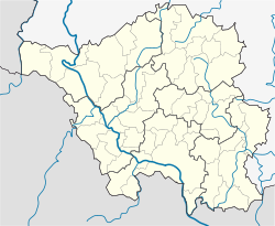
Location of Rehlingen-Siersburg within Saarlouis district  | |
| Coordinates: 49°22′7″N 6°40′43″E / 49.36861°N 6.67861°E | |
| Country | Germany |
| State | Saarland |
| District | Saarlouis |
| Subdivisions | 10 |
| Government | |
| • Mayor (2021–31) | Joshua Pawlak[1] (SPD) |
| Area | |
| • Total | 61.16 km2 (23.61 sq mi) |
| Elevation | 193 m (633 ft) |
| Population (2022-12-31)[2] | |
| • Total | 14,349 |
| • Density | 230/km2 (610/sq mi) |
| Time zone | UTC+01:00 (CET) |
| • Summer (DST) | UTC+02:00 (CEST) |
| Postal codes | 66780 |
| Dialling codes | 06835, 06869, 06833, 06861 |
| Vehicle registration | SLS |
| Website | www |
Rehlingen-Siersburg is a municipality in the district of Saarlouis, in Saarland, Germany. It is situated on the river Saar, approx. 8 km northwest of Saarlouis, and 30 km northwest of Saarbrücken.
YouTube Encyclopedic
-
1/2Views:4174 583
-
Burg Siersburg
-
Schwenk Weltrekord Siersburg 16.07.2010
Transcription
Geography
Location
Rehlingen is located at the Saar, Siersburg is located at the Nied, the other districts are partly on the Gau (Saargau), partly in the valley of the Nied, a left-side tributary of the Saar. Rehlingen-Siersburg borders France to the west, Merzig-Wadern district to the north, Dillingen / Saar to the east, and Wallerfangen to the south.
Municipal districts
- Biringen
- Eimersdorf
- Fremersdorf
- Fürweiler
- Gerlfangen
- Hemmersdorf
- Niedaltdorf
- Oberesch
- Rehlingen Siersburg
Sights
- Castle Fremersdorf
- Castle Siersburg
- Niedaltdorf stalactite cave
- Lorraine houses and castles in different districts
- Niedtal
- Saargau
- Druids path
References
- ^ Gewählte Ober-/Bürgermeister*innen, Landrät*innen und Regionalverbandsdirektor*in im Saarland, Statistisches Amt des Saarlandes, 27 March 2022.
- ^ "Fläche und Bevölkerung - Stand: 31.12.2022 (Basis Zensus 2011)" (PDF) (in German). Statistisches Amt des Saarlandes. June 2023.


