
| Fort Portal–Bundibugyo–Lamia Road | |
|---|---|
| Route information | |
| Length | 65 mi (105 km) |
| History | Designated in 2010 Completed in 2014 |
| Major junctions | |
| East end | Fort Portal |
| Bundibugyo | |
| West end | Lamia |
| Location | |
| Country | Uganda |
| Highway system | |
The Fort Portal–Bundibugyo–Lamia Road is in the Western Region of Uganda. It links Fort Portal in the Kabarole District with the towns of Bundibugyo and Lamia in the Bundibugyo District.
Location
The road starts in Fort Portal, east of the Rwenzori Mountains. It runs north along the western border of Semliki National Park. After cutting across the mountain range, it makes a 180 degree turn and runs south along the western foothills of the range. It gradually turns westward, through Bundibugyo town to end at the border with the Democratic Republic of the Congo (DRC) at the banks of the Lamia River.[1][2] The length of the road is approximately 103.6 kilometres (64.4 mi).[3] The coordinates of the road in Bundibugyo town are 0°42'25.0"N, 30°03'47.0"E (Latitude:0.706944; Longitude:30.063056).[4]
Overview
Before 2010, the road was gravel surface. Between 2010 and 2014, the government of Uganda, with funding from the African Development Bank (ADB), upgraded the road to class II asphalt bitumen with a width of 6 metres (20 ft) and shoulders of 1.5 metres (4.9 ft) on each side.[5] Construction was undertaken by the Chongqing International Construction Corporation from March 2010[6] until March 2014.[7] The road was officially commissioned in August 2015 by Allen Kagina, the executive director of the Uganda National Roads Authority.[8]
Construction costs
The original cost of the road was budgeted at USh 170 billion (US$68 million) in 2010, with the government of Uganda contributing USh 29.58 billion (17.4 percent) and the ADB providing a loan of USh 140.42 billion (82.6 percent).[3] Because of the adverse terrain and other factors, the original road design was revised and the final contract price was USh 217.8 billion.[2]
Point of interest
Other point of interest close to or near the road:
- settlement of Bujerere in Bundibugyo District on the banks of the Lamia River forming the international border with the DRC
See also
References
- ^ "Upgrading of Fort Portal – Lamia Road: Environmental And Social Impact Assessment (ESIA)" (PDF). African Development Bank. 2009. Retrieved 8 July 2015.
- ^ a b "Surfacing Fort Portal-Bundibugyo-Lamia Road" (PDF). Uganda National Roads Authority. March 2014. Retrieved 8 July 2015.
- ^ a b Rwothungeyo, Billy (24 June 2013). "Fort Portal–Bundibugyo – Lamia road almost complete". New Vision. Kampala. Retrieved 6 July 2015.
- ^ Google (6 July 2015). "Location of Fort Portal–Bundibugyo–Lamia Road At Bundibugyo Town" (Map). Google Maps. Google. Retrieved 6 July 2015.
- ^ "Upgrade Fort Portal – Bundibugyo – Lamia Road". Uganda Ministry of Works And Transport. 6 July 2015. Archived from the original on 6 July 2015. Retrieved 6 July 2015.
- ^ "New road redefines lifel in rural Uganda". Trademarksa.org Quoting East African Business Week. 28 July 2010. Retrieved 6 July 2015.
- ^ "Fort Portal – Bundibugyo-Lamia (Funded by AfDB/GOU)". Uganda National Roads Authority. 7 July 2015. Retrieved 7 July 2015.
- ^ Katusabe, Ruth; Mumbere, Morris. "UNRA boss warns road reserve encroachers". Daily Monitor. Kampala. Archived from the original on 4 March 2016. Retrieved 12 August 2015.
External links
Capital: Kabarole | ||
| Counties and sub-counties |
|  |
| Towns and villages |
| |
| Geography | ||
| Economy | ||
| Notable landmarks | ||
| Health | ||
| Education | ||
| Energy | ||
| Transport | ||
| Notable people |
| |
Capital: Bundibugyo | ||
| Towns and villages | 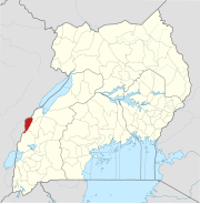 | |
| Banking | ||
| Energy | ||
| Notable landmarks |
| |
| Transport | ||
| Health | ||
| Notable people | ||
00°42′25″N 30°03′47″E / 0.70694°N 30.06306°E