
Firmino Alves
Município de Firmino Alves | |
|---|---|
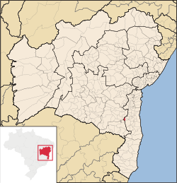 Location of Firmino Alves in Bahia | |
 Firmino Alves Location of Firmino Alves in Brazil | |
| Coordinates: 14°59′06″S 39°55′26″W / 14.98500°S 39.92389°W | |
| Country | |
| Region | Northeast |
| State | |
| Founded | August 27, 1962 |
| Government | |
| • Mayor | Lero Cunha (PSB, 2013-2016) |
| Area | |
| • Total | 172.35 km2 (66.54 sq mi) |
| Population (2020 [1]) | |
| • Total | 5,629 |
| • Density | 33/km2 (85/sq mi) |
| Demonym | Firmino-alvense |
| Time zone | UTC−3 (BRT) |
| Website | x |
Firmino Alves is a municipality in the state of Bahia in the North-East region of Brazil. It covers 172.35 km2 (66.54 sq mi), and has a population of 5,629 with a population density of 33.15 inhabitants per square kilometer. Remanso was originally inhabited by indigenous people of the Baiana or Paraguaçu ethnic group. Leonel Vieira Lima started a manioc farm and flour factory in 1935. Other families followed and formed the village Itamirim in 1938. Firmino Alves became an independent municipality on August 27, 1962, when it was separated from the municipality of Ibicaraí. It consists of two districts: Firmino Alves, the municipal seat, and Itaiá.[2]
YouTube Encyclopedic
-
1/4Views:1 3795 7001 2701 226
-
Viação Gontijo ponto de Astério Firmino Alves BA
-
firmino alves bahia 2008
-
VIAGEM 2015 FIRMINO ALVES BA
-
FIRMINO ALVES BR 415 BA
Transcription
See also
References
- ^ IBGE 2020
- ^ "Firmino Alves" (in Portuguese). Brasília, Brazil: Instituto Brasileiro de Geografia e Estatística. 2015. Retrieved 2015-06-14.

 | This Bahia, Brazil location article is a stub. You can help Wikipedia by expanding it. |