
69°23′54″N 25°50′36″E / 69.39833°N 25.84333°E
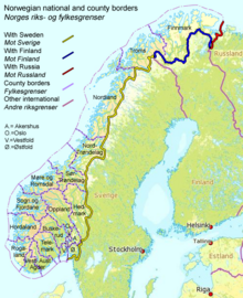

The border between Norway and Finland is 736 kilometers (457 mi) long.[1] It is a land and river border between two tripoints. The western tripoint is marked by Treriksröset, a concrete cairn where both countries border Sweden. The eastern tripoint is marked by Treriksrøysa, a stone cairn where both countries border Russia.[2]
The border was defined in a treaty from 1751, but was then a part of the border between the Kingdom of Sweden, ruling Finland, and Denmark-Norway. In the period 1738-1751 there were field investigations and negotiations on the border, although the Finnish part needed less negotiation. Cairns were erected after that with the last one at Nesseby in 1766. After Finland became the Grand Duchy of Finland, a Grand Duchy of the Russian Empire, and the independent Kingdom of Norway was evoked into but in personal union with Sweden under the Swedish King, a treaty was again negotiated in 1816 with Russia. Defining the easternmost part of the borderzone. Between 1920 and 1944, the Petsamo area belonged to Finland, so the Finland–Norway border extended along the present Norway–Russia border to the ocean. The 1751 treaty also granted the Sami people the right to cross the border freely, including their reindeer, as they always had done. In 1852, the border of Norway–Finland/Russia was closed, causing trouble for the Sami, who needed the Finnish forests for reindeer winter grazing. This rule is still in effect, which means that part of the border are fenced to prevent the crossing of reindeer, while there are stairs across the fence in place to allow humans to cross the border, as well as gates for ATVs to cross the border.

The Finland–Norway border is open as both countries are part of the Schengen Area. It is legal to cross the border anywhere if no customs declaration or passport check is needed. A treaty gives the customs officers of one country the right to carry out clearance and checks for both countries. There is an 8-meter (26 ft) wide clear-cut zone along the land border in forest areas. Almost half of the border follows the rivers Anarjohka and Tana. A fairly large share of the western part of the border goes over treeless mountains. There are 57 original cairns north of Treriksröset from until 1766, numbered 293-342 west of Anarjohka river and 343-349 east of Tana river. Later further cairns numbered 343–353 against Finland were erected east of Nesseby, and cairns in between the originals with a letter after the number.

The extreme eastern end of Norway (containing the town of Kirkenes) actually reaches east of Finland, located between Finland and Russia. Since Norway uses Central European Time and Finland uses Eastern European Time, the time zone on the east side of the border is one hour behind the time zone on the west side.
YouTube Encyclopedic
-
1/3Views:48971 0114 507
-
Norway roads | road Rv92 | Finland border - Karasjok
-
Visiting the Russia-Norway Border (October 2015) at Sør-Varanger/Kirkenes, Norway
-
Crossing the border Finland(Tornio) / Sweden(Haparanda)
Transcription
List of road border crossings

From east to west:[3]
- Neiden (road 92), N
- Polmak (road 970/895), N
- Utsjoki (road E75), F
- Karigasniemi (road 92), F
- Kivilompolo (road E45), F
- Helligskogen (road E8), N
- N = customs station on the Norwegian side
- F = customs station on the Finnish side
All road crossings on this border have customs stations.
See also
References
- ^ "Speech by President of the Republic of Finland Sauli Niinistö at the Norwegian Institute of International Affairs, 11th October 2012". President of Finland. 11 October 2012. Archived from the original on 23 August 2017. Retrieved 29 May 2013.
- ^ Svein Askheim. "Treriksrøysa – Sør-Varanger". Store norske leksikon. Retrieved October 1, 2016.
- ^ "Alphabetical list of customs offices". Archived from the original on 2014-07-24. Retrieved 2014-08-28.