
No higher resolution available.
Yorkshire_Street,_Bacup.jpg (640 × 413 pixels, file size: 86 KB, MIME type: image/jpeg)
| This is a file from the Wikimedia Commons. Information from its description page there is shown below. Commons is a freely licensed media file repository. You can help. |
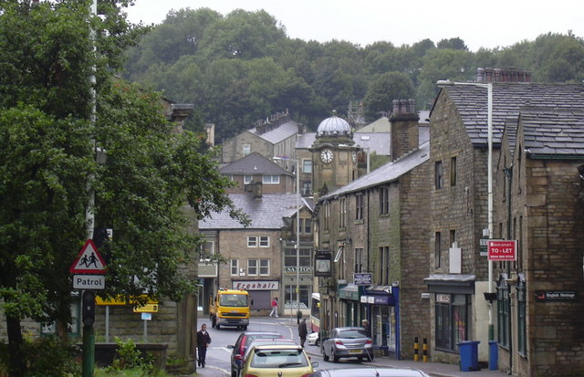
| Description | Yorkshire Street, in Bacup, Lancashire, England. | ||
| Date | |||
| Source | geograph.org.uk | ||
| Author | Robert Wade | ||
| Permission (Reusing this file) |
This file is licensed under the Creative Commons Attribution-Share Alike 2.0 Generic license. Attribution: robert wade
|
||
| Attribution (required by the license) | robert wade / Yorkshire Street / | ||

| Camera location | | View this and other nearby images on: OpenStreetMap |
|---|
_heading:247.00&language=en)
| Object location | | View this and other nearby images on: OpenStreetMap |
|---|
_heading:247.00&language=en)
File history
Click on a date/time to view the file as it appeared at that time.
| Date/Time | Thumbnail | Dimensions | User | Comment | |
|---|---|---|---|---|---|
| current | 13:24, 2 October 2008 | | 640 × 413 (86 KB) | Jza84 | {{Information |Description=Yorkshire Street, in Bacup, Lancashire, England. |Source=[http://www.geograph.org.uk/photo/929340 geograph.org.uk] |Date=19 August, 2008 |Author=Robert Wade |Permission={{geograph|929340|robert wade}} |other_versions= }} [[Cate |
File usage
The following pages on the English Wikipedia use this file (pages on other projects are not listed):
Global file usage
The following other wikis use this file:
- Usage on arz.wikipedia.org
- Usage on azb.wikipedia.org
- Usage on ceb.wikipedia.org
- Usage on cy.wikipedia.org
- Usage on de.wikipedia.org
- Usage on en.wikivoyage.org
- Usage on es.wikipedia.org
- Usage on fa.wikipedia.org
- Usage on fr.wikipedia.org
- Usage on ga.wikipedia.org
- Usage on it.wikipedia.org
- Usage on lld.wikipedia.org
- Usage on nl.wikipedia.org
- Usage on nn.wikipedia.org
- Usage on pl.wikipedia.org
- Usage on ro.wikipedia.org
- Usage on sv.wikipedia.org
- Usage on tr.wikipedia.org
- Usage on www.wikidata.org