
Size of this preview: 800 × 495 pixels. Other resolutions: 320 × 198 pixels | 640 × 396 pixels | 1,024 × 634 pixels | 1,280 × 792 pixels | 2,048 × 1,267 pixels.
Original file (2,048 × 1,267 pixels, file size: 150 KB, MIME type: image/jpeg)
| This is a file from the Wikimedia Commons. Information from its description page there is shown below. Commons is a freely licensed media file repository. You can help. |
Summary
| Description |
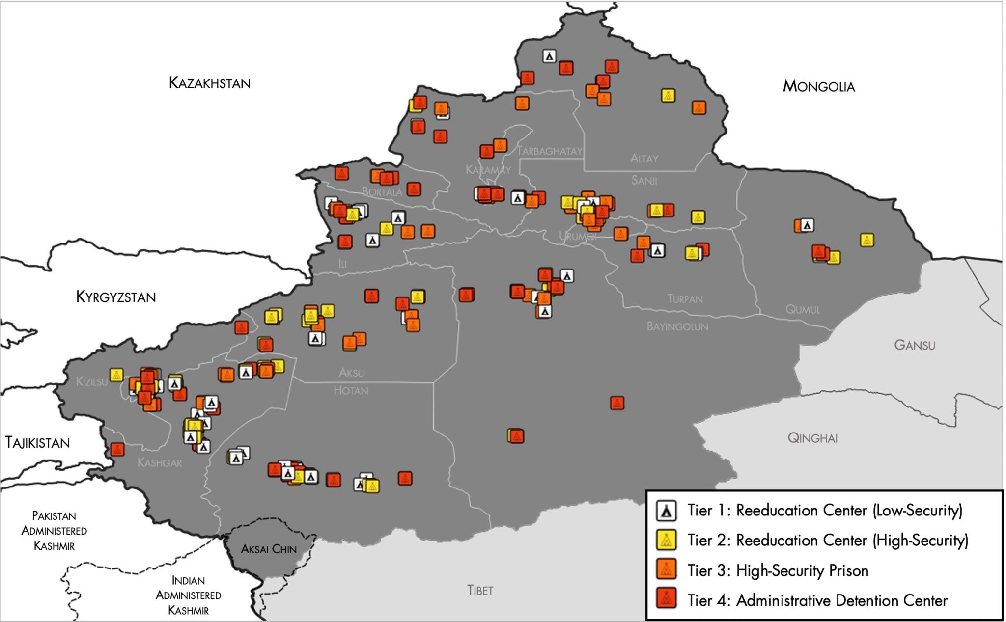
Map of the Xinjiang Internment Camps created by the RAND Corporation based on data collected by the US National Geospatial Intelligence Agency and the Australian Strategic Policy Institute. Open source here. |
||||||||
| Date | |||||||||
| Source | https://www.tearline.mil/public_page/xinjiang-nighttime-1/ | ||||||||
| Author | National Geospatial Intelligence Agency, using data from the Australian Strategic Policy Institute, and administrative boundaries from GADM. | ||||||||
| Permission (Reusing this file) |
|


File history
Click on a date/time to view the file as it appeared at that time.
| Date/Time | Thumbnail | Dimensions | User | Comment | |
|---|---|---|---|---|---|
| current | 05:05, 2 May 2021 | | 2,048 × 1,267 (150 KB) | Abovfold | Uploaded a work by {{w|National Geospatial Intelligence Agency}}, using data from the {{w|Australian Strategic Policy Institute}}, and administrative boundaries from {{w|GADM}}. from https://www.tearline.mil/public_page/xinjiang-nighttime-1/ with UploadWizard |
File usage
The following pages on the English Wikipedia use this file (pages on other projects are not listed):
Global file usage
The following other wikis use this file:
- Usage on ba.wikipedia.org
- Usage on br.wikipedia.org
- Usage on cs.wikipedia.org
- Usage on de.wikipedia.org
- Usage on el.wikipedia.org
- Usage on es.wikipedia.org
- Usage on fi.wikipedia.org
- Usage on fr.wikipedia.org
- Usage on ga.wikipedia.org
- Usage on he.wikipedia.org
- Usage on km.wikipedia.org
- Usage on nl.wikipedia.org
- Usage on or.wikipedia.org
- Usage on pl.wikipedia.org
- Usage on pt.wikipedia.org
- Usage on ru.wikinews.org
- Usage on sv.wikipedia.org
- Usage on szl.wikipedia.org
- Usage on tr.wikipedia.org
- Usage on www.wikidata.org