

Size of this preview: 800 × 311 pixels. Other resolutions: 320 × 124 pixels | 640 × 249 pixels | 1,024 × 398 pixels | 1,280 × 497 pixels | 4,191 × 1,628 pixels.
Original file (4,191 × 1,628 pixels, file size: 5.6 MB, MIME type: image/jpeg)
| This is a file from the Wikimedia Commons. Information from its description page there is shown below. Commons is a freely licensed media file repository. You can help. |
Summary
| This is a retouched picture, which means that it has been digitally altered from its original version. Modifications: High dynamic range imaging with Adobe Photoshop CS 5.1 of 9 images..
|
| Description |
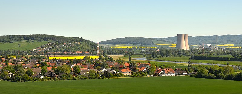
View from the Ohrbergpark to the small village Tündern and to the Grohnde Nuclear Power Plant beside the river Weser in the Upper Weser Valley and the Weser Uplands in Lower Saxony, Germany. The yellow fields are rapeseed fields. |
| Date | |
| Source | Own work |
| Author | Michael Gäbler |
| Camera location | | View this and other nearby images on: OpenStreetMap |
|---|
Licensing
Michael Gäbler, the copyright holder of this work, hereby publishes it under the following license:
This file is licensed under the Creative Commons Attribution 3.0 Unported license.
Attribution: Michael Gäbler
- You are free:
- to share – to copy, distribute and transmit the work
- to remix – to adapt the work
- Under the following conditions:
- attribution – You must give appropriate credit, provide a link to the license, and indicate if changes were made. You may do so in any reasonable manner, but not in any way that suggests the licensor endorses you or your use.
File history
Click on a date/time to view the file as it appeared at that time.
| Date/Time | Thumbnail | Dimensions | User | Comment | |
|---|---|---|---|---|---|
| current | 17:00, 30 January 2012 | 4,191 × 1,628 (5.6 MB) | Michael Gäbler | small file | |
| 23:42, 24 January 2012 |  | 4,179 × 2,200 (6.59 MB) | Michael Gäbler | Update with less sharpness, less contrast and less saturation. | |
| 01:06, 23 January 2012 |  | 4,205 × 2,331 (8.33 MB) | Michael Gäbler | —{{Information |Description= {{de|1=Blick von dem Ohrbergpark zu dem Dorf Tündern an derWeser und zu dem Kernkraftwerk Grohnde im [[:de:Weserbergland|Weserbergla |
File usage
The following pages on the English Wikipedia use this file (pages on other projects are not listed):
Global file usage
The following other wikis use this file:
- Usage on de.wikipedia.org
- Usage on es.wikipedia.org
- Usage on et.wikipedia.org
- Usage on hr.wikipedia.org
- Usage on mk.wikipedia.org
- Usage on sh.wikipedia.org