
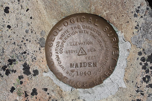
![United States National Geodetic Survey marker "MAIDEN 1940"; Maiden Peak (Washington); 6434 feet, 1961 m DESIGNATION - KNOB [1] PID - SY1638 STATE/COUNTY- WA/CLALLAM USGS QUAD - MAIDEN PEAK (1990) NAD 83(1991)- 47 56 07.29022(N) 123 18 48.68973(W) ADJUSTED](http://upload.wikimedia.org/wikipedia/commons/f/f4/United_States_National_Geodetic_Survey_marker_5667.JPG)
Size of this preview: 800 × 533 pixels. Other resolutions: 320 × 213 pixels | 640 × 427 pixels | 1,024 × 683 pixels | 1,280 × 853 pixels | 2,560 × 1,707 pixels | 4,272 × 2,848 pixels.
Original file (4,272 × 2,848 pixels, file size: 7.26 MB, MIME type: image/jpeg)
| This is a file from the Wikimedia Commons. Information from its description page there is shown below. Commons is a freely licensed media file repository. You can help. |
Summary
| Description |
United States National Geodetic Survey marker "MAIDEN 1940"; Maiden Peak (Washington); 6434 feet, 1961 m
|
| Date | 30 July 2009, 12:29:19 −07:00 |
| Source | Own work |
| Author | Walter Siegmund (talk) |
| Camera location | | View this and other nearby images on: OpenStreetMap |
|---|
- Location source: Google Earth, Topoquest
- Location Datum: WGS84
- Viewpoint location: Obstruction Point to Deer Park Trail, Olympic National Park
- Viewpoint elevation: 1961 meter (6434 ft)
- Camera: Canon EOS DIGITAL REBEL XSi
- Exposure Time: 1/200
- F Number: f/11.0
- Focal Length: 60.0
- ISO Speed Rating: 100
©2010 Walter Siegmund
Licensing
I, the copyright holder of this work, hereby publish it under the following licenses:

|
Permission is granted to copy, distribute and/or modify this document under the terms of the GNU Free Documentation License, Version 1.2 or any later version published by the Free Software Foundation; with no Invariant Sections, no Front-Cover Texts, and no Back-Cover Texts. A copy of the license is included in the section entitled GNU Free Documentation License. |
This file is licensed under the Creative Commons Attribution-Share Alike 3.0 Unported, 2.5 Generic, 2.0 Generic and 1.0 Generic license.
- You are free:
- to share – to copy, distribute and transmit the work
- to remix – to adapt the work
- Under the following conditions:
- attribution – You must give appropriate credit, provide a link to the license, and indicate if changes were made. You may do so in any reasonable manner, but not in any way that suggests the licensor endorses you or your use.
- share alike – If you remix, transform, or build upon the material, you must distribute your contributions under the same or compatible license as the original.
You may select the license of your choice.
File history
Click on a date/time to view the file as it appeared at that time.
| Date/Time | Thumbnail | Dimensions | User | Comment | |
|---|---|---|---|---|---|
| current | 06:06, 9 April 2010 | | 4,272 × 2,848 (7.26 MB) | Wsiegmund | {{Information |Description = {{en|United States National Geodetic Survey marker "MAIDEN 1940"; Maiden Peak (Washington); 6434 feet, 1961 m *PID - SY1638 [http://www.ngs.noaa.gov/cgi-bin/ds_mark.prl] * NAD 83(1991)- 47 56 07.29022(N) 1 |
File usage
The following pages on the English Wikipedia use this file (pages on other projects are not listed):
Global file usage
The following other wikis use this file:
- Usage on fa.wikipedia.org
- Usage on my.wikipedia.org
- Usage on uk.wikipedia.org