

Size of this PNG preview of this SVG file: 630 × 600 pixels. Other resolutions: 252 × 240 pixels | 504 × 480 pixels | 807 × 768 pixels | 1,076 × 1,024 pixels | 2,152 × 2,048 pixels | 3,302 × 3,143 pixels.
Original file (SVG file, nominally 3,302 × 3,143 pixels, file size: 3.1 MB)
| This is a file from the Wikimedia Commons. Information from its description page there is shown below. Commons is a freely licensed media file repository. You can help. |
Summary
| Description |
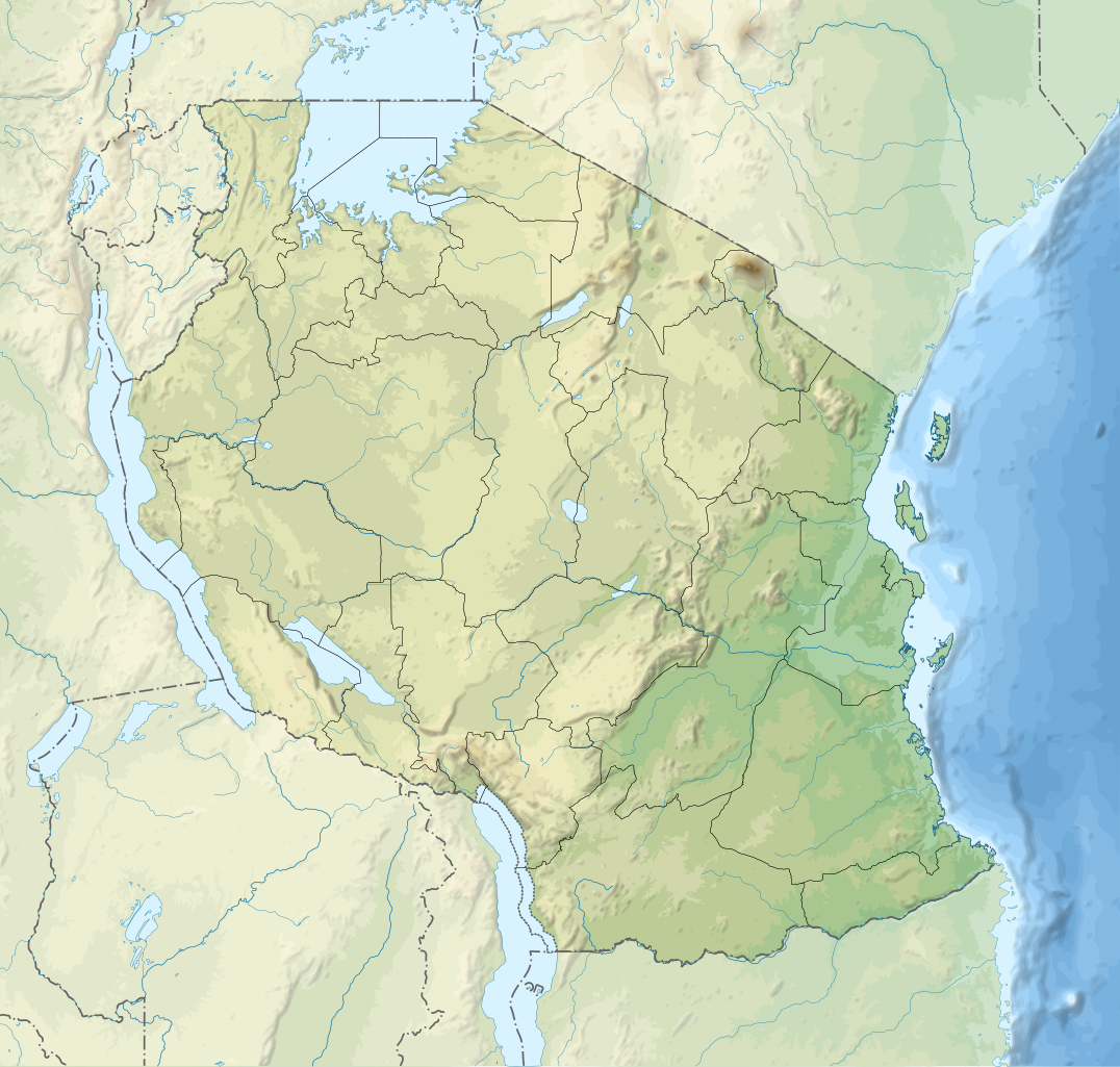
Relief location map of Tanzania.
Equirectangular projection. 1° N, 28° W, 42° E, -13° S. Center : -6.375, 35 |
||
| Date | (UTC) | ||
| Source | Derived from Tanzania_map-fr.svg | ||
| Author | Sémhur | ||
| Other versions |
[]
| ||
| Attribution (required by the license) | © Sémhur / Wikimedia Commons / | ||
| SVG | W3C-validity not checked.
|
||
| Graphic Lab |


| Object location | | View this and other nearby images on: OpenStreetMap |
|---|
Licensing
I, the copyright holder of this work, hereby publish it under the following licenses:
| Copyleft: This work of art is free; you can redistribute it and/or modify it according to terms of the Free Art License. You will find a specimen of this license on the Copyleft Attitude site as well as on other sites. |
This file is licensed under the Creative Commons Attribution-Share Alike 4.0 International, 3.0 Unported, 2.5 Generic, 2.0 Generic and 1.0 Generic license.
- You are free:
- to share – to copy, distribute and transmit the work
- to remix – to adapt the work
- Under the following conditions:
- attribution – You must give appropriate credit, provide a link to the license, and indicate if changes were made. You may do so in any reasonable manner, but not in any way that suggests the licensor endorses you or your use.
- share alike – If you remix, transform, or build upon the material, you must distribute your contributions under the same or compatible license as the original.
You may select the license of your choice.
Original upload log
This image is a derivative work of the following images:
- File:Tanzania_map-fr.svg licensed with Cc-by-sa-3.0,2.5,2.0,1.0, GFDL
- 2009-03-20T13:30:18Z Sémhur 3096x3113 (3225659 Bytes) Ol Doinyo Lengaï was misplaced
- 2009-03-20T11:14:35Z Sémhur 3096x3113 (3224368 Bytes) Add location map and few summits.
- 2009-03-19T17:14:13Z Sémhur 3096x3113 (3099209 Bytes) grrr...
- 2009-03-19T17:08:18Z Sémhur 3096x3113 (3099244 Bytes) Oups ! It wasn't the valid one.
- 2009-03-19T17:05:02Z Sémhur 3096x3113 (3122421 Bytes) {{Information |Description={{en|1=Map of [[:en:Tanzania]].}} {{fr|1=Carte de la [[:fr:Tanzanie]].}} {{es|1=Mapa de [[:es:Tanzania]].}} |Source=travail personnel (own work). Sources of data: * Elevations : NASA SRTM3 (public d
Uploaded with derivativeFX
File history
Click on a date/time to view the file as it appeared at that time.
| Date/Time | Thumbnail | Dimensions | User | Comment | |
|---|---|---|---|---|---|
| current | 20:32, 3 March 2020 | | 3,302 × 3,143 (3.1 MB) | Sémhur | Modifying Tanzanian border claim (from https://www.nbs.go.tz/index.php/en/census-surveys/gis/385-2012-phc-shapefiles-level-one-and-two) |
| 20:18, 28 June 2017 |  | 3,302 × 3,143 (3.09 MB) | Sémhur | Update with Songwe region | |
| 14:11, 28 December 2013 |  | 3,096 × 2,947 (3.1 MB) | Sémhur | Updated with the four new regions | |
| 15:17, 3 May 2009 |  | 3,096 × 2,947 (3.55 MB) | Sémhur | Adding border between Arusha and Manyara | |
| 18:58, 1 May 2009 |  | 3,096 × 2,947 (3.54 MB) | Sémhur | {{int:summary}} {{Information |Description={{en|1=Relief location map of en:Tanzania.}} {{fr|1=Carte de géolocalisation du relief de la fr:Tanzanie.}} {{es|1=Mapa de georreferenciación de es:Tanzania.}} Equirectangular projection. 0.25� |
File usage
More than 100 pages use this file. The following list shows the first 100 pages that use this file only. A full list is available.
- 2005 Lake Tanganyika earthquake
- Abeid Amani Karume International Airport
- Amani Nature Reserve
- Amboni Caves
- Arusha
- Arusha National Park
- Bank of Tanzania
- Benjamin Mkapa Stadium
- Bongoyo Island
- Bukoba
- Bukoba Airport
- Butiama
- Chumbe Island
- Churamiti
- Dar es Salaam
- Dar es Salaam Marine Reserve
- Dodoma
- Engaruka
- Fungu Yasini Island
- Furtwängler Glacier
- Gombe Stream National Park
- Hale Dam
- Hombolo Dam
- Hyperolius kihangensis
- Ikama
- Ikolo
- Ipinda
- Isange
- Kalambo Falls
- Kashasha
- Katavi National Park
- Kidatu Dam
- Kigoma
- Kihansi Hydroelectric Power Station
- Kilimanjaro International Airport
- Kilimanjaro National Park
- Kizimkazi Mosque
- Kondoa Rock-Art Sites
- Korogwe
- Laetoli
- Lake Eyasi
- Lake Manyara
- Lake Manyara National Park
- Lake Natron
- Lake Ngozi
- Lake Rukwa
- Lindi
- Lusungo
- Machame
- Mafia Channel
- Mafia Island
- Mahale Mountains National Park
- Makwale
- Manza Bay
- Matema
- Mbeya
- Mbudya Island
- Menai Bay
- Mikindani
- Misungwi
- Mkomazi National Park
- Mnazi Bay-Ruvuma Estuary Marine Park
- Morogoro
- Moshi, Tanzania
- Mount Kilimanjaro
- Mount Meru (Tanzania)
- Mtera Dam
- Mtwara
- Mumba Cave
- Mwanza
- Mwanza Airport
- Mwaya
- Nectophrynoides laticeps
- Nectophrynoides poyntoni
- Ngorongoro Conservation Area
- Nyumba ya Mungu Dam
- Olduvai Gorge
- Oyster Bay, Tanzania
- Pangani Falls Dam
- Pangavini Island
- Pemba Island
- Rebmann Glacier
- Ruaha National Park
- Saadani National Park
- Selous Game Reserve
- Serengeti National Park
- Shinyanga
- Shirati
- Songea
- Stone Town
- Sumbawanga
- Sumve
- Tabora
- Tanga Island
- Tarangire National Park
- Tendaguru Formation
- Tongoni Ruins
- Tukuyu
- Udzungwa Mountains
- Ujiji
View more links to this file.
Global file usage
The following other wikis use this file:
- Usage on af.wikipedia.org
- Usage on als.wikipedia.org
- Usage on ar.wikipedia.org
- Usage on ast.wikipedia.org
- Usage on as.wikipedia.org
- Usage on avk.wikipedia.org
- Usage on av.wikipedia.org
- Usage on azb.wikipedia.org
- Usage on az.wikipedia.org
- Usage on ban.wikipedia.org
- Usage on ba.wikipedia.org
View more global usage of this file.