To install click the Add extension button. That's it.

The source code for the WIKI 2 extension is being checked by specialists of the Mozilla Foundation, Google, and Apple. You could also do it yourself at any point in time.

4,5
Kelly Slayton
Congratulations on this excellent venture… what a great idea!
Alexander Grigorievskiy
I use WIKI 2 every day and almost forgot how the original Wikipedia looks like.
Live Statistics
English Articles
Improved in 24 Hours
Added in 24 Hours
What we do. Every page goes through several hundred of perfecting techniques; in live mode. Quite the same Wikipedia. Just better.
.
Leo
Newton
Brights
Milds

File:Satellite image of South Island New Zealand.jpg

From Wikipedia, the free encyclopedia

Original file(2,600 × 3,200 pixels, file size: 2.08 MB, MIME type: image/jpeg)

Description
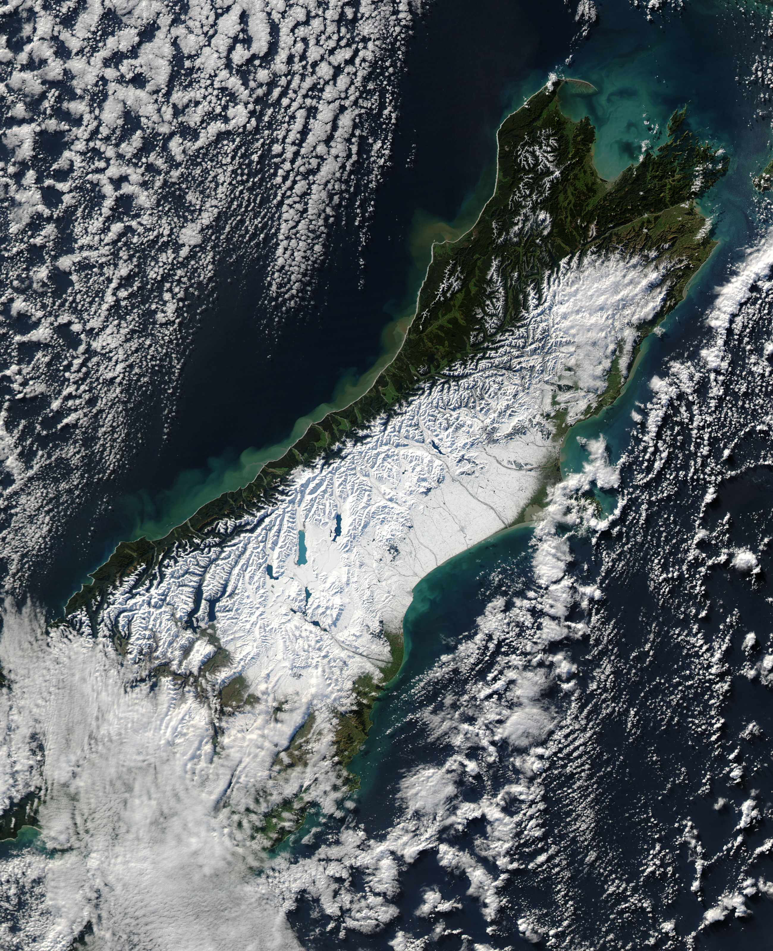
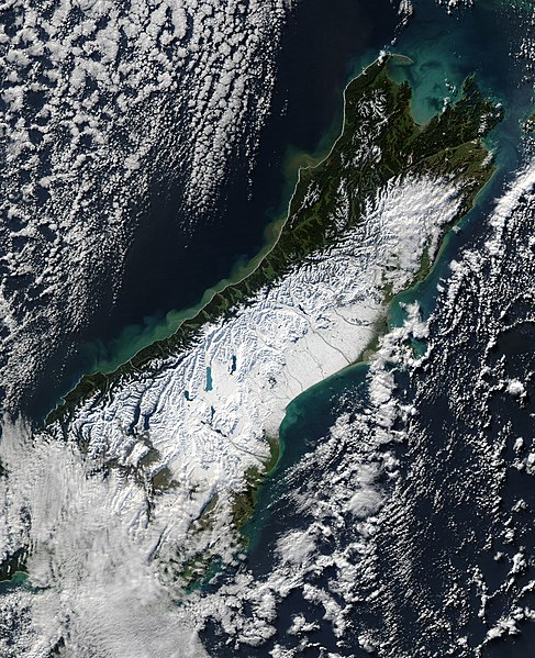
Satellite image of the South Island of New Zealand in June 2006. NASA's description:
A powerful winter storm swept across New Zealand on June 12, 2006. The storm brought strong winds that gusted up to 130 kilometers per hour (80 miles per hour) and at least one tornado, reported the Australian Broadcasting Corporation (ABC). Heavy rains triggered floods and landslides along the western coast of South Island, and snow blanketed the central part of the island. This wild weather, said the ABC, knocked out power in Auckland, on North Island (not pictured), and throughout the Canterbury region, shown here.
On June 13, skies were clear when the Moderate Resolution Imaging Spectroradiometer (MODIS) on NASA’s Aqua satellite captured this photo-like image of South Island, New Zealand. Snow covers the Southern Alps, making the finger-like glacier lakes stand out like sapphires against a field of white. The snow stretches to the sea on the east side of the island. It is here, in the river basins and valleys east of the mountains and around Christchurch, that deep snow closed roads and isolated communities, say news reports.
The impact of heavy rain along the western shore of South Island is also evident in this image. Mud-laden water, full of sediment from landslides and run-off, flows into the Tasman Sea from the many streams that run out of the mountains. In the ocean, the muddy water is tan and fades to a cloudy green as the sediment disperse
Date
Source [1]
Author NASA
Permission
(Reusing this file)
Public domain This file is in the public domain in the United States because it was solely created by NASA. NASA copyright policy states that "NASA material is not protected by copyright unless noted". (See Template:PD-USGov, NASA copyright policy page or JPL Image Use Policy.)
Warnings:

Captions

Add a one-line explanation of what this file represents

Items portrayed in this file

depicts

13 June 2006

File history

Click on a date/time to view the file as it appeared at that time.

Date/TimeThumbnailDimensionsUserComment
current11:47, 20 June 2006Thumbnail for version as of 11:47, 20 June 20062,600 × 3,200 (2.08 MB)Brian{{PD-USGov-NASA}} Satellite image of the w:South Island of w:New Zealand in June 2005. NASA's description: :A powerful winter storm swept across New Zealand on June 12, 2006. The storm brought strong winds that gusted up to 130 kilometers per h
The following pages on the English Wikipedia use this file (pages on other projects are not listed):

Global file usage

The following other wikis use this file:

Metadata

Basis of this page is in Wikipedia. Text is available under the CC BY-SA 3.0 Unported License. Non-text media are available under their specified licenses. Wikipedia® is a registered trademark of the Wikimedia Foundation, Inc. WIKI 2 is an independent company and has no affiliation with Wikimedia Foundation.