
Size of this preview: 800 × 600 pixels. Other resolutions: 320 × 240 pixels | 640 × 480 pixels | 1,024 × 768 pixels | 1,280 × 960 pixels | 2,048 × 1,536 pixels.
Original file (2,048 × 1,536 pixels, file size: 1.38 MB, MIME type: image/jpeg)
| This is a file from the Wikimedia Commons. Information from its description page there is shown below. Commons is a freely licensed media file repository. You can help. |
Summary
| Description |
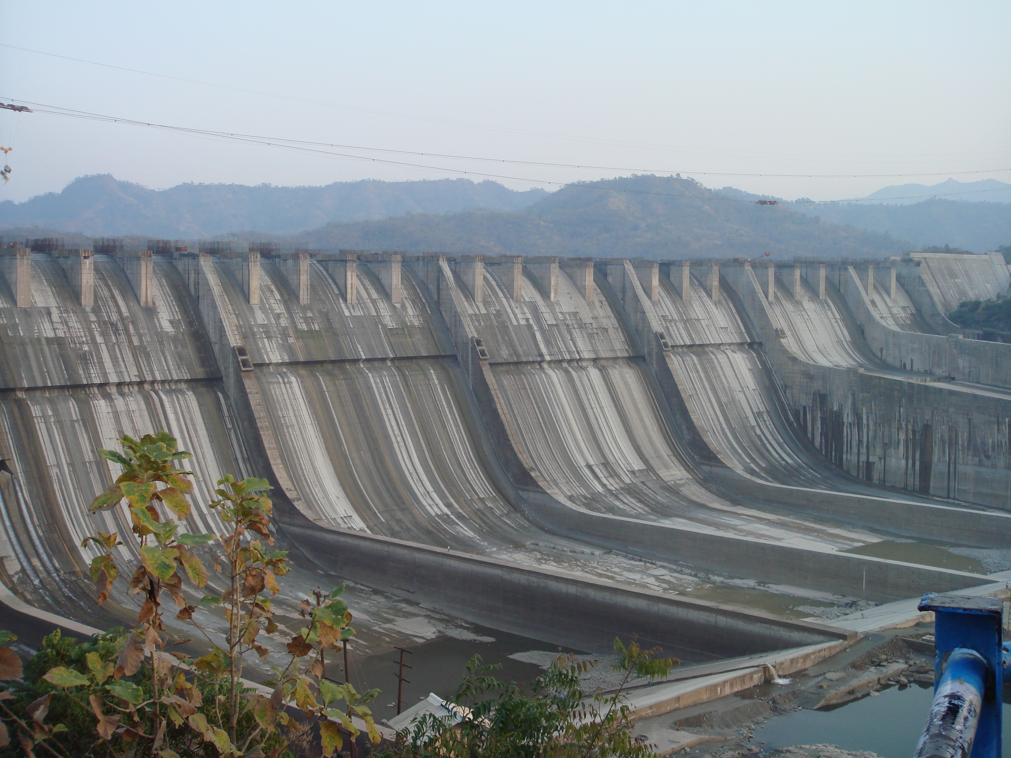
A photograph of the Sardar Sarovar Dam on the River Narmada, India, showing the principal spillway and construction underway for increasing the height from 110.64 metres to 121.92 as per clearance granted in March 2006. |
| Date | |
| Source | Own work |
| Author | AceFighter19 |
| Camera location | | View this and other nearby images on: OpenStreetMap |
|---|
Licensing
| I, the copyright holder of this work, release this work into the public domain. This applies worldwide. In some countries this may not be legally possible; if so: I grant anyone the right to use this work for any purpose, without any conditions, unless such conditions are required by law. |
File history
Click on a date/time to view the file as it appeared at that time.
| Date/Time | Thumbnail | Dimensions | User | Comment | |
|---|---|---|---|---|---|
| current | 19:17, 8 June 2009 | | 2,048 × 1,536 (1.38 MB) | AceFighter19 | {{Information |Description={{en|1=A photograph of the Sardar Sarovar Dam on the River Narmada, India, showing the principal spillway and construction underway for increasing the height from 110.64 metres to 121.92 as per clearance granted in March 2006.}} |
File usage
The following pages on the English Wikipedia use this file (pages on other projects are not listed):
Global file usage
The following other wikis use this file:
- Usage on bn.wikipedia.org
- Usage on es.wikipedia.org
- Usage on fr.wikipedia.org
- Usage on gu.wikipedia.org
- Usage on he.wikipedia.org
- Usage on hi.wikipedia.org
- Usage on hy.wikipedia.org
- Usage on it.wikipedia.org
- Usage on pt.wikipedia.org
- Usage on ru.wikipedia.org
- Usage on rw.wikipedia.org
- Usage on tg.wikipedia.org
- Usage on zh.wikipedia.org