

Size of this preview: 800 × 535 pixels. Other resolutions: 320 × 214 pixels | 640 × 428 pixels | 1,024 × 685 pixels | 1,280 × 856 pixels | 2,560 × 1,713 pixels | 4,018 × 2,688 pixels.
Original file (4,018 × 2,688 pixels, file size: 1.57 MB, MIME type: image/jpeg)
| This is a file from the Wikimedia Commons. Information from its description page there is shown below. Commons is a freely licensed media file repository. You can help. |
|
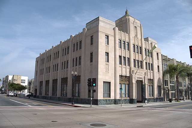
This is an image of a place or building that is listed on the National Register of Historic Places in the United States of America. Its reference number is 82000975. |
| Description |
Santa Ana City Hall
|
||
| Date | |||
| Source | originally posted to Flickr as Santa Ana City Hall | ||
| Author | Eli Pousson | ||
| Permission (Reusing this file) |
This file is licensed under the Creative Commons Attribution-Share Alike 2.0 Generic license.
|
||
| Other versions |
.jpg)
.jpg)
| Object location | | View this and other nearby images on: OpenStreetMap |
|---|
File history
Click on a date/time to view the file as it appeared at that time.
| Date/Time | Thumbnail | Dimensions | User | Comment | |
|---|---|---|---|---|---|
| current | 04:47, 2 May 2010 | | 4,018 × 2,688 (1.57 MB) | Flickr upload bot | Uploaded from http://flickr.com/photo/59179756@N00/4560714861 using Flickr upload bot |
File usage
The following pages on the English Wikipedia use this file (pages on other projects are not listed):
Global file usage
The following other wikis use this file:
- Usage on fr.wikipedia.org
- Usage on fy.wikipedia.org
- Usage on he.wikipedia.org
- Usage on ja.wikipedia.org
- Usage on nl.wikipedia.org
- Usage on pl.wikipedia.org
- Usage on ru.wikipedia.org
- Usage on sco.wikipedia.org
- Usage on sr.wikipedia.org
- Usage on zh-min-nan.wikipedia.org