

Size of this PNG preview of this SVG file: 800 × 558 pixels. Other resolutions: 320 × 223 pixels | 640 × 447 pixels | 1,024 × 715 pixels | 1,280 × 893 pixels | 2,560 × 1,787 pixels | 1,175 × 820 pixels.
Original file (SVG file, nominally 1,175 × 820 pixels, file size: 224 KB)
| This is a file from the Wikimedia Commons. Information from its description page there is shown below. Commons is a freely licensed media file repository. You can help. |
Summary
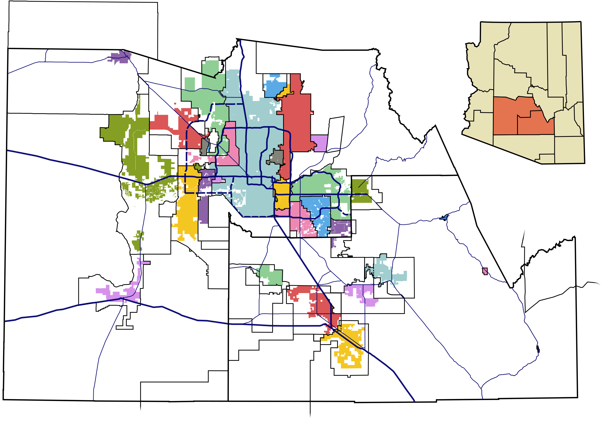
| Description | This map shows the incorporated areas and unincorporated areas for the Phoenix metro area, which is defined by the US Census Bureau as Maricopa County and Pinal County, Arizona. Data for Maricopa County are based on the MAG Municipal Planning Areas and Incorporated Areas Map (PDF).Data for Pinal County are based on the Pinal County 2006 Land Use Map (.pdf), Pinal County Planning Areas Map, and data for Indian Reservation borders is based on the ITCA Map of Tribal Homelands in Arizona. I created this map in Inkscape. |
| Date | |
| Source | My own work, based on public domain information |
| Author | Ixnayonthetimmay |
| Permission (Reusing this file) |
Copyleft-type licensing. See below. |
| Other versions | See Category:Maps of Maricopa County and Category:Maps of Pinal County for other versions of this image. |
Licensing
| I, the copyright holder of this work, release this work into the public domain. This applies worldwide. In some countries this may not be legally possible; if so: I grant anyone the right to use this work for any purpose, without any conditions, unless such conditions are required by law. |
File history
Click on a date/time to view the file as it appeared at that time.
| Date/Time | Thumbnail | Dimensions | User | Comment | |
|---|---|---|---|---|---|
| current | 05:05, 8 October 2014 | | 1,175 × 820 (224 KB) | Wereldburger758 | Valid SVG now. |
| 01:21, 21 August 2012 |  | 1,175 × 820 (524 KB) | Andros 1337 | Red Mountain Freeway now complete | |
| 07:01, 30 May 2007 |  | 1,175 × 820 (523 KB) | Ixnayonthetimmay | == Summary == {{Information |Description=This map shows the incorporated areas and unincorporated areas for the Phoenix metro area, which is defined by the US Census Bureau |
File usage
The following pages on the English Wikipedia use this file (pages on other projects are not listed):
Global file usage
The following other wikis use this file:
- Usage on ca.wikipedia.org
- Phoenix (Arizona)
- Fountain Hills
- Mesa (Arizona)
- Chandler (Arizona)
- Scottsdale (Arizona)
- Gilbert (Arizona)
- Tempe (Arizona)
- Apache Junction
- Avondale (Arizona)
- Buckeye (Arizona)
- Carefree
- Cave Creek
- Coolidge (Arizona)
- El Mirage
- Eloy (Arizona)
- Florence (Arizona)
- Gila Bend
- Goodyear (Arizona)
- Guadalupe (Arizona)
- Litchfield Park
- Maricopa (Arizona)
- New River
- Paradise Valley
- Peoria (Arizona)
- Queen Creek
- Sun City (Arizona)
- Sun City West
- Sun Lakes
- Superior (Arizona)
- Surprise
- Tolleson
- Wickenburg
- Youngtown
- Comunitat índia Gila River
- Comunitat índia Pima-Maricopa Salt River
- Plantilla:Àrea metropolitana de Phoenix