
_png)
Size of this preview: 480 × 600 pixels. Other resolutions: 192 × 240 pixels | 590 × 737 pixels.
Original file (590 × 737 pixels, file size: 1.25 MB, MIME type: image/png)
| This is a file from the Wikimedia Commons. Information from its description page there is shown below. Commons is a freely licensed media file repository. You can help. |
.png)
Summary
| Description |
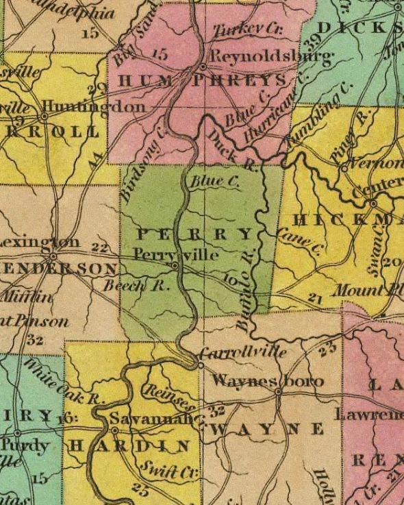
A map depicting Perry County in 1836, before Decatur County was separated as an independent county and while Perryville was still the County Seat. Of note, the map does not correctly depict the western and southern borders of the county. |
| Date | |
| Source | Tanner's New Universal Atlas - 1836 |
| Author | Henry S. Tanner |
Licensing
This work is in the public domain in the United States because it was published (or registered with the U.S. Copyright Office) before January 1, 1929.
Public domain works must be out of copyright in both the United States and in the source country of the work in order to be hosted on the Commons. If the work is not a U.S. work, the file must have an additional copyright tag indicating the copyright status in the source country.
Note: This tag should not be used for sound recordings. |
File history
Click on a date/time to view the file as it appeared at that time.
| Date/Time | Thumbnail | Dimensions | User | Comment | |
|---|---|---|---|---|---|
| current | 00:42, 24 May 2022 | | 590 × 737 (1.25 MB) | Nfutvol | Uploaded a work by Henry S. Tanner from Tanner's New Universal Atlas - 1836 with UploadWizard |
File usage
The following pages on the English Wikipedia use this file (pages on other projects are not listed):
.png)