

Size of this PNG preview of this SVG file: 642 × 600 pixels. Other resolutions: 257 × 240 pixels | 514 × 480 pixels | 822 × 768 pixels | 1,096 × 1,024 pixels | 2,193 × 2,048 pixels | 1,000 × 934 pixels.
Original file (SVG file, nominally 1,000 × 934 pixels, file size: 228 KB)
| This is a file from the Wikimedia Commons. Information from its description page there is shown below. Commons is a freely licensed media file repository. You can help. |
Summary
| Description |
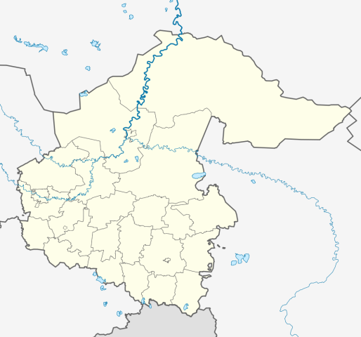
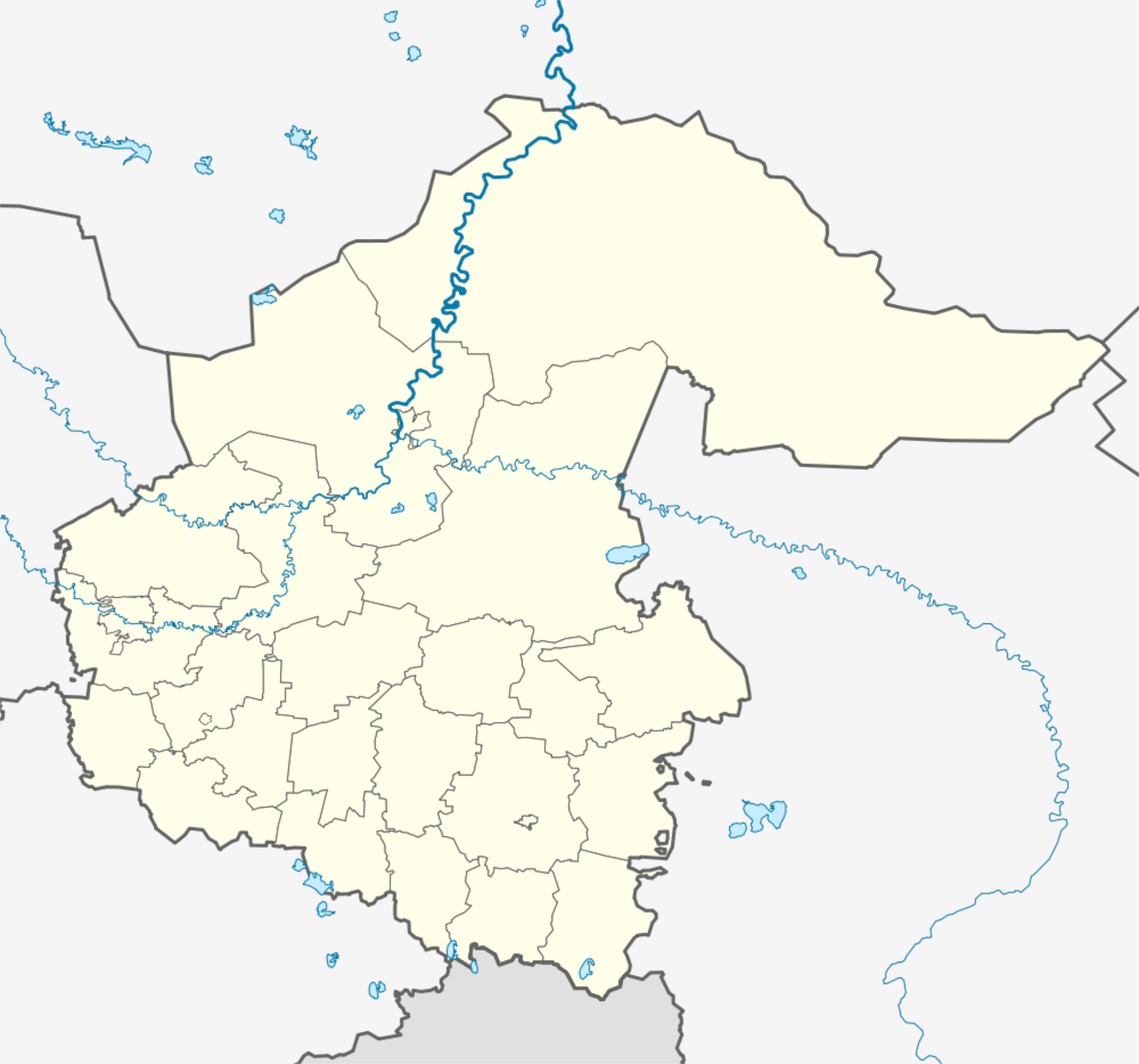
Русский: Позиционная карта Тюменской области
|top = 60.5 |bottom = 54.8 |left = 64.3 |right = 75.5 |
| Date | |
| Source |
Own work This W3C-unspecified vector image was created with Inkscape .
|
| Author | Виктор В |
| Other versions |
Derivative works of this file: Omsk Oblast region notext.svg
[] |


Licensing
| I, the copyright holder of this work, release this work into the public domain. This applies worldwide. In some countries this may not be legally possible; if so: I grant anyone the right to use this work for any purpose, without any conditions, unless such conditions are required by law. |
File history
Click on a date/time to view the file as it appeared at that time.
| Date/Time | Thumbnail | Dimensions | User | Comment | |
|---|---|---|---|---|---|
| current | 09:08, 2 April 2023 | | 1,000 × 934 (228 KB) | Вальдимар | змінив кордон навколо Ялуторовська |
| 16:48, 15 February 2023 |  | 1,000 × 934 (229 KB) | Вальдимар | змінив кордон | |
| 17:45, 27 August 2010 |  | 1,000 × 934 (112 KB) | Виктор В | +3 городских округа | |
| 16:27, 25 August 2010 |  | 1,000 × 934 (104 KB) | Виктор В | == {{int:filedesc}} == {{Information |Description={{ru|1=Позиционная карта Тюменской области *Проекция — равноугольная. *Стандартная параллель — 57°00′00″с.ш. *Парам� |
File usage
The following pages on the English Wikipedia use this file (pages on other projects are not listed):
Global file usage
The following other wikis use this file:
- Usage on af.wikipedia.org
- Usage on ar.wikipedia.org
- Usage on ba.wikipedia.org
- Usage on be.wikipedia.org
- Табольск
- Ялутараўск
- Ішым
- Заводаўкоўск
- Цюмень
- Шаблон:На карце/Расія Цюменская вобласць
- Галышманава
- Абацкае
- Амуцінскае
- Армізонскае
- Яркава (Цюменская вобласць)
- Юргінскае
- Ніжняя Таўда
- Упорава
- Сладкова (Цюменская вобласць)
- Уват (Цюменская вобласць)
- Казанскае (Казанскі раён)
- Ісецкае (Цюменская вобласць)
- Вялікае Сарокіна
- Вікулава (Цюменская вобласць)
- Бярдзюжжа (Цюменская вобласць)
- Арамашава
- Usage on bg.wikipedia.org
- Usage on ceb.wikipedia.org
- Usage on ce.wikipedia.org
- Тюмень
- Тобольск
- Абатски
- Артамонова (Абатскан кӀошт)
- Балаир (Тюменан область)
- Банниково (Тюменан область)
- Берендеева
- Бития
- Бобыльск (Тюменан область)
- Бокова
- Болдырево (Тюменан область)
- Бурдина
- Быструха (Тюменан область)
- Водолазово (Тюменан область)
- Волостни (Тюменан область)
- Восток (Тюменан область)
- Горки (Тюменан область)
- Еремина
- Ефимова
- Земляни (Абатскан кӀошт)
- Камышинка (Абатскан кӀошт)
View more global usage of this file.