
Size of this preview: 507 × 600 pixels. Other resolutions: 203 × 240 pixels | 515 × 609 pixels.
Original file (515 × 609 pixels, file size: 9 KB, MIME type: image/png)
| This is a file from the Wikimedia Commons. Information from its description page there is shown below. Commons is a freely licensed media file repository. You can help. |
Summary
| Description |
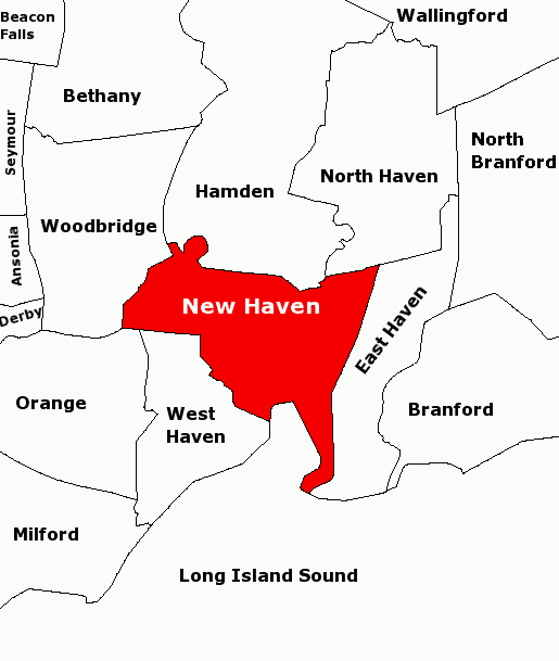
Subject: Map of townships in the New Haven Area. 21-Aug-2007 version fixes town name in upper left: Beacon Falls. Derived from sub-county SVG map of Connecticut at Libre Map Project using Adobe SVG viewer and Gimp 2.2.1.3 |
| Date | 4 August 2007 (original upload date) |
| Source | Transferred from en.wikipedia to Commons. |
| Author | The original uploader was Karlhahn at English Wikipedia. |
Licensing
This file is licensed under the Creative Commons Attribution 2.0 Generic license.
- You are free:
- to share – to copy, distribute and transmit the work
- to remix – to adapt the work
- Under the following conditions:
- attribution – You must give appropriate credit, provide a link to the license, and indicate if changes were made. You may do so in any reasonable manner, but not in any way that suggests the licensor endorses you or your use.
Original upload log
The original description page was here. All following user names refer to en.wikipedia.
- 2007-08-21 12:31 Karlhahn 515×609×4 (9674 bytes) Subject: Map of townships in the New Haven Area. 21-Aug-2007 version fixes town name in upper left to Beacon Falls. Derived from sub-county SVG map of Connecticut at [http://libremap.org/data/boundary/ Libre Map Project] using Adobe SVG viewer and Gimp
- 2007-08-04 13:18 Karlhahn 515×609×8 (15969 bytes) Subject: Map of townships in the New Haven Area Derived from sub-county SVG map of Connecticut at [http://libremap.org/data/boundary/ Libre Map Project] using Adobe SVG viewer and Gimp 2.2.1.3 {{cc-by-sa}}
- 2007-08-04 02:47 Karlhahn 515×609×8 (14096 bytes) Subject: Map of townships in the New Haven Area Derived from sub-county SVG map of Connecticut at [http://libremap.org/data/boundary/ Libre Map Project] using Adobe SVG viewer and Gimp 2.2.1.3 {{cc-by-sa}}
- 2007-08-04 02:38 Karlhahn 515×609×8 (13471 bytes) Subject: Map of townships in the New Haven Area Derived from sub-county SVG map of Connecticut at [http://libremap.org/data/boundary/ Libre Map Project] using Adobe SVG viewer and Gimp 2.2.1.3 {{cc-by-sa}}
File history
Click on a date/time to view the file as it appeared at that time.
| Date/Time | Thumbnail | Dimensions | User | Comment | |
|---|---|---|---|---|---|
| current | 17:18, 24 August 2007 | | 515 × 609 (9 KB) | Karlhahn | {{Information |Description=Subject: Map of townships in the New Haven Area. 21-Aug-2007 version fixes town name in upper left: Beacon Falls. Derived from sub-county SVG map of Connecticut at [http://libremap.org/data/boundary/ Libre Map Project] using Ad |
File usage
No pages on the English Wikipedia use this file (pages on other projects are not listed).
Global file usage
The following other wikis use this file:
- Usage on no.wikipedia.org