To install click the Add extension button. That's it.

The source code for the WIKI 2 extension is being checked by specialists of the Mozilla Foundation, Google, and Apple. You could also do it yourself at any point in time.

4,5
Kelly Slayton
Congratulations on this excellent venture… what a great idea!
Alexander Grigorievskiy
I use WIKI 2 every day and almost forgot how the original Wikipedia looks like.
Live Statistics
English Articles
Improved in 24 Hours
Added in 24 Hours
What we do. Every page goes through several hundred of perfecting techniques; in live mode. Quite the same Wikipedia. Just better.
.
Leo
Newton
Brights
Milds

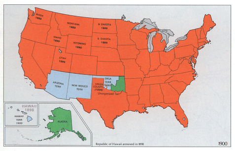
File:National-atlas-1970-1900.png

From Wikipedia, the free encyclopedia

National-atlas-1970-1900.png(477 × 307 pixels, file size: 92 KB, MIME type: image/png)

Transwiki approved by: w:en:User:Dmcdevit

This image was copied from wikipedia:en. The original description was:


Public domain
This map was obtained from an edition of the National Atlas of the United States. Like almost all works of the U.S. federal government, works from the National Atlas are in the public domain in the United States.
Online access: NationalAtlas.gov | 1970 print edition: Library of Congress, Perry-Castañeda Library

čeština | Deutsch | English | français | Bahasa Indonesia | italiano | македонски | മലയാളം | sicilianu | 中文 | 中文(简体)‎ | 中文(繁體)‎ | +/−

w:en:Category:National Atlas territorial expansion maps

Original upload log

date/time username resolution size edit summary
19:40, 22 December 2004 w:en:User:Berkut 477×307 92 KB optimized (pngrewrite)
01:13, 14 October 2004 w:en:User:Jengod 477×307 146 KB {{PD-USGov}}

Image description page history

link date/time username edit summary
http://en.wikipedia.org/w/index.php?title=Image:National-atlas-1970-1900.png&redirect=no&oldid=16839183 07:05, 10 September 2007 w:en:User:Dmcdevit
http://en.wikipedia.org/w/index.php?title=Image:National-atlas-1970-1900.png&redirect=no&oldid=16839183 01:12, 24 November 2004 w:en:User:Neutrality
http://en.wikipedia.org/w/index.php?title=Image:National-atlas-1970-1900.png&redirect=no&oldid=7798433 22:35, 14 October 2004 w:en:User:Jengod
http://en.wikipedia.org/w/index.php?title=Image:National-atlas-1970-1900.png&redirect=no&oldid=6584138 04:42, 14 October 2004 w:en:User:Jengod
http://en.wikipedia.org/w/index.php?title=Image:National-atlas-1970-1900.png&redirect=no&oldid=6568481 01:13, 14 October 2004 w:en:User:Jengod ({{PD-USGov}})

File history

Click on a date/time to view the file as it appeared at that time.

Date/TimeThumbnailDimensionsUserComment
current15:59, 10 September 2007Thumbnail for version as of 15:59, 10 September 2007477 × 307 (92 KB)BetacommandBotTranswiki approved by: w:en:User:Dmcdevit This image was copied from wikipedia:en. The original description was: {{PD-USGov-Atlas}} w:en:Category:National Atlas territorial expansion maps === File history === {| class=wikitable ! date/time || u
The following pages on the English Wikipedia use this file (pages on other projects are not listed):
Basis of this page is in Wikipedia. Text is available under the CC BY-SA 3.0 Unported License. Non-text media are available under their specified licenses. Wikipedia® is a registered trademark of the Wikimedia Foundation, Inc. WIKI 2 is an independent company and has no affiliation with Wikimedia Foundation.