
Original file (2,048 × 1,536 pixels, file size: 345 KB, MIME type: image/jpeg)
| This is a file from the Wikimedia Commons. Information from its description page there is shown below. Commons is a freely licensed media file repository. You can help. |
Summary
| Description |
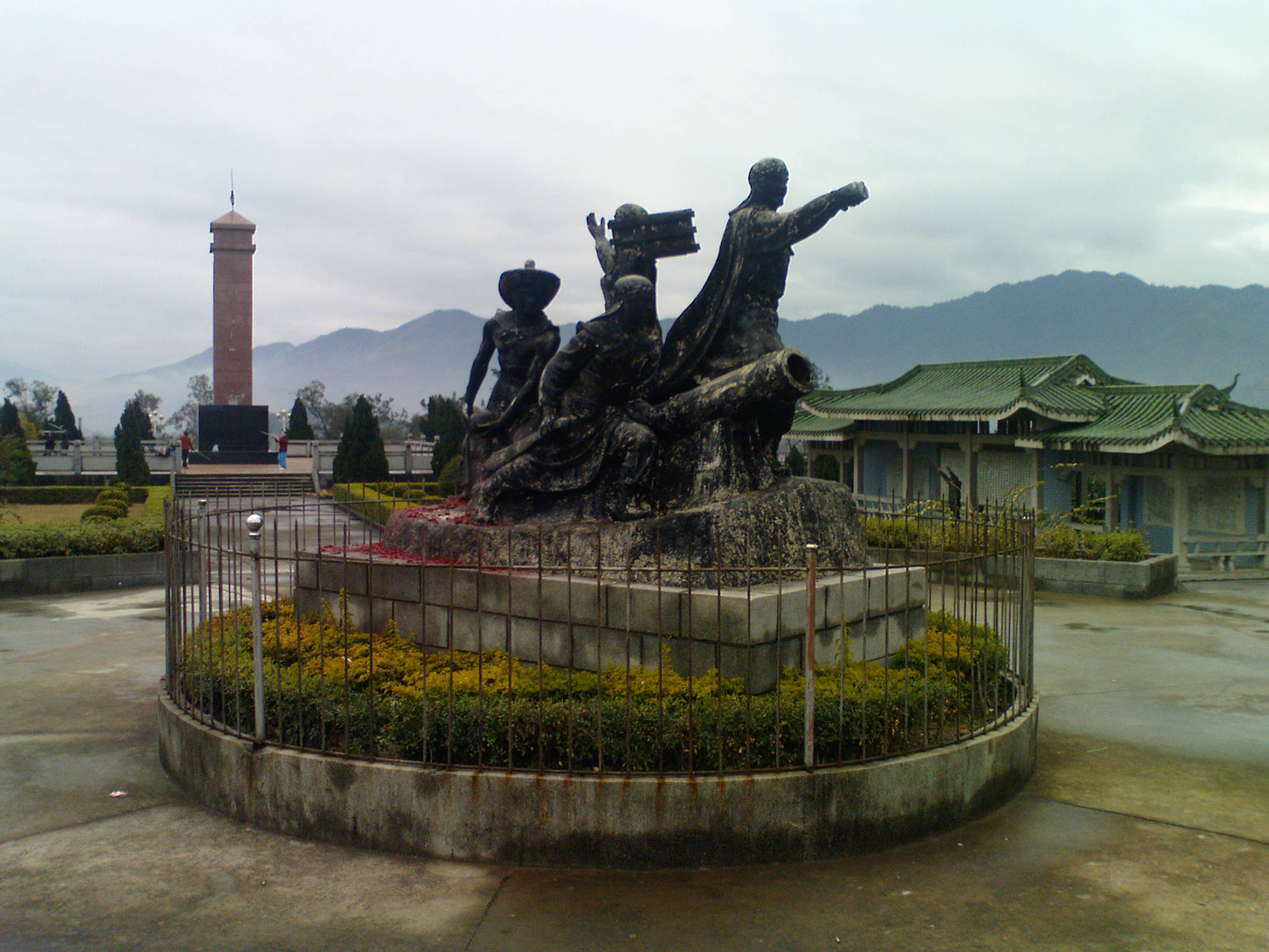
A historic monument to the Tai Ping Heavenly Kingdom, which was an early seat of Government of the Taiping Rebellion, located in Mengshan town, in Wuzhou Prefecture, Guangxi, China. The monument is located on a remaining section of the original city wall of the walled city of Yongan, now called Mengshan town. |
| Date | |
| Source | Own work |
| Author | Meumo |
<?xml version="1.0" encoding="UTF-8"?> <kml xmlns="http://www.opengis.net/kml/2.2" xmlns:gx="http://www.google.com/kml/ext/2.2" xmlns:kml="http://www.opengis.net/kml/2.2" xmlns:atom="http://www.w3.org/2005/Atom"> <Placemark> <name>05:49:12</name>
<description><![][<a href="http://tim.alder-digital.de/earth/hjl-koordinaten-en.php?ns=N&we=E&lat=24.204437739022&lon=110.5129210309">specification</a>
24°12′15.9″N 110°30′46.5″E / 24.204417°N 110.512917°E
| Camera location | | View this and other nearby images on: OpenStreetMap |
|---|
]></description>
<Style> <IconStyle> <heading>0</heading> <Icon> <href>http://maps.google.com/mapfiles/kml/pal3/icon52.png</href> </Icon> </IconStyle> </Style> <Point> <coordinates>110.5129210309,24.204437739022,0</coordinates> </Point> </Placemark> </kml>
Licensing
| I, the copyright holder of this work, release this work into the public domain. This applies worldwide. In some countries this may not be legally possible; if so: I grant anyone the right to use this work for any purpose, without any conditions, unless such conditions are required by law. |
File history
Click on a date/time to view the file as it appeared at that time.
| Date/Time | Thumbnail | Dimensions | User | Comment | |
|---|---|---|---|---|---|
| current | 04:53, 20 March 2009 | | 2,048 × 1,536 (345 KB) | Meumo | {{Information |Description={{en|1=A historic monument to the Tai Ping Heavenly Kingdom, which was an early seat of Government of the Taiping Rebellion, located in Mengshan town, in Wuzhou Prefecture, Guangxi, China. The monument is located on a remaining |
File usage
Global file usage
The following other wikis use this file:
- Usage on azb.wikipedia.org
- Usage on de.wikipedia.org
- Usage on el.wikipedia.org
- Usage on et.wikipedia.org
- Usage on hr.wikipedia.org
- Usage on ja.wikipedia.org
- Usage on ko.wikipedia.org
- Usage on no.wikipedia.org
- Usage on pt.wikipedia.org
- Usage on zh.wikipedia.org