
No higher resolution available.
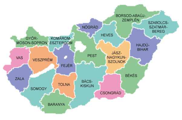
Map_of_counties_of_Hungary_2004.png (602 × 396 pixels, file size: 34 KB, MIME type: image/png)
| This is a file from the Wikimedia Commons. Information from its description page there is shown below. Commons is a freely licensed media file repository. You can help. |

|
File:Map of counties of Hungary 2004.svg is a vector version of this file. It should be used in place of this PNG file when not inferior.
File:Map of counties of Hungary 2004.png → File:Map of counties of Hungary 2004.svg
For more information, see Help:SVG. |
 |
Summary
Español: Provincias de Hungría
Counties of Hungary
Uploaded to hu: on August 26, 2004 by hu:User:Szajd and licensed under GFDL

|
Permission is granted to copy, distribute and/or modify this document under the terms of the GNU Free Documentation License, Version 1.2 or any later version published by the Free Software Foundation; with no Invariant Sections, no Front-Cover Texts, and no Back-Cover Texts. A copy of the license is included in the section entitled GNU Free Documentation License. |
| This file is licensed under the Creative Commons Attribution-Share Alike 3.0 Unported license. | ||
| ||
| This licensing tag was added to this file as part of the GFDL licensing update. |
File history
Click on a date/time to view the file as it appeared at that time.
| Date/Time | Thumbnail | Dimensions | User | Comment | |
|---|---|---|---|---|---|
| current | 10:36, 26 November 2016 | | 602 × 396 (34 KB) | Tacsipacsi | transparent background |
| 13:03, 2 March 2007 |  | 602 × 396 (14 KB) | Tene~commonswiki | Optimised (0) | |
| 04:03, 6 June 2005 |  | 602 × 396 (15 KB) | Thuresson | Counties of Hungary Uploaded to hu: on August 26, 2004 by hu:User:Szajd and licensed under GFDL {{GFDL}} Category:Maps of Hungary hu:Kép:Magyarorszag-megyek.png |
File usage
The following pages on the English Wikipedia use this file (pages on other projects are not listed):
Global file usage
The following other wikis use this file:
- Usage on als.wikipedia.org
- Usage on be-tarask.wikipedia.org
- Usage on cs.wikipedia.org
- Usage on da.wikipedia.org
- Usage on de.wikipedia.org
- Usage on eo.wikipedia.org
- Usage on fiu-vro.wikipedia.org
- Usage on frr.wikipedia.org
- Usage on fr.wikipedia.org
- Usage on gl.wikipedia.org
- Usage on hu.wikipedia.org
- Usage on is.wikipedia.org
- Usage on it.wikipedia.org
- Usage on nrm.wikipedia.org
- Usage on oc.wikipedia.org
- Usage on pl.wikipedia.org
- Usage on ro.wikipedia.org
- Usage on rue.wikipedia.org
- Usage on sh.wikipedia.org
- Usage on sk.wikipedia.org
- Usage on tr.wikipedia.org
- Usage on vi.wikipedia.org