
Size of this preview: 800 × 506 pixels. Other resolutions: 320 × 202 pixels | 640 × 404 pixels | 1,024 × 647 pixels | 1,280 × 809 pixels | 2,560 × 1,618 pixels | 7,025 × 4,439 pixels.
Original file (7,025 × 4,439 pixels, file size: 75.62 MB, MIME type: image/png)
| This is a file from the Wikimedia Commons. Information from its description page there is shown below. Commons is a freely licensed media file repository. You can help. |
Summary
| Description |
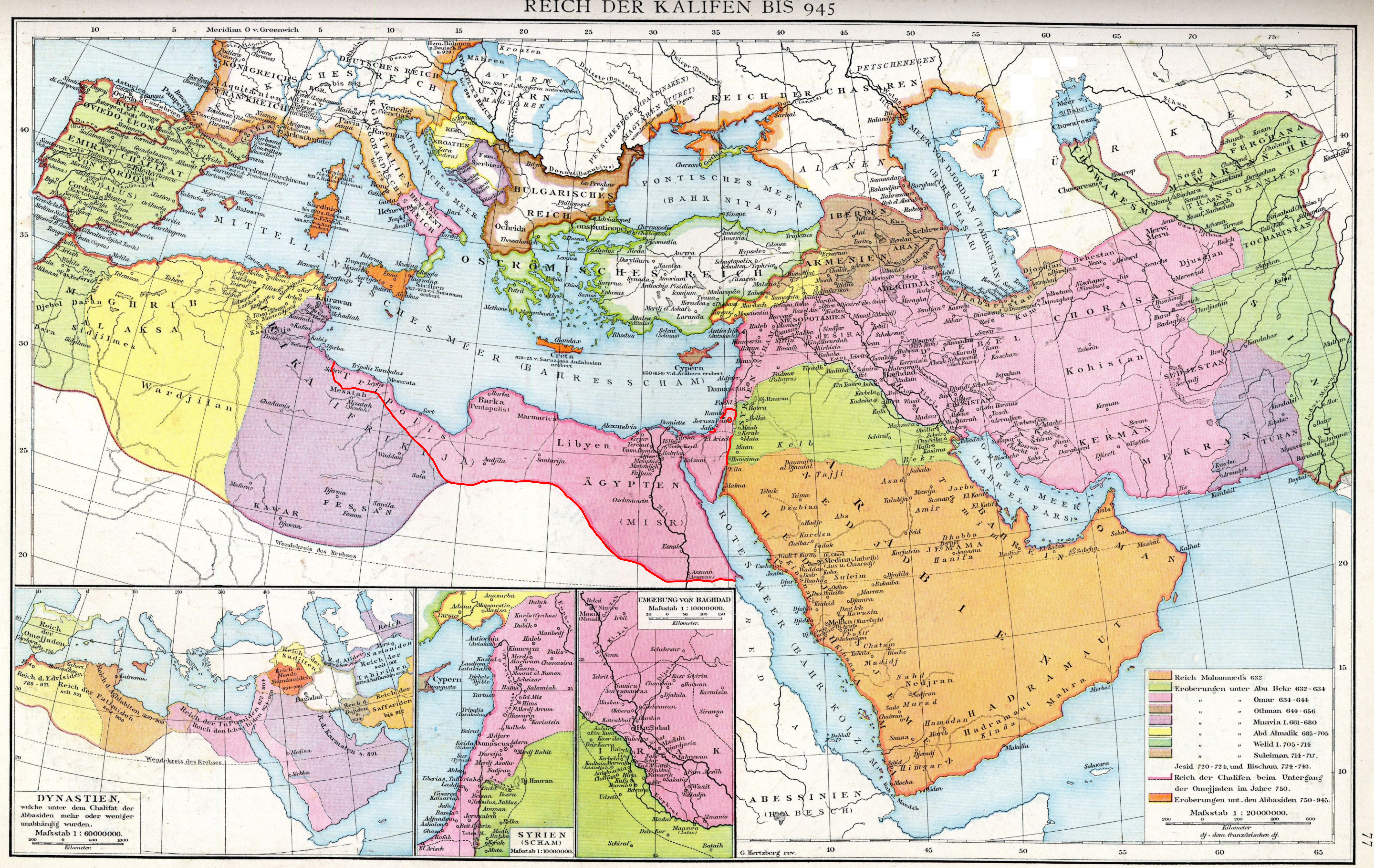
The empire of the Caliphs to 945. Map of the Historical Atlas of Gustav Droysen, 1886.
|
| Date | (Red-line edit done by uploader on 23 September 2019 |
| Source | Gustav Droysens Allgemeiner historischer Handatlas in 96 Karten mit erläuterndem Text Bielefeld [u.a.]: Velhagen & Klasing 1886, S. 77. |
| Author | Johann Gustav Droysen (6 July 1808 – 19 June 1884) |
Licensing
|
This work is in the public domain in its country of origin and other countries and areas where the copyright term is the author's life plus 100 years or fewer. This work is in the public domain in the United States because it was published (or registered with the U.S. Copyright Office) before January 1, 1929. | |
| This file has been identified as being free of known restrictions under copyright law, including all related and neighboring rights. | |
File history
Click on a date/time to view the file as it appeared at that time.
| Date/Time | Thumbnail | Dimensions | User | Comment | |
|---|---|---|---|---|---|
| current | 20:57, 23 September 2019 | | 7,025 × 4,439 (75.62 MB) | Al Ameer son | User created page with UploadWizard |
File usage
The following pages on the English Wikipedia use this file (pages on other projects are not listed):
Global file usage
The following other wikis use this file:
- Usage on zh.wikipedia.org