
No higher resolution available.
Lycée_Louis-le-Grand_-_Paris_-_Médiathèque_de_l'architecture_et_du_patrimoine_-_APMH00024623.jpg (720 × 512 pixels, file size: 74 KB, MIME type: image/jpeg)
| This is a file from the Wikimedia Commons. Information from its description page there is shown below. Commons is a freely licensed media file repository. You can help. |
Summary
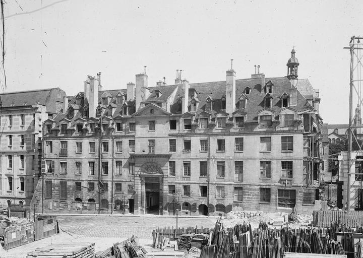
| Lycée Louis-le-Grand
( |
||||||||||||||||||||||||||
|---|---|---|---|---|---|---|---|---|---|---|---|---|---|---|---|---|---|---|---|---|---|---|---|---|---|---|
| Photographer |
|
|||||||||||||||||||||||||
| Title |
Lycée Louis-le-Grand |
|||||||||||||||||||||||||
| Depicted place | Paris | |||||||||||||||||||||||||
| Medium | Négatif | |||||||||||||||||||||||||
| Accession number |
MH0024623 |
|||||||||||||||||||||||||
| References | Base Mémoire: APMH00024623 | |||||||||||||||||||||||||
| Source | Ministère de la Culture (France) - Médiathèque de l'architecture et du patrimoine - diffusion RMN (image) | |||||||||||||||||||||||||
| Permission (Reusing this file) |
|
|||||||||||||||||||||||||
| Object location | | View this and other nearby images on: OpenStreetMap |
|---|
|
This building is indexed in the base Mérimée, a database of architectural heritage maintained by the French Ministry of Culture, under the reference PA00088477
|
File history
Click on a date/time to view the file as it appeared at that time.
| Date/Time | Thumbnail | Dimensions | User | Comment | |
|---|---|---|---|---|---|
| current | 18:04, 16 July 2014 | | 720 × 512 (74 KB) | Jean-Frédéric | GWToolset: Creating mediafile for Jean-Frédéric. See project page |
File usage
The following pages on the English Wikipedia use this file (pages on other projects are not listed):