

Size of this PNG preview of this SVG file: 563 × 600 pixels. Other resolutions: 225 × 240 pixels | 451 × 480 pixels | 721 × 768 pixels | 962 × 1,024 pixels | 1,923 × 2,048 pixels | 678 × 722 pixels.
Original file (SVG file, nominally 678 × 722 pixels, file size: 55 KB)
| This is a file from the Wikimedia Commons. Information from its description page there is shown below. Commons is a freely licensed media file repository. You can help. |
Summary
| Description |
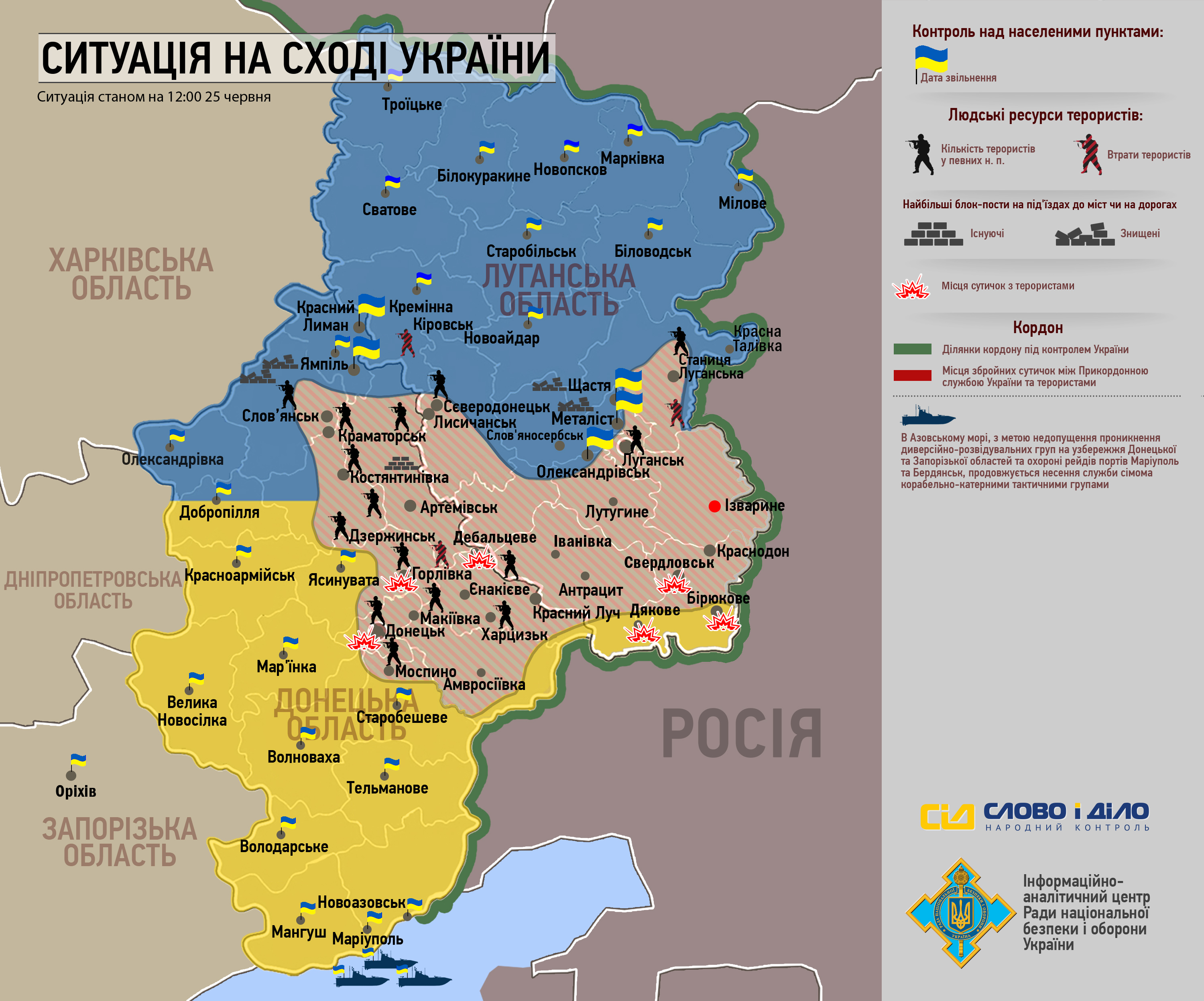
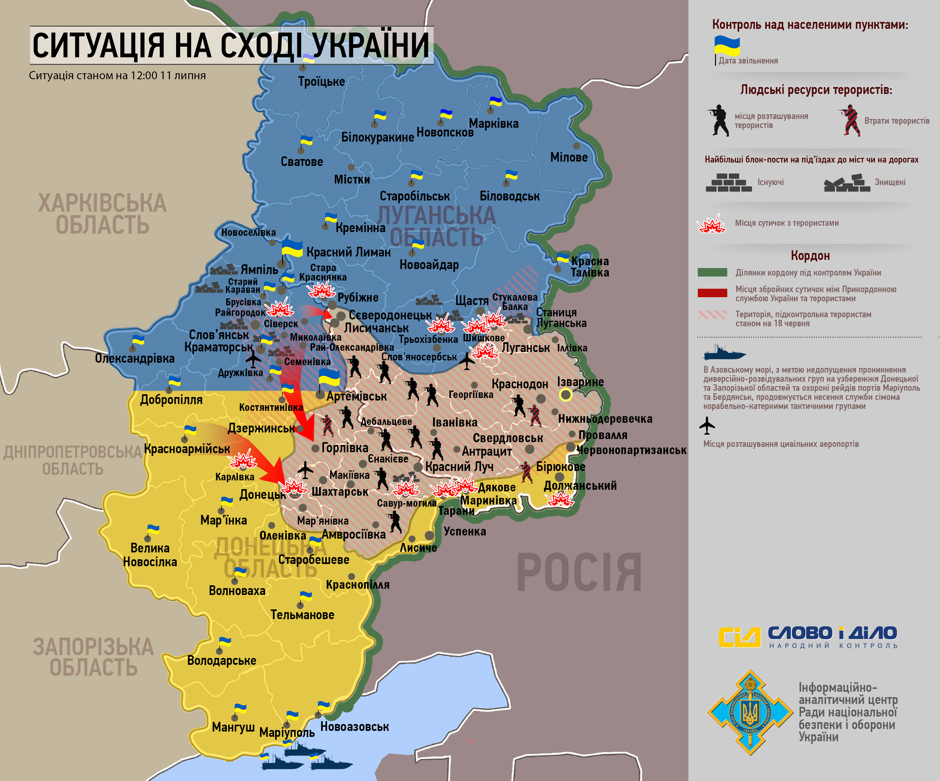
Map battle for Kramatorsk, Sloviansk, Druzhkivka, and Kostiantynivka during the war in the Donbass (2014)
|
| Date | |
| Source |
Own work Derivated from; This file was derived from: Withdrawal from Debaltseve.svg |
| Author | Goran tek-en |
| SVG development | This vector image was created with Inkscape. |

| Object location | | View this and other nearby images on: OpenStreetMap |
|---|


Licensing
This file is licensed under the Creative Commons Attribution-Share Alike 4.0 International license.
Attribution: Goran tek-en
- You are free:
- to share – to copy, distribute and transmit the work
- to remix – to adapt the work
- Under the following conditions:
- attribution – You must give appropriate credit, provide a link to the license, and indicate if changes were made. You may do so in any reasonable manner, but not in any way that suggests the licensor endorses you or your use.
- share alike – If you remix, transform, or build upon the material, you must distribute your contributions under the same or compatible license as the original.
File history
Click on a date/time to view the file as it appeared at that time.
| Date/Time | Thumbnail | Dimensions | User | Comment | |
|---|---|---|---|---|---|
| current | 12:15, 20 March 2015 | | 678 × 722 (55 KB) | Goran tek-en | edited legend |
| 12:10, 20 March 2015 |  | 678 × 722 (55 KB) | Goran tek-en | User created page with UploadWizard |
File usage
The following pages on the English Wikipedia use this file (pages on other projects are not listed):
Global file usage
The following other wikis use this file:
- Usage on el.wikipedia.org
- Usage on es.wikipedia.org
- Usage on fi.wikipedia.org
- Usage on he.wikipedia.org
- Usage on it.wikipedia.org
- Usage on ja.wikipedia.org
- Usage on ka.wikipedia.org
- Usage on ko.wikipedia.org
- Usage on ru.wikipedia.org
- Usage on ru.wikinews.org
- Usage on sr.wikipedia.org
- Usage on uk.wikipedia.org
- Usage on vi.wikipedia.org
- Usage on www.wikidata.org
- Usage on zh.wikipedia.org