To install click the Add extension button. That's it.

The source code for the WIKI 2 extension is being checked by specialists of the Mozilla Foundation, Google, and Apple. You could also do it yourself at any point in time.

4,5
Kelly Slayton
Congratulations on this excellent venture… what a great idea!
Alexander Grigorievskiy
I use WIKI 2 every day and almost forgot how the original Wikipedia looks like.
Live Statistics
English Articles
Improved in 24 Hours
Added in 24 Hours
What we do. Every page goes through several hundred of perfecting techniques; in live mode. Quite the same Wikipedia. Just better.
.
Leo
Newton
Brights
Milds

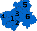
File:Législatives 2017 - Participation au premier tour.svg

From Wikipedia, the free encyclopedia

Original file(SVG file, nominally 512 × 466 pixels, file size: 915 KB)

Summary

Description
Français : Participation au premier tour de l'élection législative française de 2017.
 
Supérieur à 65%
 
60-65%
 
55-60%
 
50-55%
 
45-50%
 
40-45%
 
35-40%
 
30-35%
 
Inférieur à 30%
 
Pas de données
SVG development
InfoField
 
The SVG code is valid.
 
This vector image was created with Adobe Illustrator.
Date
Source
 
This vector image includes elements that have been taken or adapted from this file:
Circonscriptions législatives françaises depuis 2012.svg (by Superbenjamin).
Author User:Ternoc
Permission
(Reusing this file)
This work is licensed under the Open Database License (summary).
Other versions

[edit]

French legislative election maps, 2017


First round results by Regions and overseas territories
Overseas regions
Overseas territories
Foreign french
Incumbent deputies by Regions and overseas territories
Metropolitan regions
Overseas regions
Overseas territories
Foreign french
Incumbent deputies by departments
Auvergne-Rhône-Alpes
SVG development
InfoField
 
The SVG code is valid.
 
This map was created with Adobe Illustrator.
[[Category:Valid SVG created with Adobe Illustrator:Maps
FLEM|Législatives 2017 - Participation au premier tour.svg]]
 
This SVG map was uploaded with Commonist.
 
This map uses embedded text/digits.

Captions

Add a one-line explanation of what this file represents

Éléments décrits dans ce fichier

depicts

8 June 2017

File history

Click on a date/time to view the file as it appeared at that time.

Date/TimeThumbnailDimensionsUserComment
current17:25, 12 June 2017Thumbnail for version as of 17:25, 12 June 2017512 × 466 (915 KB)Titidu11Version complétée
13:53, 11 June 2017Thumbnail for version as of 13:53, 11 June 20171,721 × 1,567 (1.18 MB)TernocWallis et Futuna
13:33, 11 June 2017Thumbnail for version as of 13:33, 11 June 20171,721 × 1,567 (1.18 MB)TernocOutre mers
00:39, 8 June 2017Thumbnail for version as of 00:39, 8 June 20171,721 × 1,567 (1.18 MB)TernocUser created page with UploadWizard
The following pages on the English Wikipedia use this file (pages on other projects are not listed):

Global file usage

Metadata

Basis of this page is in Wikipedia. Text is available under the CC BY-SA 3.0 Unported License. Non-text media are available under their specified licenses. Wikipedia® is a registered trademark of the Wikimedia Foundation, Inc. WIKI 2 is an independent company and has no affiliation with Wikimedia Foundation.