To install click the Add extension button. That's it.

The source code for the WIKI 2 extension is being checked by specialists of the Mozilla Foundation, Google, and Apple. You could also do it yourself at any point in time.

4,5
Kelly Slayton
Congratulations on this excellent venture… what a great idea!
Alexander Grigorievskiy
I use WIKI 2 every day and almost forgot how the original Wikipedia looks like.
Live Statistics
English Articles
Improved in 24 Hours
Added in 24 Hours
What we do. Every page goes through several hundred of perfecting techniques; in live mode. Quite the same Wikipedia. Just better.
.
Leo
Newton
Brights
Milds

File:Interstate Highway plan September 1955.jpg

From Wikipedia, the free encyclopedia

Original file(1,799 × 1,268 pixels, file size: 123 KB, MIME type: image/jpeg)

Description
;Major changes from August 2, 1947 (in today's terms)
  • I-8 no longer serves Phoenix
  • I-80 shifted south in Pennsylvania, forming the separate I-380
  • I-135 added in Kansas
  • I-495 added around Boston City map from the 1955 "Yellow Book" of Interstate Highway System plans
Date
Source
This file is a direct scan by Adam Froehlig from the following book:

Bureau of Public Roads (September 1955). "National System of Interstate and Defense Highways" (Map). General Location of National System of Interstate Highways Including All Additional Routes at Urban Areas Designated in September 1955 Scale not given. Washington, DC: Government Printing Office. p. i. OCLC 4165975.
The Bureau of Public Roads (BPR) was originally a part of the United States Department of Agriculture then the United States Department of Commerce.
The BPR is the predecessor agency to the Federal Highway Administration, a part of the United States Department of Transportation.


This tag does not indicate the copyright status of the attached work. A normal copyright tag is still required. See Commons:Licensing for more information.

Author Public Roads Administration - Federal Works Agency (predecessor to the United States Department of Transportation).
Permission
(Reusing this file)
Public domain
This image or file is a work of a United States Department of Commerce employee, taken or made as part of that person's official duties. As a work of the U.S. federal government, the image is in the public domain.

Deutsch  English  Tiếng Việt  македонски  русский  українська  日本語  +/−

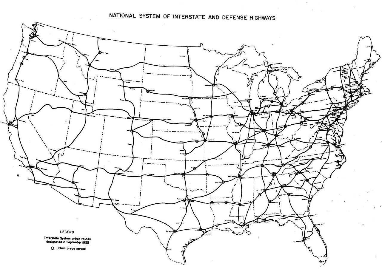
Interstate Highway System planning maps
August 2, 1947
map 1 - map 2
September 1955 August 14, 1957

Captions

Add a one-line explanation of what this file represents

Items portrayed in this file

depicts

September 1955

File history

Click on a date/time to view the file as it appeared at that time.

Date/TimeThumbnailDimensionsUserComment
current05:54, 25 December 2005Thumbnail for version as of 05:54, 25 December 20051,799 × 1,268 (123 KB)SPUI~commonswiki{{PD-USGov}} October 1957 map of the Interstate Highway System, from [http://www.kurumi.com/roads/3di/pics/map-isr-sep55.jpg]. Map 19571000 Category:road maps
The following pages on the English Wikipedia use this file (pages on other projects are not listed):

Global file usage

The following other wikis use this file:

Basis of this page is in Wikipedia. Text is available under the CC BY-SA 3.0 Unported License. Non-text media are available under their specified licenses. Wikipedia® is a registered trademark of the Wikimedia Foundation, Inc. WIKI 2 is an independent company and has no affiliation with Wikimedia Foundation.