
Size of this preview: 800 × 407 pixels. Other resolutions: 320 × 163 pixels | 640 × 326 pixels | 1,000 × 509 pixels.
Original file (1,000 × 509 pixels, file size: 169 KB, MIME type: image/jpeg)
| This is a file from the Wikimedia Commons. Information from its description page there is shown below. Commons is a freely licensed media file repository. You can help. |
Summary
| Description |
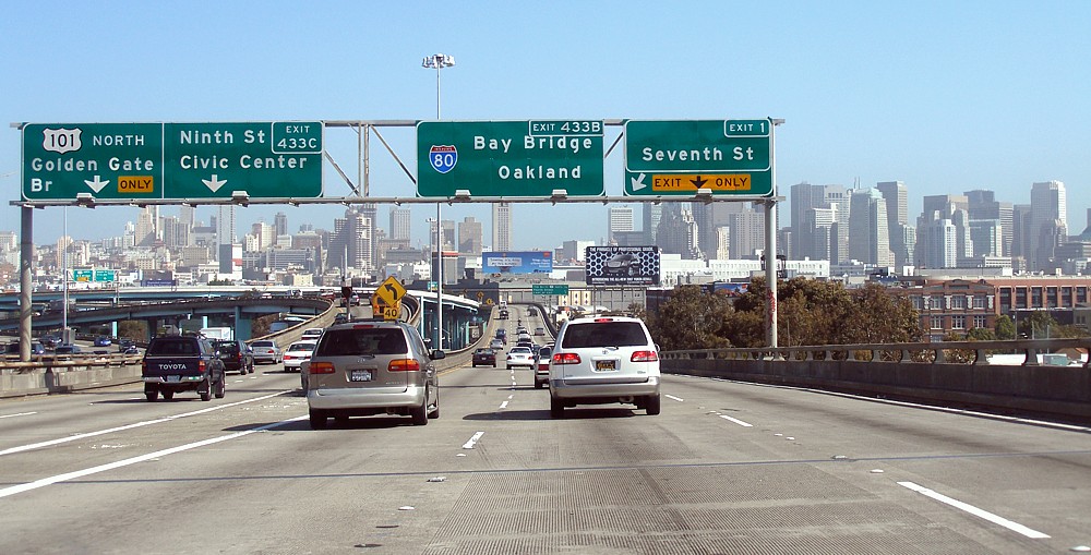
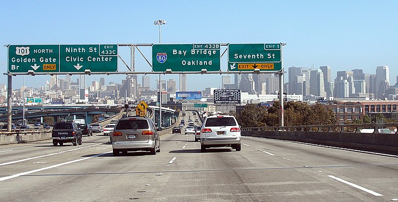
The interchange of Interstate 80 with U.S. Highway 101 in San Francisco. This is where Interstate 80 starts or ends, depending upon which way one is traveling. |
| Date | May 9, 2006 |
| Source | Own work |
| Author | user:Coolcaesar |
| Camera location | | View this and other nearby images on: OpenStreetMap |
|---|
The geographical information in this file was retrospectively estimated.
The location may therefore be somewhat imprecise. Verifying and refining these coordinates is strongly encouraged. |
File history from English Wikipedia
- 13 May 2006 00:19:15 . . Coolcaesar (Talk | contribs ) . . 1000×509 (173,399 bytes) (The interchange of Interstate 80 with U.S. Highway 101 in San Francisco, California. This is where Interstate 80 starts or ends, depending upon which way one is traveling. Photographed by user Coolcaesar on May 9)
Licensing
| This file is licensed under the Creative Commons Attribution-Share Alike 3.0 Unported license. Subject to disclaimers. | ||
| ||
| This licensing tag was added to this file as part of the GFDL licensing update. |

|
Permission is granted to copy, distribute and/or modify this document under the terms of the GNU Free Documentation License, Version 1.2 or any later version published by the Free Software Foundation; with no Invariant Sections, no Front-Cover Texts, and no Back-Cover Texts. A copy of the license is included in the section entitled GNU Free Documentation License. Subject to disclaimers. |
File history
Click on a date/time to view the file as it appeared at that time.
| Date/Time | Thumbnail | Dimensions | User | Comment | |
|---|---|---|---|---|---|
| current | 17:39, 5 October 2006 | | 1,000 × 509 (169 KB) | Scott5114 | The sign for the w:Sand Hill Road exit from w:Interstate 280 (California) northbound. Photographed by user Coolcaesar on the morning of August 18, 2005. ==File history from English Wikipedia== * 26 August 2005 . . Coolcaesar |
File usage
The following pages on the English Wikipedia use this file (pages on other projects are not listed):
Global file usage
The following other wikis use this file:
- Usage on bg.wikipedia.org
- Usage on ca.wikipedia.org
- Usage on da.wikipedia.org
- Usage on es.wikipedia.org
- Usage on fa.wikipedia.org
- Usage on io.wikipedia.org
- Usage on pam.wikipedia.org
- Usage on sv.wikipedia.org
- Usage on www.wikidata.org
- Usage on zh.wikipedia.org