
Size of this preview: 800 × 599 pixels. Other resolutions: 320 × 240 pixels | 640 × 479 pixels | 1,024 × 766 pixels | 1,280 × 958 pixels.
Original file (1,280 × 958 pixels, file size: 366 KB, MIME type: image/jpeg)
| This is a file from the Wikimedia Commons. Information from its description page there is shown below. Commons is a freely licensed media file repository. You can help. |
Summary
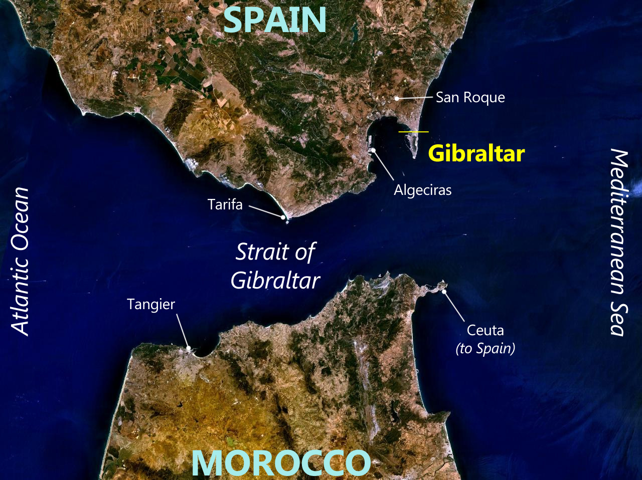
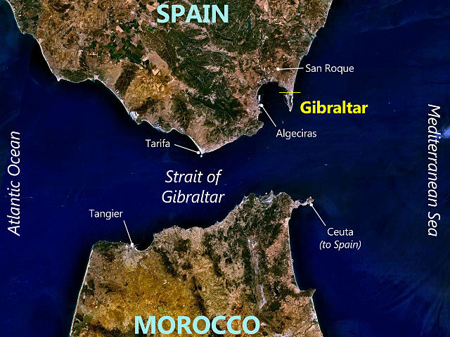
| Description | Annotated satellite map of Gibraltar and surrounding area |
| Date | |
| Source | NASA |
| Author | NASA World Wind (image), Prioryman (annotations) |
| Other versions | Derivative from File:Strait of Gibraltar 5.53940W 35.97279N.jpg |
Licensing
I, the copyright holder of this work, hereby publish it under the following license:
| This file is made available under the Creative Commons CC0 1.0 Universal Public Domain Dedication. | |
| The person who associated a work with this deed has dedicated the work to the public domain by waiving all of their rights to the work worldwide under copyright law, including all related and neighboring rights, to the extent allowed by law. You can copy, modify, distribute and perform the work, even for commercial purposes, all without asking permission.
|
| This image is in the public domain because it is a screenshot from NASA’s globe software World Wind using a public domain layer, such as Blue Marble, MODIS, Landsat, SRTM, USGS or GLOBE.
|
 |
File history
Click on a date/time to view the file as it appeared at that time.
| Date/Time | Thumbnail | Dimensions | User | Comment | |
|---|---|---|---|---|---|
| current | 23:57, 19 February 2013 | | 1,280 × 958 (366 KB) | Prioryman | {{Information |Description=Annotated satellite map of Gibraltar and surrounding area |Source=NASA |Date=19 February 2013 |Author=Prioryman |Permission= |other_versions=Derivative from [[:File:Strait of Gibraltar 5.53940W 35.97279N.jp... |
File usage
The following pages on the English Wikipedia use this file (pages on other projects are not listed):
Global file usage
The following other wikis use this file:
- Usage on ar.wikipedia.org
- Usage on it.wikipedia.org
- Usage on ja.wikipedia.org
- Usage on mt.wikipedia.org
- Usage on zh.wikipedia.org