
Original file (1,200 × 1,600 pixels, file size: 671 KB, MIME type: image/jpeg)
| This is a file from the Wikimedia Commons. Information from its description page there is shown below. Commons is a freely licensed media file repository. You can help. |
| Description |
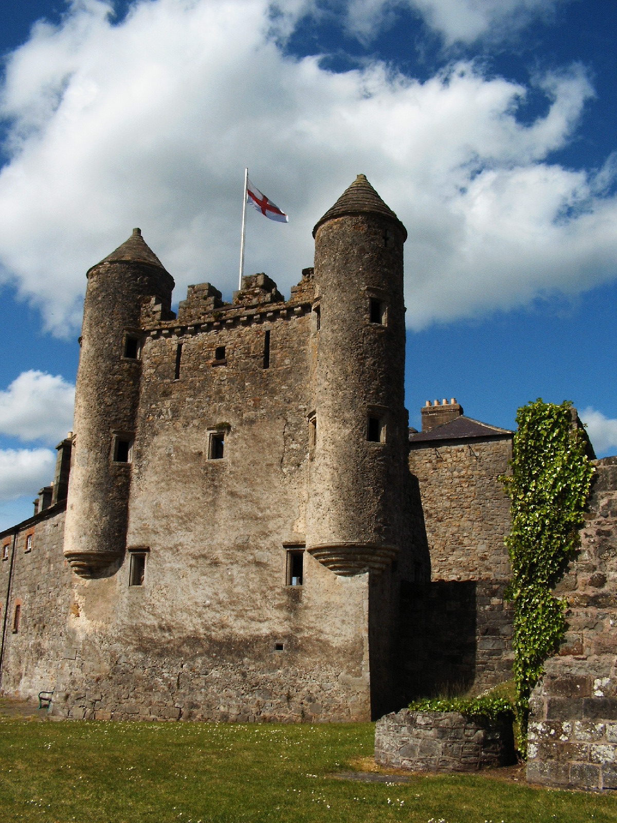
Enniskillen (from the Irish: Inis Ceithleann meaning "Kathleen's Island") is the county town (and largest town) in County Fermanagh and the west of Northern Ireland. It is located almost exactly in the centre of the county on the natural island which separates the Upper and Lower sections of Lough Erne. Enniskillen Castle is situated in Enniskillen, County Fermanagh, Northern Ireland. The first castle was built on this site by Hugh Maguire in the 16th century. It consists of two sections, a central keep and a curtain wall and provided the main defence for the west end of the town and guarded the Sligo road. It has been substantially rebuilt. It is a State Care Historic Monument. It featured greatly in Irish rebellions against English rule in the 16th century and was taken after an eight day siege in 1594. In 1607 it was remodelled and refurbished by Captain William Cole. The riverside tower at the south, known as the Watergate, was added at this time. In the 18th century the castle was remodelled as the Castle Barracks and now houses the Regimental Museum of the Royal Inniskilling Fusiliers. |
| Date | |
| Source |
|
| Author | Jule_Berlin from Berlin, Germany |
| Camera location | | View this and other nearby images on: OpenStreetMap |
|---|
Licensing
- You are free:
- to share – to copy, distribute and transmit the work
- to remix – to adapt the work
- Under the following conditions:
- attribution – You must give appropriate credit, provide a link to the license, and indicate if changes were made. You may do so in any reasonable manner, but not in any way that suggests the licensor endorses you or your use.
| This image, originally posted to Flickr, was reviewed on May 15, 2009 by the administrator or reviewer File Upload Bot (Magnus Manske), who confirmed that it was available on Flickr under the stated license on that date. |
File history
Click on a date/time to view the file as it appeared at that time.
| Date/Time | Thumbnail | Dimensions | User | Comment | |
|---|---|---|---|---|---|
| current | 16:19, 15 May 2009 | | 1,200 × 1,600 (671 KB) | File Upload Bot (Magnus Manske) | {{Information |Description= Enniskillen (from the Irish: Inis Ceithleann meaning "Kathleen's Island") is the county town (and largest town) in County Fermanagh and the west of Northern Ireland. It is located almost exactly in the centre of the |
File usage
Global file usage
The following other wikis use this file:
- Usage on fr.wikipedia.org
- Usage on ga.wikipedia.org
- Usage on pl.wikipedia.org