
Size of this preview: 623 × 599 pixels. Other resolutions: 250 × 240 pixels | 630 × 606 pixels.
Original file (630 × 606 pixels, file size: 222 KB, MIME type: image/png)
| This is a file from the Wikimedia Commons. Information from its description page there is shown below. Commons is a freely licensed media file repository. You can help. |
Summary
| Description |
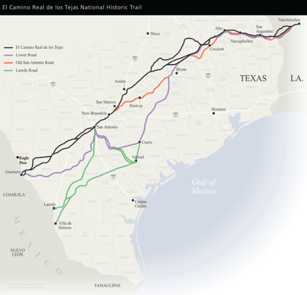
Map of the El Camino Real de los Tejas National Historic Trail.
|
| Date | Unknown date |
| Source | nps.gov |
| Author | National Park Service |
Licensing
| This image or media file contains material based on a work of a National Park Service employee, created as part of that person's official duties. As a work of the U.S. federal government, such work is in the public domain in the United States. See the NPS website and NPS copyright policy for more information. |
File history
Click on a date/time to view the file as it appeared at that time.
| Date/Time | Thumbnail | Dimensions | User | Comment | |
|---|---|---|---|---|---|
| current | 09:55, 7 March 2009 | | 630 × 606 (222 KB) | CMBJ | {{Information |Description=El Camino Real de los Tejas National Historic Trail |Source=[http://www.nps.gov/elte/planyourvisit/maps.htm nps.gov] |Date=Unknown |Author=National Park Service |Permission= |other_versions= }} <!--{{ImageUpload|basic}}--> |
File usage
The following pages on the English Wikipedia use this file (pages on other projects are not listed):
Global file usage
The following other wikis use this file:
- Usage on de.wikipedia.org
- Usage on es.wikipedia.org
- Usage on it.wikipedia.org