
_geograph-3193573-by-Ben-Brooksbank_jpg)
Size of this preview: 800 × 482 pixels. Other resolutions: 320 × 193 pixels | 640 × 386 pixels | 1,024 × 617 pixels | 1,280 × 772 pixels | 1,810 × 1,091 pixels.
Original file (1,810 × 1,091 pixels, file size: 1.62 MB, MIME type: image/jpeg)
| This is a file from the Wikimedia Commons. Information from its description page there is shown below. Commons is a freely licensed media file repository. You can help. |
_geograph-3193573-by-Ben-Brooksbank.jpg)
Summary
| Description |
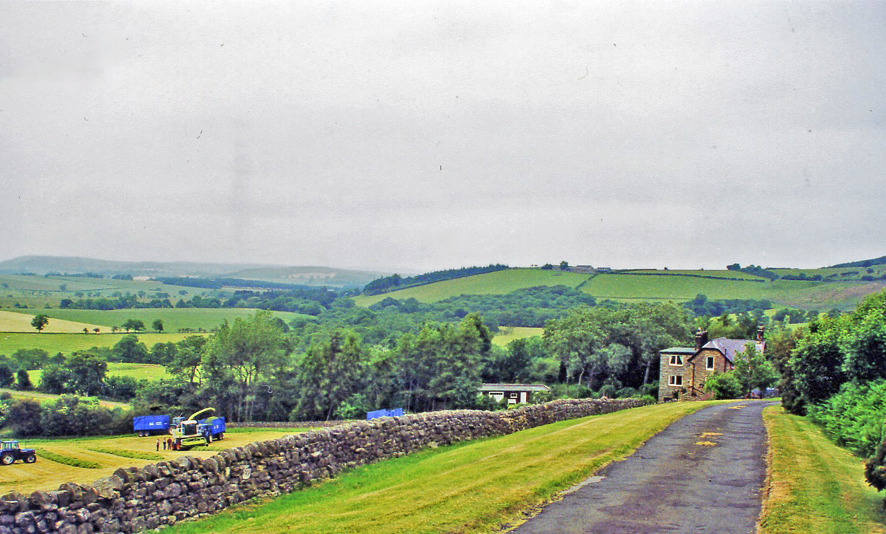
Site of Edlingham Halt and trackbed of former line from Alnwick, 2000. View NE, towards Alnwick: ex-NER Alnwick - Wooler - Coldstream line, which was closed to passengers from 22/9/30 but remained open for goods Alnwick - Ilderton until 2/3/53. On the left horizon is the Cheviot (2,676 ft.). |
| Date | |
| Source | From geograph.org.uk |
| Author | Ben Brooksbank |
| Permission (Reusing this file) |
Creative Commons Attribution Share-alike license 2.0 |
| Attribution (required by the license) | Ben Brooksbank / Site of Edlingham Halt and trackbed of former line from Alnwick, 2000 / |
| Camera location | | View this and other nearby images on: OpenStreetMap |
|---|
_geograph-3193573-by-Ben-Brooksbank.jpg¶ms=055.377174_N_-001.810605_E_globe:Earth_type:camera_heading:45.00&language=en)
Licensing

|
This image was taken from the Geograph project collection. See this photograph's page on the Geograph website for the photographer's contact details. The copyright on this image is owned by Ben Brooksbank and is licensed for reuse under the Creative Commons Attribution-ShareAlike 2.0 license.
|
This file is licensed under the Creative Commons Attribution-Share Alike 2.0 Generic license.
Attribution: Ben Brooksbank
- You are free:
- to share – to copy, distribute and transmit the work
- to remix – to adapt the work
- Under the following conditions:
- attribution – You must give appropriate credit, provide a link to the license, and indicate if changes were made. You may do so in any reasonable manner, but not in any way that suggests the licensor endorses you or your use.
- share alike – If you remix, transform, or build upon the material, you must distribute your contributions under the same or compatible license as the original.
File history
Click on a date/time to view the file as it appeared at that time.
| Date/Time | Thumbnail | Dimensions | User | Comment | |
|---|---|---|---|---|---|
| current | 13:03, 28 October 2012 | | 1,810 × 1,091 (1.62 MB) | Chevin | == {{int:filedesc}} == {{Information |Description={{en|1='''Site of Edlingham Halt and trackbed of former line from Alnwick, 2000.'''<br/> View NE, towards Alnwick: ex-NER Alnwick - Wooler - Coldstream line, which was closed to passengers from 22/9/30 ... |
File usage
The following pages on the English Wikipedia use this file (pages on other projects are not listed):
Global file usage
The following other wikis use this file:
- Usage on www.wikidata.org
_geograph-3193573-by-Ben-Brooksbank.jpg)