
_jpg)

Original file (4,000 × 3,000 pixels, file size: 2.7 MB, MIME type: image/jpeg)
| This is a file from the Wikimedia Commons. Information from its description page there is shown below. Commons is a freely licensed media file repository. You can help. |
.jpg)
Summary
| Description |
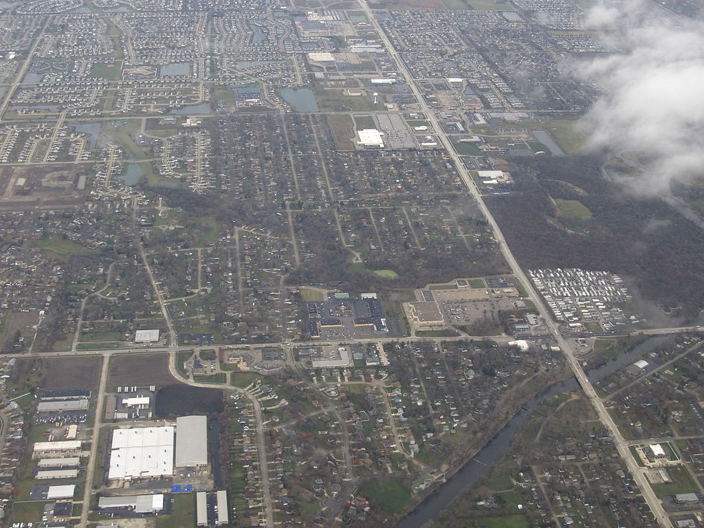
The DuPage River is a 28.3-mile-long (45.5 km) tributary of the Des Plaines River in the U.S. state of Illinois. The river begins as two individual streams. The West Branch of the DuPage River, 35.0 miles (56.3 km) long, starts in Schaumburg at Campanelli Park in Cook County and continues southward through the entire county of DuPage, including the towns of Bartlett, Wheaton, Warrenville, Winfield and Naperville (including through its riverwalk). The East Branch of the DuPage River, 25.0 miles (40.2 km) long, begins in Bloomingdale and flows southward through Glendale Heights, Glen Ellyn, Lisle, Woodridge, parts of Naperville and parts of Bolingbrook. The two branches meet at a spot between Naperville and Bolingbrook. The combined DuPage River continues southward from that point, through Plainfield and then west of Joliet, before finally meeting the Des Plaines River. en.wikipedia.org/wiki/Dupage_River en.wikipedia.org/wiki/Wikipedia:Text_of_Creative_Commons_... |
| Date | |
| Source | DuPage River, Shorewood, Illinois |
| Author | Ken Lund from Reno, Nevada, USA |
| Camera location | | View this and other nearby images on: OpenStreetMap |
|---|
.jpg¶ms=041.520659_N_-088.197158_E_globe:Earth_type:camera_source:Flickr_&language=en)
Licensing
- You are free:
- to share – to copy, distribute and transmit the work
- to remix – to adapt the work
- Under the following conditions:
- attribution – You must give appropriate credit, provide a link to the license, and indicate if changes were made. You may do so in any reasonable manner, but not in any way that suggests the licensor endorses you or your use.
- share alike – If you remix, transform, or build upon the material, you must distribute your contributions under the same or compatible license as the original.
| This image was originally posted to Flickr by Ken Lund at https://flickr.com/photos/75683070@N00/11004138155. It was reviewed on 4 December 2015 by FlickreviewR and was confirmed to be licensed under the terms of the cc-by-sa-2.0. |
File history
Click on a date/time to view the file as it appeared at that time.
| Date/Time | Thumbnail | Dimensions | User | Comment | |
|---|---|---|---|---|---|
| current | 00:58, 4 December 2015 | | 4,000 × 3,000 (2.7 MB) | INeverCry | Transferred from Flickr via Flickr2Commons |
File usage
Global file usage
The following other wikis use this file:
- Usage on azb.wikipedia.org
- Usage on tr.wikipedia.org
- Usage on uk.wikipedia.org
- Usage on zh.wikipedia.org
.jpg)