
_png)
No higher resolution available.
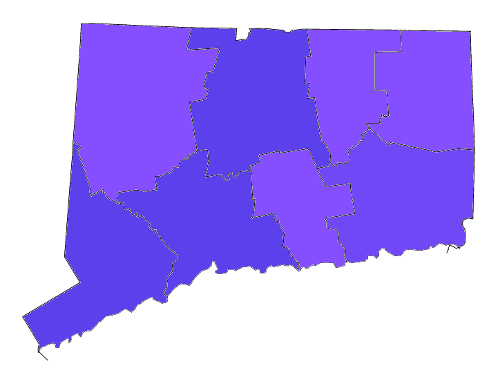
CT_Counties_by_Population_(2020_census).png (721 × 543 pixels, file size: 31 KB, MIME type: image/png)
| This is a file from the Wikimedia Commons. Information from its description page there is shown below. Commons is a freely licensed media file repository. You can help. |
.png)

|
This demographic map image could be re-created using vector graphics as an SVG file. This has several advantages; see Commons:Media for cleanup for more information. If an SVG form of this image is available, please upload it and afterwards replace this template with
{{vector version available|new image name}}.
It is recommended to name the SVG file “CT Counties by Population (2020 census).svg”—then the template Vector version available (or Vva) does not need the new image name parameter. |
Summary
| Description |
Map of Connecticut Counties by population. The colors are based on total population according to the 2020 census. 500,000-957,419
200,000-499,999
116,418-199,999 |
| Date | |
| Source | Map shapefile from [File:Connecticut-counties-map.gif], results from 2020 census [1] |
| Author | Infrarrojo00 |
Licensing
I, the copyright holder of this work, hereby publish it under the following license:
This file is licensed under the Creative Commons Attribution-Share Alike 4.0 International license.
- You are free:
- to share – to copy, distribute and transmit the work
- to remix – to adapt the work
- Under the following conditions:
- attribution – You must give appropriate credit, provide a link to the license, and indicate if changes were made. You may do so in any reasonable manner, but not in any way that suggests the licensor endorses you or your use.
- share alike – If you remix, transform, or build upon the material, you must distribute your contributions under the same or compatible license as the original.
- ↑ Connecticut QuickFacts. U.S. Census Bureau. Retrieved on March 15, 2021.
File history
Click on a date/time to view the file as it appeared at that time.
| Date/Time | Thumbnail | Dimensions | User | Comment | |
|---|---|---|---|---|---|
| current | 20:57, 15 March 2022 | | 721 × 543 (31 KB) | Infrarrojo00 | Uploaded own work with UploadWizard |
File usage
The following pages on the English Wikipedia use this file (pages on other projects are not listed):
.png)