To install click the Add extension button. That's it.

The source code for the WIKI 2 extension is being checked by specialists of the Mozilla Foundation, Google, and Apple. You could also do it yourself at any point in time.

4,5
Kelly Slayton
Congratulations on this excellent venture… what a great idea!
Alexander Grigorievskiy
I use WIKI 2 every day and almost forgot how the original Wikipedia looks like.
Live Statistics
English Articles
Improved in 24 Hours
Added in 24 Hours
What we do. Every page goes through several hundred of perfecting techniques; in live mode. Quite the same Wikipedia. Just better.
.
Leo
Newton
Brights
Milds

File:Bulgaria map drainage divide and river bassins.svg

From Wikipedia, the free encyclopedia

Original file(SVG file, nominally 2,724 × 1,800 pixels, file size: 12.03 MB)

Summary

Description
Map of rivers, drainage divide and main drainage basins in Bulgaria
Date
Source

Own work

  • Sources of data:
    • Topography: SRTM v4(public domain);
    • Rivers and water bodies: Produced using Copernicus data and information funded by the European Union - EU-Hydro layers
    • Borders: © OpenStreetMap contributors;
  • Tool:
    • The map is created with Octave scripts developed by Ikonact
Author Ikonact
Permission
(Reusing this file)
Any use of this map is subject of the license(s) stated below with the condition that you credit (Wikimedia Commons user: Ikonact) as the author . A message with a reply address would also be greatly appreciated.
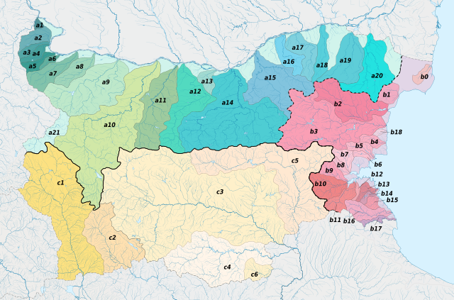
Legend
InfoField
English: Legend:

     Danube

     a1 Timok
     a2 Topolovets
     a3 Voynishka reka
     a4 Vidbol
     a5 Archar
     a6 Skomlya
     a7 Lom
     a8 Tsibritsa
     a9 Ogosta
     a10 Iskar
     a11 Vit
     a12 Osam
     a13 Barata
     a14 Yantra
     a15 Rusenski Lom
     a16 Topchiyska reka
     a17 Tsaratsar
     a18 Senkovets
     a19 Kanagyol
     a20 Suha reka
     a21 Nishava

     Black sea

     b0 Shablenska reka
     b1 Batova reka
     b2 Provadiyska reka
     b3 Kamchiya
     b18 Fandakliyska reka
     b4 Dvoynitsa
     b5 Hadzhiyska reka
     b6 Aheloy
     b7 Aytoska reka
     b8 Chukarska reka
     b9 Rusokastrenska reka
     b10 Sredetska reka
     b11 Fakiyska reka
     b12 Izvorska reka
     b13 Ropotamo
     b14 Dyavolska reka
     b15 Kitenska reka
     b16 Veleka
     b17 Rezovska reka

Aegean sea

     c1 Struma
     c2 Mesta
     c3 Maritsa
     c4 Arda
     c5 Tundzha
     c6 Luda reka

Note: in Bulgarian, reka means river.

Български: Легенда:

     Дунав

     a1 Тимок
     a2 Тополовец
     a3 Войнишка река
     a4 Видбол
     a5 Арчар
     a6 Скомля
     a7 Лом
     a8 Цибрица
     a9 Огоста
     a10 Искър
     a11 Вит
     a12 Осъм
     a13 Барата
     a14 Янтра
     a15 Русенски Лом
     a16 Топчийска река
     a17 Царацар
     a18 Сенковец
     a19 Канагьол
     a20 Суха река
     a21 Нишава

     Черно море

     b0 Шабленска река
     b1 Батова река
     b2 Провадийска река
     b3 Камчия
     b18 Фъндъклийска река
     b4 Двойница
     b5 Хаджийска река
     b6 Ахелой
     b7 Айтоска река
     b8 Чукарска река
     b9 Русокастренска река
     b10 Средецка река
     b11 Факийска река
     b12 Изворска река
     b13 Ропотамо
     b14 Дяволска река
     b15 Китенска река
     b16 Велека
     b17 Резовска река

Бяло море (Егейско море)

     c1 Струма
     c2 Места
     c3 Марица
     c4 Арда
     c5 Тунджа
     c6 Луда река

Licensing

I, the copyright holder of this work, hereby publish it under the following license:
w:en:Creative Commons
attribution share alike
You are free:
  • to share – to copy, distribute and transmit the work
  • to remix – to adapt the work
Under the following conditions:
  • attribution – You must give appropriate credit, provide a link to the license, and indicate if changes were made. You may do so in any reasonable manner, but not in any way that suggests the licensor endorses you or your use.
  • share alike – If you remix, transform, or build upon the material, you must distribute your contributions under the same or compatible license as the original.
Annotations
InfoField
This image is annotated: View the annotations at Commons

Captions

Map of rivers, drainage divide and main drainage basins in Bulgaria

Items portrayed in this file

depicts

2 February 2020

image/svg+xml

7b30ab6ff4cf1ce86ea6eac6b6d90a720156670d

12,614,363 byte

1,800 pixel

2,724 pixel

File history

Click on a date/time to view the file as it appeared at that time.

Date/TimeThumbnailDimensionsUserComment
current18:39, 8 February 2020Thumbnail for version as of 18:39, 8 February 20202,724 × 1,800 (12.03 MB)Ikonactsome more numbering
17:19, 8 February 2020Thumbnail for version as of 17:19, 8 February 20202,724 × 1,800 (12.01 MB)Ikonactnumbered
14:22, 3 February 2020Thumbnail for version as of 14:22, 3 February 20202,724 × 1,800 (11.87 MB)IkonactArda river corrected
20:05, 2 February 2020Thumbnail for version as of 20:05, 2 February 20202,724 × 1,800 (11.88 MB)IkonactUser created page with UploadWizard
The following pages on the English Wikipedia use this file (pages on other projects are not listed):

Global file usage

Metadata

Basis of this page is in Wikipedia. Text is available under the CC BY-SA 3.0 Unported License. Non-text media are available under their specified licenses. Wikipedia® is a registered trademark of the Wikimedia Foundation, Inc. WIKI 2 is an independent company and has no affiliation with Wikimedia Foundation.