

Size of this preview: 466 × 599 pixels. Other resolutions: 187 × 240 pixels | 373 × 480 pixels | 597 × 768 pixels | 796 × 1,024 pixels | 1,593 × 2,048 pixels | 5,600 × 7,200 pixels.
Original file (5,600 × 7,200 pixels, file size: 31.04 MB, MIME type: image/jpeg)
| This is a file from the Wikimedia Commons. Information from its description page there is shown below. Commons is a freely licensed media file repository. You can help. |
Summary
| Description |
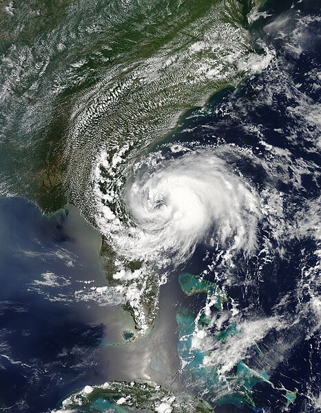
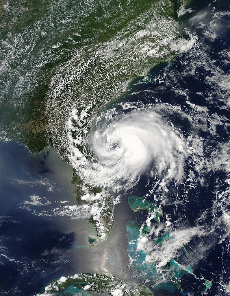
Beryl first formed as a subtropical storm over the Atlantic Ocean on May 25, 2012. The U.S. National Hurricane Center (NHC) tracked the storm’s progress, and at 2:00 p.m. Eastern Daylight Time (EDT) on May 27, the NHC announced that the storm was located roughly 110 miles (175 kilometers) east of Jacksonville, Florida. Having strengthened into a tropical storm, Beryl had maximum sustained winds of 65 miles (100 kilometers) per hour.
The Moderate Resolution Imaging Spectroradiometer (MODIS) on NASA’s Aqua satellite captured this natural-color image of Beryl on May 27, around 2:30 p.m. EDT. Beryl was making landfall along Florida’s east coast. The NHC warned that the hazards affecting land included high winds and flooding resulting from a combination of the storm surge and the tide. |
| Date | |
| Source | http://earthobservatory.nasa.gov/NaturalHazards/view.php?id=78120 |
| Author | NASA image courtesy Jeff Schmaltz, LANCE MODIS Rapid Response Team, Goddard Space Flight Center. Caption by Michon Scott |
Licensing
| This file is in the public domain in the United States because it was solely created by NASA. NASA copyright policy states that "NASA material is not protected by copyright unless noted". (See Template:PD-USGov, NASA copyright policy page or JPL Image Use Policy.) | ||
 |
Warnings:
|
File history
Click on a date/time to view the file as it appeared at that time.
| Date/Time | Thumbnail | Dimensions | User | Comment | |
|---|---|---|---|---|---|
| current | 00:24, 23 April 2013 | | 5,600 × 7,200 (31.04 MB) | Supportstorm | Better quality |
| 03:40, 17 April 2013 |  | 5,600 × 7,200 (9.72 MB) | Earth100 | Please keep the official version. | |
| 19:25, 24 November 2012 |  | 6,400 × 7,800 (43.77 MB) | Supportstorm | HDF file quality | |
| 21:57, 27 May 2012 |  | 5,616 × 7,269 (11.19 MB) | Supportstorm | {{Information |Description ={{en|1=Tropical Storm Beryl at near peak strength, hours before it makes landfall, on May 27, 2012.}} |Source =http://lance2.modaps.eosdis.nasa.gov/wms/usecase_all_devel.html?zoom=4&lat=31.22657&lon=-66.10546&laye... |
File usage
The following pages on the English Wikipedia use this file (pages on other projects are not listed):
Global file usage
The following other wikis use this file:
- Usage on de.wikipedia.org
- Usage on es.wikipedia.org
- Usage on fr.wikipedia.org
- Usage on ko.wikipedia.org
- Usage on nl.wikipedia.org
- Usage on pt.wikipedia.org
- Usage on simple.wikipedia.org
- Usage on zh.wikipedia.org