
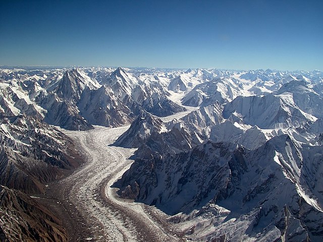
Size of this preview: 800 × 600 pixels. Other resolutions: 320 × 240 pixels | 640 × 480 pixels | 1,024 × 768 pixels | 1,280 × 960 pixels | 2,560 × 1,920 pixels | 2,848 × 2,136 pixels.
Original file (2,848 × 2,136 pixels, file size: 1.46 MB, MIME type: image/jpeg)
| This is a file from the Wikimedia Commons. Information from its description page there is shown below. Commons is a freely licensed media file repository. You can help. |
Summary
| Description |
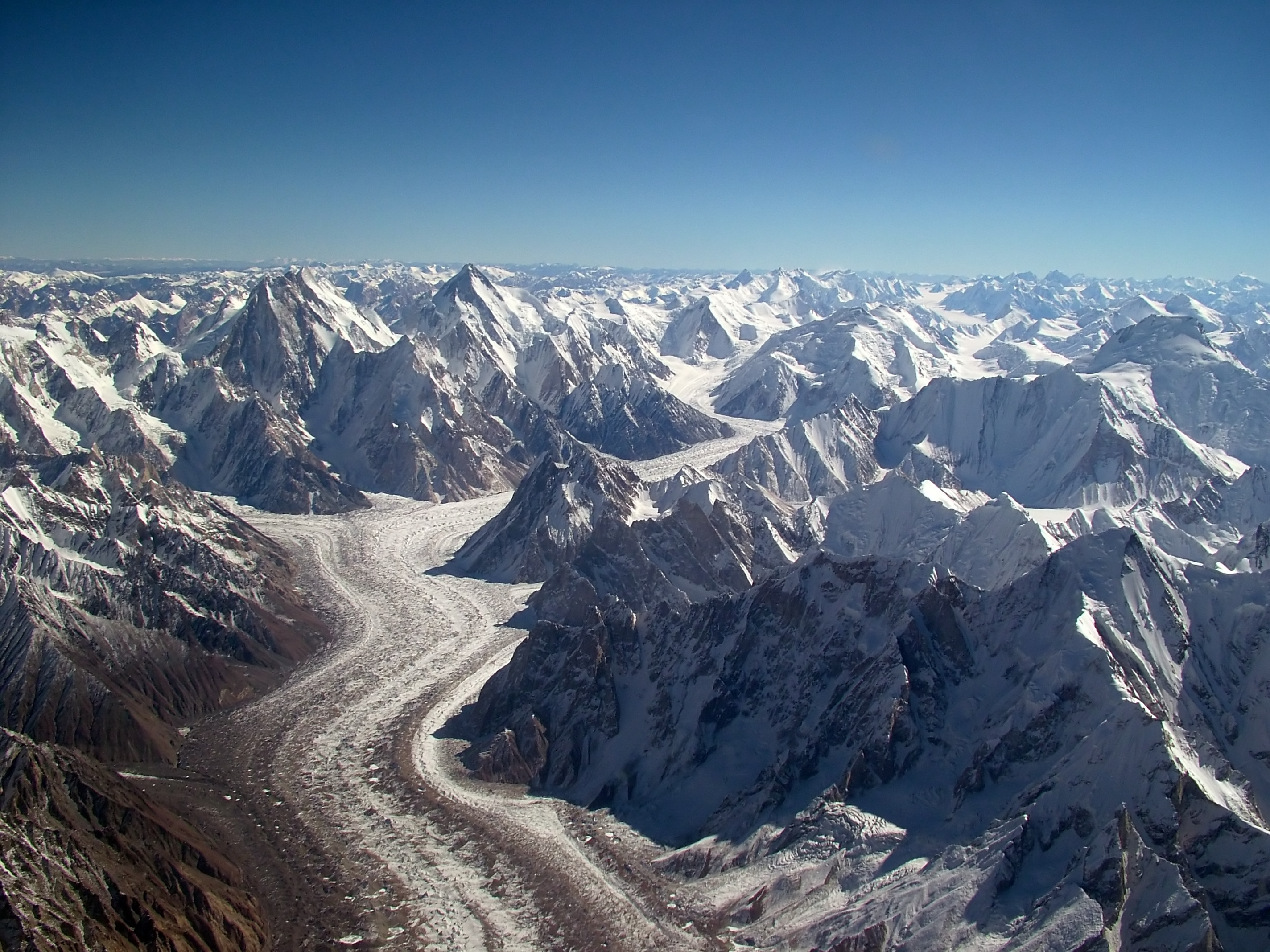
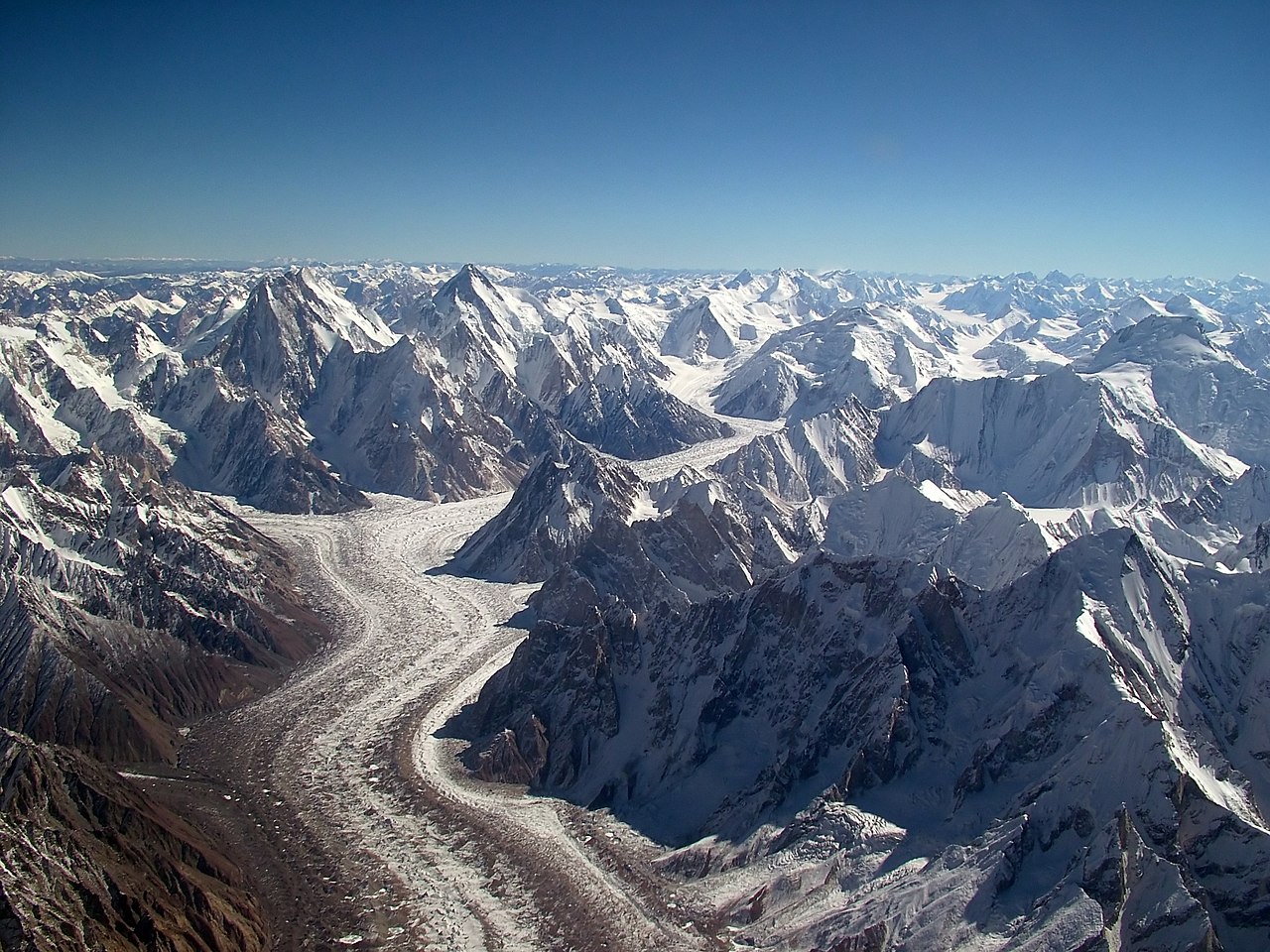
Aerial View of the Baltoro Glacier towards Concordia with Gasherbrum IV and Gasherbrum I on the left, Baltoro Kangri and Chogolisa on the upper right ; Mitre Peak is right in the center (where the glacier turns left while flowing down).
|
| Date | |
| Source | Glacier |
| Author | Guilhem Vellut from Paris |
| Permission (Reusing this file) |
CC-BY-SA-2.0 |
Licensing
This file is licensed under the Creative Commons Attribution-Share Alike 2.0 Generic license.
- You are free:
- to share – to copy, distribute and transmit the work
- to remix – to adapt the work
- Under the following conditions:
- attribution – You must give appropriate credit, provide a link to the license, and indicate if changes were made. You may do so in any reasonable manner, but not in any way that suggests the licensor endorses you or your use.
- share alike – If you remix, transform, or build upon the material, you must distribute your contributions under the same or compatible license as the original.
| This image was originally posted to Flickr by *_* at https://www.flickr.com/photos/22539273@N00/55896170. It was reviewed on 3 September 2008 by FlickreviewR and was confirmed to be licensed under the terms of the cc-by-sa-2.0. |
| Annotations | This image is annotated: View the annotations at Commons |
File history
Click on a date/time to view the file as it appeared at that time.
| Date/Time | Thumbnail | Dimensions | User | Comment | |
|---|---|---|---|---|---|
| current | 21:43, 2 September 2008 | | 2,848 × 2,136 (1.46 MB) | Iain99 | {{Information |Description= The Baltoro Glacier from the air, surrounded by the mountains of the Karakoram |Source=[http://www.flickr.com/photos/22539273@N00/55896170/ Glacier] |Date=October 23, 2005 at 10:00 |Auth |
File usage
The following pages on the English Wikipedia use this file (pages on other projects are not listed):
Global file usage
The following other wikis use this file:
- Usage on af.wikipedia.org
- Usage on ar.wikipedia.org
- Usage on ast.wikipedia.org
- Usage on as.wikipedia.org
- Usage on azb.wikipedia.org
- Usage on az.wikipedia.org
- Usage on bcl.wikipedia.org
- Usage on beta.wikiversity.org
- Usage on be.wikipedia.org
- Usage on bg.wikipedia.org
- Usage on bh.wikipedia.org
- Usage on bn.wikipedia.org
- Usage on br.wikipedia.org
- Usage on bs.wikipedia.org
- Usage on ca.wikipedia.org
- Usage on ceb.wikipedia.org
- Usage on ckb.wikipedia.org
- Usage on cv.wikipedia.org
- Usage on da.wikipedia.org
- Usage on de.wikipedia.org
- Usage on el.wikipedia.org
- Usage on en.wikiversity.org
- Usage on es.wikipedia.org
- Usage on eu.wikipedia.org
- Usage on fa.wikipedia.org
View more global usage of this file.