

Size of this PNG preview of this SVG file: 362 × 599 pixels. Other resolutions: 145 × 240 pixels | 290 × 480 pixels | 464 × 768 pixels | 619 × 1,024 pixels | 1,238 × 2,048 pixels | 534 × 883 pixels.
Original file (SVG file, nominally 534 × 883 pixels, file size: 747 KB)
| This is a file from the Wikimedia Commons. Information from its description page there is shown below. Commons is a freely licensed media file repository. You can help. |
| Description |
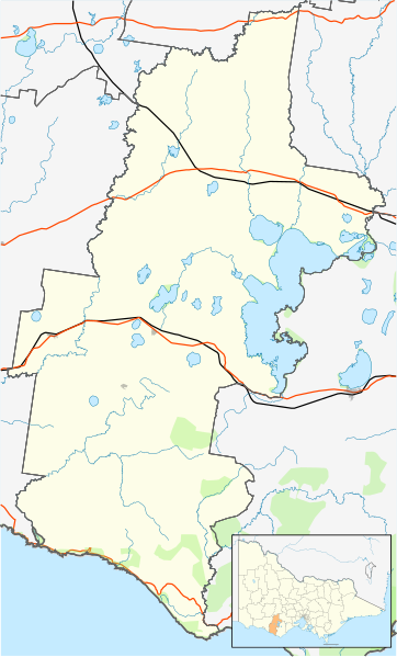
Blank map of w:Corangamite Shire, Victoria, Australia, with the following information shown:
Geographic limits:
|
||
| Source | Own work + VicMap Lite | ||
| Author | Cassowary |

File history
Click on a date/time to view the file as it appeared at that time.
| Date/Time | Thumbnail | Dimensions | User | Comment | |
|---|---|---|---|---|---|
| current | 12:31, 17 February 2011 | | 534 × 883 (747 KB) | Cassowary | {{Information |Description ={{en|1=Blank map of w:Corangamite Shire, Victoria, Australia, with the following information shown: * LGA boundaries * Coastline, lakes and rivers * Roads and railways * Urban areas * Parks Geographic limits: * North: 3 |
File usage
The following pages on the English Wikipedia use this file (pages on other projects are not listed):
- Ayrford, Victoria
- Brucknell, Victoria
- Camperdown, Victoria
- Cobden, Victoria
- Cobrico, Victoria
- Cooriemungle, Victoria
- Cressy, Victoria
- Curdievale
- Darlington, Victoria
- Derrinallum
- Ecklin South, Victoria
- Foxhow, Victoria
- Heytesbury Settlement Scheme
- Jancourt East
- Lismore, Victoria
- Moonlight Head
- Noorat
- Pirron Yallock, Victoria
- Port Campbell
- Princetown, Victoria
- Scotts Creek, Victoria
- Shire of Corangamite
- Simpson, Victoria
- Skipton, Victoria
- Terang
- The Twelve Apostles (Victoria)
- Timboon
- Waarre, Victoria
Global file usage
The following other wikis use this file:
- Usage on ar.wikipedia.org
- Usage on ceb.wikipedia.org
- Usage on fa.wikipedia.org
- Usage on ja.wikipedia.org
- Usage on kn.wikipedia.org
- Usage on sco.wikipedia.org
- Usage on si.wikipedia.org
- Usage on tr.wikipedia.org
- Usage on uz.wikipedia.org
- Usage on war.wikipedia.org