
Size of this preview: 800 × 597 pixels. Other resolutions: 320 × 239 pixels | 640 × 478 pixels | 1,024 × 765 pixels | 1,275 × 952 pixels.
Original file (1,275 × 952 pixels, file size: 561 KB, MIME type: image/jpeg)
| This is a file from the Wikimedia Commons. Information from its description page there is shown below. Commons is a freely licensed media file repository. You can help. |
Summary
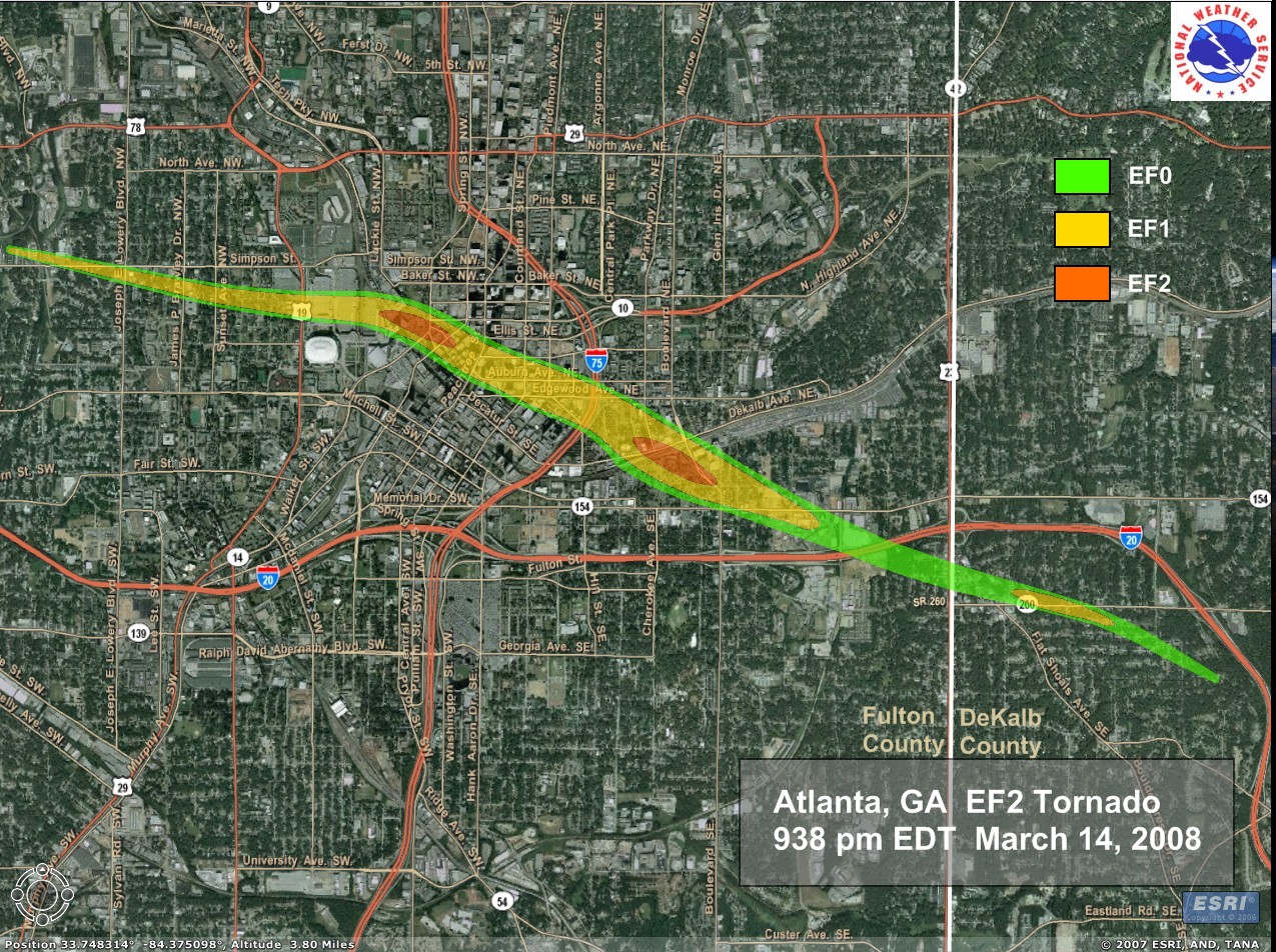
Street Level Tornado Track Map of the March 14, 2008 Atlanta tornado with street level damage ratings on the Enhanced Fujita Scale. This is the first ever tornado to hit downtown Atlanta since records are kept in 1950. 27 people were injured and damage estimated were at least several millions of dollars (Courtesy of NWS Peachtree City, GA)
Source:http://www.srh.noaa.gov/ffc/html/tor031408.shtml archive copy at the Wayback Machine
Licensing
This image is in the public domain because it contains materials that originally came from the U.S. National Oceanic and Atmospheric Administration, taken or made as part of an employee's official duties.
|
File history
Click on a date/time to view the file as it appeared at that time.
| Date/Time | Thumbnail | Dimensions | User | Comment | |
|---|---|---|---|---|---|
| current | 19:45, 20 March 2008 | | 1,275 × 952 (561 KB) | JForget | Street Level Tornado Track Map of the Atlanta tornado with street level damage ratings (Courtesy of NWS Peachtree City, GA) Source:http://www.srh.noaa.gov/ffc/images/AtlantaTornadoMap.jpg |
File usage
The following pages on the English Wikipedia use this file (pages on other projects are not listed):