
No higher resolution available.
Arrondissement_Brussels-Periphery_Belgium_Map.PNG (270 × 203 pixels, file size: 5 KB, MIME type: image/png)
| This is a file from the Wikimedia Commons. Information from its description page there is shown below. Commons is a freely licensed media file repository. You can help. |
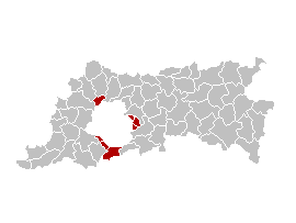
English: Map of the former Arrondissement of Brussels-Periphery in the Province of Flemish Brabant, Belgium.
Nederlands: Kaart van het voormalige arrondissement Brussel-Randgemeenten in de provincie Vlaams-Brabant.
Français : Carte indiquant la localisation de l'ancien arronddissement de Bruxelles-Périphérie dans la Province de Brabant-Flamand.
| This work has been released into the public domain by its author, Ganchelkas. This applies worldwide. In some countries this may not be legally possible; if so: |
I changed the colors of this map, based on the work of w:nl:Gebruiker:LennartBolks/kaartenhoekje, which is also in the public domain.
File history
Click on a date/time to view the file as it appeared at that time.
| Date/Time | Thumbnail | Dimensions | User | Comment | |
|---|---|---|---|---|---|
| current | 13:45, 31 March 2007 | | 270 × 203 (5 KB) | <bdi>Ganchelkas~commonswiki</bdi> | {{en|Map of the former Arrondissement of Brussels-Periphery in the Province of Flemish Brabant, Belgium.}} {{nl|Kaart van het voormalige arrondissement Brussel-Randgemeenten in de provincie Vlaams-Brabant.}} {{fr|Carte indiquant la localisation de l'ancie |
File usage
The following pages on the English Wikipedia use this file (pages on other projects are not listed):
Global file usage
The following other wikis use this file:
- Usage on ar.wikipedia.org
- Usage on ast.wikipedia.org
- Usage on ca.wikipedia.org
- Usage on de.wikipedia.org
- Usage on es.wikipedia.org
- Usage on fr.wikipedia.org
- Usage on fr.wiktionary.org
- Usage on ko.wikipedia.org
- Usage on nl.wikipedia.org
- Usage on ro.wikipedia.org
- Usage on sco.wikipedia.org
- Usage on sl.wikipedia.org
- Usage on vi.wikipedia.org
- Usage on www.wikidata.org
- Usage on zh-yue.wikipedia.org
- Usage on zh.wikipedia.org