

Size of this PNG preview of this SVG file: 592 × 600 pixels. Other resolutions: 237 × 240 pixels | 474 × 480 pixels | 758 × 768 pixels | 1,010 × 1,024 pixels | 2,021 × 2,048 pixels | 894 × 906 pixels.
Original file (SVG file, nominally 894 × 906 pixels, file size: 111 KB)
| This is a file from the Wikimedia Commons. Information from its description page there is shown below. Commons is a freely licensed media file repository. You can help. |
Summary
| Description |
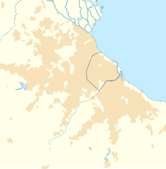
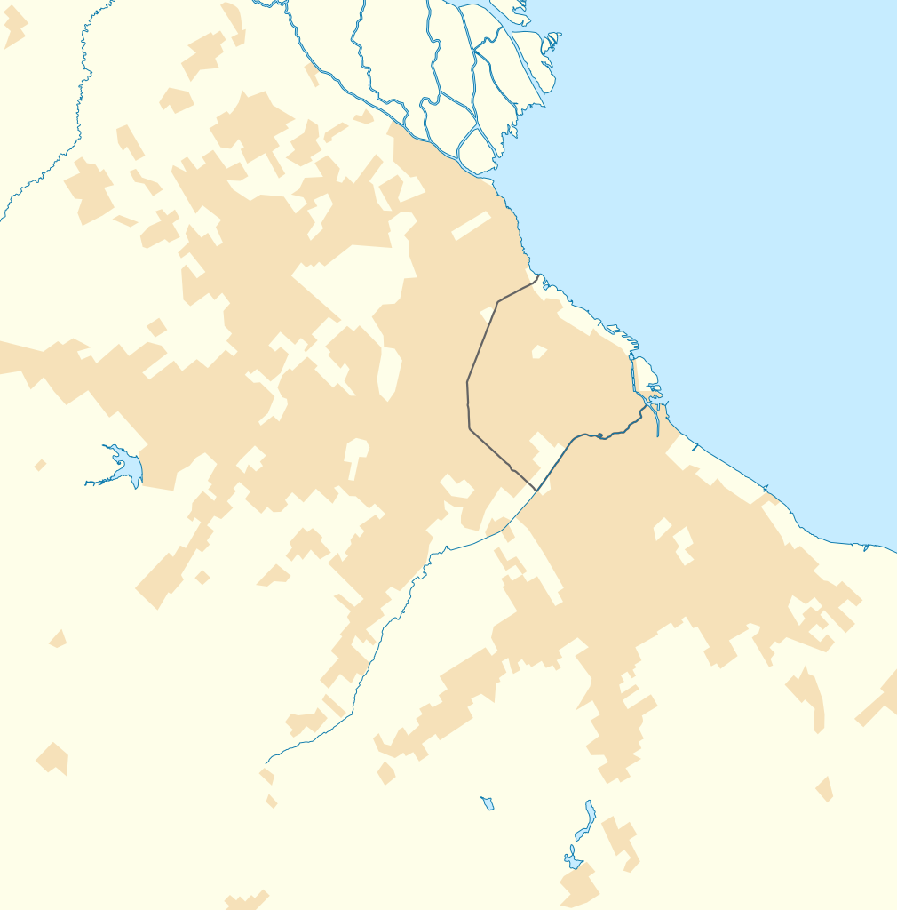
Quadratische Plattkarte. Geographische Begrenzung der Karte:
Location map of Greater Buenos Aires, Argentina
Equirectangular projection. Geographic limits of the map:
|
| Date | |
| Source |
Own work using
|
| Author | NordNordWest and OpenStreetMap contributors |

|
This map has been made or improved in the German Kartenwerkstatt (Map Lab). You can propose maps to improve as well.
|
Licensing
This file is licensed under the Creative Commons Attribution-Share Alike 2.0 Generic license.
- You are free:
- to share – to copy, distribute and transmit the work
- to remix – to adapt the work
- Under the following conditions:
- attribution – You must give appropriate credit, provide a link to the license, and indicate if changes were made. You may do so in any reasonable manner, but not in any way that suggests the licensor endorses you or your use.
- share alike – If you remix, transform, or build upon the material, you must distribute your contributions under the same or compatible license as the original.
File history
Click on a date/time to view the file as it appeared at that time.
| Date/Time | Thumbnail | Dimensions | User | Comment | |
|---|---|---|---|---|---|
| current | 08:33, 29 May 2012 | | 894 × 906 (111 KB) | NordNordWest | == {{int:filedesc}} == {{Information |Description= {{de|Positionskarte des Großraums von Buenos Aires, Argentinien}} Quadratische Plattkarte. Geographische Begrenzung der Karte: * N: 34.3° S * S: 35.05° S * W... |
File usage
More than 100 pages use this file. The following list shows the first 100 pages that use this file only. A full list is available.
- 2007–08 Argentine Primera División
- 2008–09 Argentine Primera División season
- Acassuso
- Adrogué
- Alejandro Korn, Buenos Aires
- Avellaneda
- Banfield, Argentina
- Bella Vista, Buenos Aires
- Berazategui
- Bernal, Argentina
- Boulogne Sur Mer
- Burzaco
- Béccar
- Campo de Mayo
- Carapachay
- Caseros, Buenos Aires
- Castelar
- Ciudad Evita
- Ciudadela, Buenos Aires
- Claypole, Argentina
- Crucecita
- Dock Sud
- Don Bosco, Buenos Aires
- Don Torcuato
- El Palomar, Argentina
- El Palomar Airport
- Ezeiza, Buenos Aires
- Florencio Varela, Buenos Aires
- Florida, Buenos Aires
- General Pacheco
- General Rodríguez
- Gerli
- Glew, Argentina
- Guernica, Argentina
- Haedo, Argentina
- Isidro Casanova
- Ituzaingó, Buenos Aires
- José C. Paz, Buenos Aires
- La Lucila
- Lanús
- Libertad, Buenos Aires
- List of top-division football clubs in CONMEBOL countries
- Llavallol
- Lomas de Zamora
- Lomas del Mirador
- Los Polvorines
- Marcos Paz, Buenos Aires
- Mariano Acosta, Buenos Aires
- Martínez, Buenos Aires
- Merlo, Buenos Aires
- Ministro Pistarini International Airport
- Monte Chingolo
- Monte Grande
- Moreno, Buenos Aires
- Morón, Buenos Aires
- Munro, Buenos Aires
- Muñiz, Buenos Aires
- Olivos, Buenos Aires
- Parque San Martín, Buenos Aires
- Paso del Rey
- Pilar, Buenos Aires
- Pontevedra, Buenos Aires
- Quilmes
- Rafael Calzada, Buenos Aires
- Rafael Castillo, Buenos Aires
- Ramos Mejía
- Remedios de Escalada
- Remedios de Escalada, Tres de Febrero
- San Antonio de Padua
- San Fernando de la Buena Vista
- San Francisco Solano
- San Isidro, Buenos Aires
- San José, Buenos Aires
- San Justo, Buenos Aires
- San Martín, Buenos Aires
- San Miguel, Buenos Aires
- San Vicente, Buenos Aires
- Santos Lugares
- Sarandí, Buenos Aires
- Temperley
- Tigre, Buenos Aires
- Tortuguitas
- Tristán Suárez
- Turdera
- Valentín Alsina, Buenos Aires
- Veinte de Junio
- Vicente López, Buenos Aires
- Victoria, Buenos Aires
- Villa Adelina
- Villa Ballester
- Villa Centenario
- Villa Domínico
- Villa Fiorito
- Villa La Florida
- Villa Maipú
- Villa Martelli
- Villa Sarmiento
- Villa Tesei
- Virreyes, Buenos Aires
- Wilde, Buenos Aires
View more links to this file.
Global file usage
The following other wikis use this file:
- Usage on ar.wikipedia.org
- Usage on ceb.wikipedia.org
- Usage on da.wikipedia.org
- Usage on de.wikipedia.org
- Usage on es.wikipedia.org
- Villa Adelina
- Quilmes
- Banfield
- Llavallol
- Turdera
- Villa Centenario
- Villa Fiorito
- Temperley
- Gerli
- Remedios de Escalada (Lanús)
- Valentín Alsina (Lanús)
- Bernal
- Don Bosco (Buenos Aires)
- Ezpeleta
- San Francisco Solano (Buenos Aires)
- San Miguel (Buenos Aires)
- Vicente López (Buenos Aires)
- Del Viso
- Nordelta
- Loma Hermosa
- Tigre (ciudad)
- San Isidro (Buenos Aires)
- Lomas de Zamora
- Adrogué
- Ciudadela (Buenos Aires)
- San Justo (Buenos Aires)
- González Catán
- Don Torcuato
- Haedo
- Olivos
- La Lucila
- José Ingenieros (Buenos Aires)
- Martín Coronado (Buenos Aires)
- Sáenz Peña (Buenos Aires)
- Santos Lugares (Tres de Febrero)
- Villa Bosch
- Villa Raffo
- Rafael Calzada
- El Talar (Buenos Aires)
- Florencio Varela (ciudad)
- San Antonio de Padua (Buenos Aires)
- José Mármol (Buenos Aires)
View more global usage of this file.