

Size of this preview: 800 × 534 pixels. Other resolutions: 320 × 213 pixels | 640 × 427 pixels | 1,024 × 683 pixels | 1,280 × 854 pixels | 2,560 × 1,708 pixels | 7,196 × 4,800 pixels.
Original file (7,196 × 4,800 pixels, file size: 19.7 MB, MIME type: image/jpeg)
| This is a file from the Wikimedia Commons. Information from its description page there is shown below. Commons is a freely licensed media file repository. You can help. |
Summary
| Description |
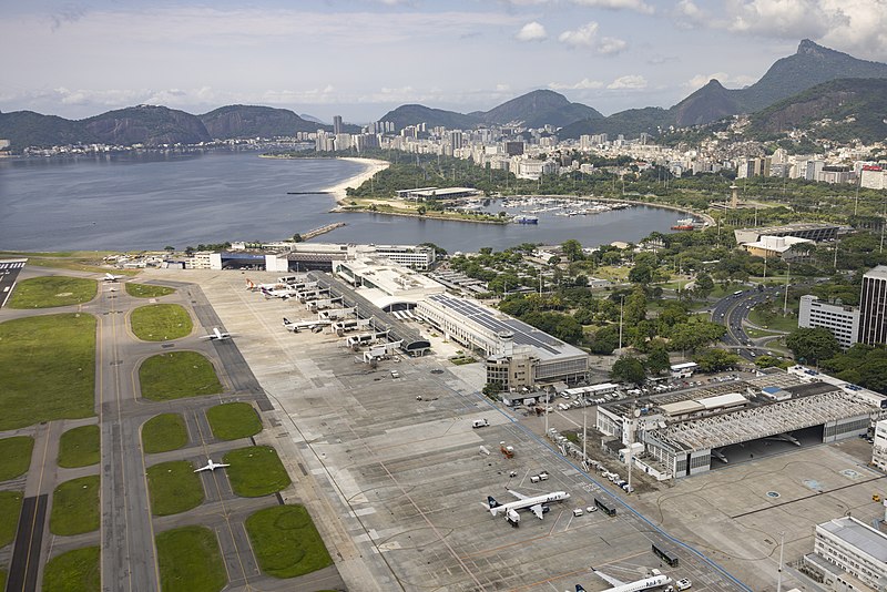
Santos Dumont Airport, Rio de Janeiro, Brasil |
|||||||||||||||||
| Date | ||||||||||||||||||
| Source |
|
|||||||||||||||||
| Author |
|
|||||||||||||||||
| Permission (Reusing this file) |
I published this file as author under the Creative Commons License CC-by-SA-3.0.. This means that a ‘free use outside Wikimedia’s projects’ is only possible under the following conditions:
I would be very grateful if you could send me a specimen copy of the photo/map or the details of the website where the photo/map will be used. Basically, all my photos and maps can be licensed under the conditions of the Mittelstandsgemeinschaft Foto-Marketing (MFM). Please send an email to lizenz AT arne-mueseler.de if you
Arne Müseler / www.arne-mueseler.com, the copyright holder of this work, hereby publishes it under the following license: This file is licensed under the Creative Commons Attribution-Share Alike 3.0 Germany license. Attribution: Arne Müseler / www.arne-mueseler.com
 |
|||||||||||||||||

| Camera location | | View this and other nearby images on: OpenStreetMap |
|---|
File history
Click on a date/time to view the file as it appeared at that time.
| Date/Time | Thumbnail | Dimensions | User | Comment | |
|---|---|---|---|---|---|
| current | 06:28, 7 April 2022 | | 7,196 × 4,800 (19.7 MB) | Arne Müseler | {{Information |Description= {{en|1=Santos Dumont Airport, Rio de Janeiro, Brasil}} |Source=*own work *http://www.arne-mueseler.com |Date=2022-02-15 |source={{own}} |Author={{User:Arne mueseler/Autor}} |Permission={{Template:ArneMueselerCredit}} |other_versions= }} {{Location|22|59|12.35|S|43|22|17.52|W}} Category:Santos Dumont Airport Category:Rio de Janeiro - Photographs by Arne Müseler |
File usage
The following pages on the English Wikipedia use this file (pages on other projects are not listed):